Property Record
201 Main St, Roundup, MT 59072
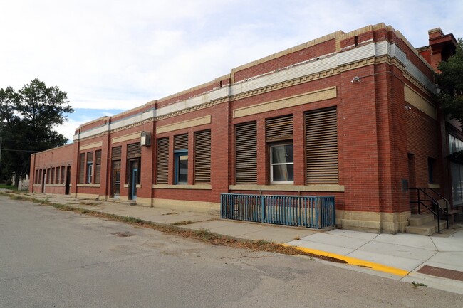
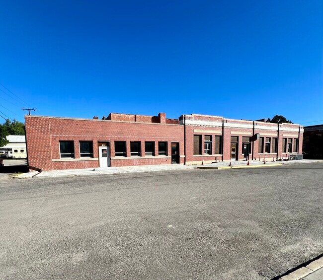
This Property Is For Sale
Current Lease Availabilities
NEARBY LISTINGS FOR SALE OR LEASE
Property Detail
201 Main St
23171713318010000
Roundup Original Townsite
Storebuilding
ROUNDUP ORIGINAL TOWNSITE, S13, T08 N, R25 E, BLOCK 17, LOT 12
X
Musselshell
30065C0833C
Montana
2025
12
2025
0.08 AC
000200
Montana Other Areas
3,500 SF
Other Market Areas
DEMOGRAPHICS near 201 Main St
1 mile
3 mile
5 mile
2024 Total Population
2,443
2,987
3,370
2029 Population
3,044
3,708
4,164
Pop Growth 2024-2029
+ 24.60%
+ 24.14%
+ 23.56%
Average Age
45
45
46
2024 Total Households
1,093
1,330
1,494
HH Growth 2024-2029
+ 25.43%
+ 24.89%
+ 24.36%
Median Household Inc
$44,818
$46,521
$47,777
Avg Household Size
2.20
2.20
2.20
2024 Avg HH Vehicles
2.00
2.00
2.00
Median Home Value
$126,814
$143,684
$161,716
Median Year Built
1957
1966
1970
Nearby Places
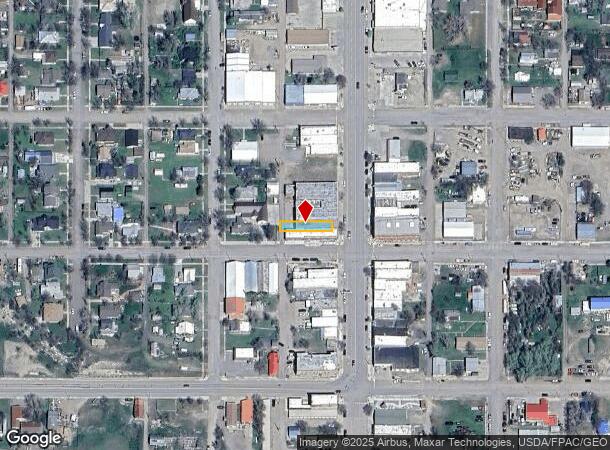
Map Layers
Map Styles
 Street
 Aerial
Transit
 Traffic
 Biking
Places
Listings with unknown addresses are not visible on the map
- Restaurants
- Banks
- Shops
- Fitness
- Groceries
Nearby Properties
Address
Land Use
TOTAL SIZE
Lot Size
Zoning
Address
Land Use
TOTAL SIZE
Lot Size
Zoning
39,814 SF
1.45 AC
1
Address
Land Use
TOTAL SIZE
Lot Size
Zoning
58,154 SF
5 AC
Address
Land Use
TOTAL SIZE
Lot Size
Zoning
38,638 SF
3.18 AC
1
Address
Land Use
TOTAL SIZE
Lot Size
Zoning
24,856 SF
0.96 AC
1
Address
Land Use
TOTAL SIZE
Lot Size
Zoning
7,727 SF
1.93 AC
1
Address
Land Use
TOTAL SIZE
Lot Size
Zoning
7,642 SF
0.96 AC
1
Address
Land Use
TOTAL SIZE
Lot Size
Zoning
6,894 SF
0.27 AC
1
Address
Land Use
TOTAL SIZE
Lot Size
Zoning
19,200 SF
5.25 AC
1
Address
Land Use
TOTAL SIZE
Lot Size
Zoning
15,912 SF
0.96 AC
1
Address
Land Use
TOTAL SIZE
Lot Size
Zoning
10,260 SF
1.43 AC
Address
Land Use
TOTAL SIZE
Lot Size
Zoning
4,139 SF
0.51 AC
1
Address
Land Use
TOTAL SIZE
Lot Size
Zoning
7,132 SF
1.17 AC
1
Address
Land Use
TOTAL SIZE
Lot Size
Zoning
6,800 SF
0.32 AC
1
Address
Land Use
TOTAL SIZE
Lot Size
Zoning
3.05 AC
Address
Land Use
TOTAL SIZE
Lot Size
Zoning
4,436 SF
0.64 AC
1
Address
Land Use
TOTAL SIZE
Lot Size
Zoning
60.49 AC
Address
Land Use
TOTAL SIZE
Lot Size
Zoning
4,110 SF
80.46 AC
Address
Land Use
TOTAL SIZE
Lot Size
Zoning
2,669 SF
0.64 AC
1
Address
Land Use
TOTAL SIZE
Lot Size
Zoning
14,004 SF
0.64 AC
1
Address
Land Use
TOTAL SIZE
Lot Size
Zoning
5,934 SF
0.32 AC
1
Address
Land Use
TOTAL SIZE
Lot Size
Zoning
2,145 SF
0.08 AC
1
Address
Land Use
TOTAL SIZE
Lot Size
Zoning
6,216 SF
0.32 AC
1
Address
Land Use
TOTAL SIZE
Lot Size
Zoning
2,752 SF
0.32 AC
Address
Land Use
TOTAL SIZE
Lot Size
Zoning
6,528 SF
0.80 AC
1
Address
Land Use
TOTAL SIZE
Lot Size
Zoning
2,828 SF
20.03 AC
Address
Land Use
TOTAL SIZE
Lot Size
Zoning
9,731 SF
0.16 AC
1
Address
Land Use
TOTAL SIZE
Lot Size
Zoning
4,747 SF
0.32 AC
1
Address
Land Use
TOTAL SIZE
Lot Size
Zoning
2,243 SF
0.48 AC
1
Address
Land Use
TOTAL SIZE
Lot Size
Zoning
2,448 SF
0.56 AC
1
Address
Land Use
TOTAL SIZE
Lot Size
Zoning
11,088 SF
0.24 AC
1
The World's #1 Commercial Real Estate Marketplace
Connect with us
© 2026 CoStar Group
The information above has been obtained from sources believed reliable. While we do not doubt its accuracy we have not verified it and make no guarantee, warranty or representation about it. It is your responsibility to independently confirm its accuracy and completeness. Any projections, opinions, assumptions, or estimates used are for example only and do not represent the current or future performance of the property. The value of this transaction to you depends on tax and other factors which should be evaluated by your tax, financial, and legal advisors. You and your advisors should conduct a careful, independent investigation of the property to determine to your satisfaction the suitability of the property for your needs.