Property Record
201 Maple St, Junction City, OR 97448
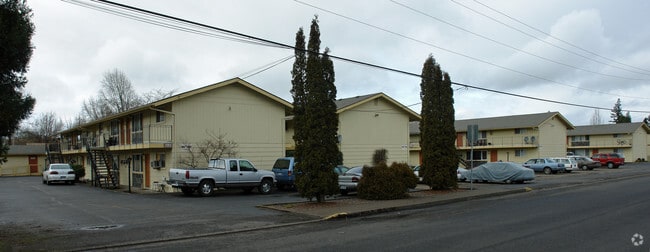
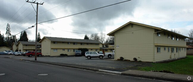
Property Detail
201 Maple St
Eugene-Springfield, OR
TL 01400
0005866
Lane
Multifamilydwelling
Oregon
R3
1400
B and X Area of moderate flood hazard, usually the area between the limits of the 100-year and 500-year floods.
0.98 AC
2025
West Lane County
2025
Portland
000403
NEARBY LISTINGS FOR SALE OR LEASE
-
-
View all Junction City listings for sale on LoopNet.com
DEMOGRAPHICS near 201 Maple St
1 mile
3 mile
5 mile
2025 Total Population
7,669
9,385
15,213
2030 Population
7,698
9,431
15,361
Pop Growth 2025-2030
+ 0.38%
+ 0.49%
+ 0.97%
Average Age
40
41
41
2025 Total Households
2,978
3,595
5,745
HH Growth 2025-2030
+ 0.24%
+ 0.36%
+ 0.89%
Median Household Inc
$80,009
$80,467
$77,631
Avg Household Size
2.50
2.50
2.60
2025 Avg HH Vehicles
2.00
2.00
2.00
Median Home Value
$411,886
$425,788
$416,988
Median Year Built
1978
1978
1978
Nearby Places
Map Layers
Map Styles
 Street
 Aerial
Layers
 Traffic
 Biking
Places
Listings with unknown addresses are not visible on the map
- Restaurants
- Banks
- Shops
- Fitness
- Groceries
PUBLIC TRANSPORTATION
AIRPORT
Mahlon Sweet Field
Drive
Walk
Distance
Mahlon Sweet Field
16 min
9.7 mi
Freight Ports
Port of Coos Bay, OR
Drive
Walk
Distance
Port of Coos Bay, OR
159 min
110.7 mi
Nearby Properties
Address
Land Use
TOTAL SIZE
Lot Size
Zoning
Address
Land Use
TOTAL SIZE
Lot Size
Zoning
Address
Land Use
TOTAL SIZE
Lot Size
Zoning
Address
Land Use
TOTAL SIZE
Lot Size
Zoning
31.27 AC
E30
Address
Land Use
TOTAL SIZE
Lot Size
Zoning
Address
Land Use
TOTAL SIZE
Lot Size
Zoning
4.86 AC
R4
Address
Land Use
TOTAL SIZE
Lot Size
Zoning
26.56 AC
PL
Address
Land Use
TOTAL SIZE
Lot Size
Zoning
12.65 AC
EFU
Address
Land Use
TOTAL SIZE
Lot Size
Zoning
6.83 AC
GC
Address
Land Use
TOTAL SIZE
Lot Size
Zoning
11.88 AC
PL
Address
Land Use
TOTAL SIZE
Lot Size
Zoning
19.15 AC
E30
Address
Land Use
TOTAL SIZE
Lot Size
Zoning
3.67 AC
R3
Address
Land Use
TOTAL SIZE
Lot Size
Zoning
3.70 AC
R3
Address
Land Use
TOTAL SIZE
Lot Size
Zoning
Address
Land Use
TOTAL SIZE
Lot Size
Zoning
1.26 AC
R3
Address
Land Use
TOTAL SIZE
Lot Size
Zoning
10.18 AC
PL
Address
Land Use
TOTAL SIZE
Lot Size
Zoning
1,578 SF
8.23 AC
GC
Address
Land Use
TOTAL SIZE
Lot Size
Zoning
3.29 AC
M1
Address
Land Use
TOTAL SIZE
Lot Size
Zoning
20.98 AC
E30
Address
Land Use
TOTAL SIZE
Lot Size
Zoning
19.15 AC
E30
Address
Land Use
TOTAL SIZE
Lot Size
Zoning
Address
Land Use
TOTAL SIZE
Lot Size
Zoning
2.52 AC
GC
Address
Land Use
TOTAL SIZE
Lot Size
Zoning
8.09 AC
M1
Address
Land Use
TOTAL SIZE
Lot Size
Zoning
Address
Land Use
TOTAL SIZE
Lot Size
Zoning
39.37 AC
PL
Address
Land Use
TOTAL SIZE
Lot Size
Zoning
1,226 SF
3.99 AC
GC
Address
Land Use
TOTAL SIZE
Lot Size
Zoning
8.31 AC
CR
Address
Land Use
TOTAL SIZE
Lot Size
Zoning
Address
Land Use
TOTAL SIZE
Lot Size
Zoning
4.17 AC
E30
Address
Land Use
TOTAL SIZE
Lot Size
Zoning
6.88 AC
E30
Address
Land Use
TOTAL SIZE
Lot Size
Zoning
4,864 SF
3.07 AC
R4
The World's #1 Commercial Real Estate Marketplace
Connect with us
© 2026 CoStar Group
The information above has been obtained from sources believed reliable. While we do not doubt its accuracy we have not verified it and make no guarantee, warranty or representation about it. It is your responsibility to independently confirm its accuracy and completeness. Any projections, opinions, assumptions, or estimates used are for example only and do not represent the current or future performance of the property. The value of this transaction to you depends on tax and other factors which should be evaluated by your tax, financial, and legal advisors. You and your advisors should conduct a careful, independent investigation of the property to determine to your satisfaction the suitability of the property for your needs.