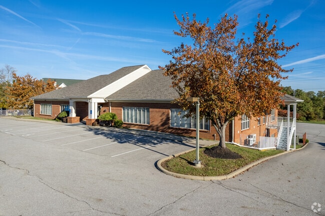
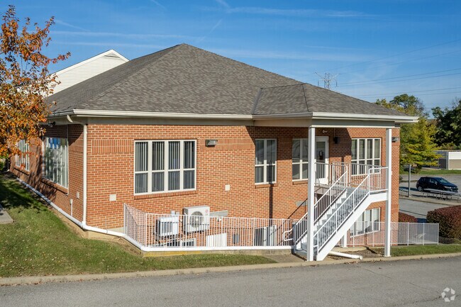
Property Record
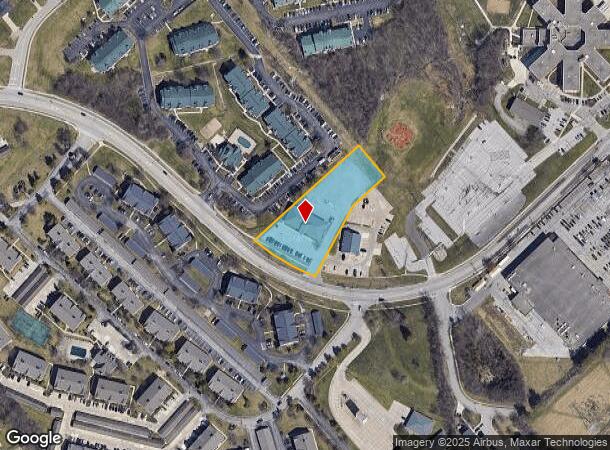
201 Martha Layne Collins Blvd, Cold Spring, KY 41076
NEARBY LISTINGS FOR SALE OR LEASE
Property Detail
201 Martha Layne Collins Blvd
999-99-22-132.01
CONT 1.433 ACRES
Commercialnec
Campbell
X
Kentucky
21037C0039E
1.43 AC
2024
Outlying N Kentucky
2025
Cincinnati/Dayton
053301
Cincinnati, OH-KY-IN
6,655 SF
DEMOGRAPHICS near 201 Martha Layne Collins Blvd
1 Mile
3 Mile
5 Mile
2024 Total Population
6,134
33,585
112,633
2029 Population
6,133
33,887
114,533
Pop Growth 2024-2029
(0.02%)
+ 0.90%
+ 1.69%
Average Age
38
41
40
2024 Total Households
2,613
14,350
47,536
HH Growth 2024-2029
(0.04%)
+ 0.86%
+ 1.70%
Median Household Inc
$52,293
$63,263
$62,860
Avg Household Size
2.00
2.20
2.30
2024 Avg HH Vehicles
2.00
2.00
2.00
Median Home Value
$163,239
$181,887
$204,497
Median Year Built
1990
1979
1963
Nearby Places
Map Layers
Map Styles
 Street
 Aerial
- Restaurants
- Banks
- Shops
- Fitness
- Groceries
PUBLIC TRANSPORTATION
COMMUTER RAIL
DRIVE
WALK
Distance
16 min
9.8 mi
AIRPORT
Cincinnati/Northern Kentucky International
DRIVE
WALK
Distance
Cincinnati/Northern Kentucky International
28 min
15.1 mi
SALE & LEASE HISTORY
LISTING DATE
SALE/LEASE

Nov 11, 2016
For Sale
Jun 06, 2017
For Lease
Jan 19, 2022
For Lease
Nearby Properties
Address
Land Use
TOTAL SIZE
Lot Size
Zoning
Address
Land Use
TOTAL SIZE
Lot Size
Zoning
560 SF
218.94 AC
Address
Land Use
TOTAL SIZE
Lot Size
Zoning
243,000 SF
11.30 AC
Address
Land Use
TOTAL SIZE
Lot Size
Zoning
0.95 AC
Address
Land Use
TOTAL SIZE
Lot Size
Zoning
0.83 AC
Address
Land Use
TOTAL SIZE
Lot Size
Zoning
0.74 AC
Address
Land Use
TOTAL SIZE
Lot Size
Zoning
0.71 AC
Address
Land Use
TOTAL SIZE
Lot Size
Zoning
0.71 AC
Address
Land Use
TOTAL SIZE
Lot Size
Zoning
360,000 SF
Address
Land Use
TOTAL SIZE
Lot Size
Zoning
0.53 AC
Address
Land Use
TOTAL SIZE
Lot Size
Zoning
0.56 AC
Address
Land Use
TOTAL SIZE
Lot Size
Zoning
0.57 AC
Address
Land Use
TOTAL SIZE
Lot Size
Zoning
0.49 AC
Address
Land Use
TOTAL SIZE
Lot Size
Zoning
0.59 AC
Address
Land Use
TOTAL SIZE
Lot Size
Zoning
0.48 AC
Address
Land Use
TOTAL SIZE
Lot Size
Zoning
0.40 AC
Address
Land Use
TOTAL SIZE
Lot Size
Zoning
1,049,050 SF
8.60 AC
Address
Land Use
TOTAL SIZE
Lot Size
Zoning
0.33 AC
Address
Land Use
TOTAL SIZE
Lot Size
Zoning
20.01 AC
Address
Land Use
TOTAL SIZE
Lot Size
Zoning
1,800 SF
10.18 AC
Address
Land Use
TOTAL SIZE
Lot Size
Zoning
16.50 AC
Address
Land Use
TOTAL SIZE
Lot Size
Zoning
15,570 SF
21.35 AC
Address
Land Use
TOTAL SIZE
Lot Size
Zoning
46,600 SF
52.47 AC
Address
Land Use
TOTAL SIZE
Lot Size
Zoning
18,288 SF
41.21 AC
Address
Land Use
TOTAL SIZE
Lot Size
Zoning
2,837 SF
3.77 AC
Address
Land Use
TOTAL SIZE
Lot Size
Zoning
385,100 SF
4.60 AC
Address
Land Use
TOTAL SIZE
Lot Size
Zoning
66,540 SF
4 AC
Address
Land Use
TOTAL SIZE
Lot Size
Zoning
175,481 SF
38.92 AC
Address
Land Use
TOTAL SIZE
Lot Size
Zoning
3,726,400 SF
12.60 AC
Address
Land Use
TOTAL SIZE
Lot Size
Zoning
173,940 SF
22.52 AC
Address
Land Use
TOTAL SIZE
Lot Size
Zoning
The World's #1 Commercial Real Estate Marketplace
Connect with us
© 2025 CoStar Group
The information above has been obtained from sources believed reliable. While we do not doubt its accuracy we have not verified it and make no guarantee, warranty or representation about it. It is your responsibility to independently confirm its accuracy and completeness. Any projections, opinions, assumptions, or estimates used are for example only and do not represent the current or future performance of the property. The value of this transaction to you depends on tax and other factors which should be evaluated by your tax, financial, and legal advisors. You and your advisors should conduct a careful, independent investigation of the property to determine to your satisfaction the suitability of the property for your needs.