Property Record
201 Middlesex Ave, Chester, CT 06412

Property Detail
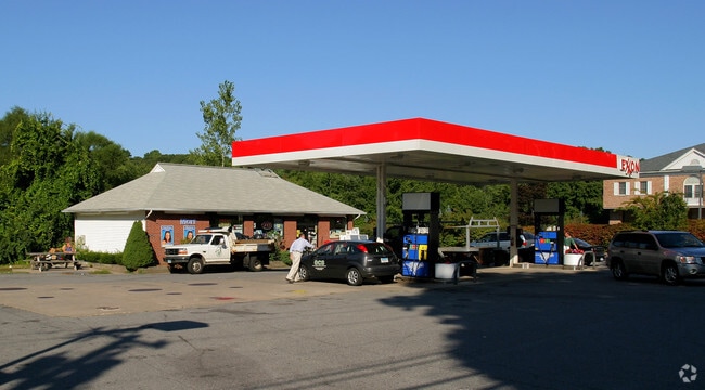
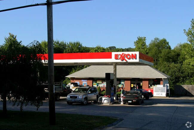
201 Middlesex Ave
Servicestation
Lower Ct River Vly
C
Connecticut
B and X Area of moderate flood hazard, usually the area between the limits of the 100-year and 500-year floods.
0.55 AC
2025
SW Midlsx/Old Saybrk/Rt 9
2025
Hartford
600100
Hartford-West Hartford-East Hartford, CT
1,400 SF
CHES-000009-000000-000017
NEARBY LISTINGS FOR SALE OR LEASE
DEMOGRAPHICS near 201 Middlesex Ave
1 mile
3 mile
5 mile
2025 Total Population
1,165
6,942
15,937
2030 Population
1,175
7,020
16,131
Pop Growth 2025-2030
+ 0.86%
+ 1.12%
+ 1.22%
Average Age
47
47
48
2025 Total Households
479
3,022
6,915
HH Growth 2025-2030
+ 0.84%
+ 1.13%
+ 1.17%
Median Household Inc
$107,291
$88,796
$100,236
Avg Household Size
2.20
2.20
2.20
2025 Avg HH Vehicles
2.00
2.00
2.00
Median Home Value
$490,505
$393,401
$419,881
Median Year Built
1967
1963
1966
Nearby Places
Map Layers
Map Styles
 Street
 Aerial
Layers
 Traffic
 Biking
Places
Listings with unknown addresses are not visible on the map
- Restaurants
- Banks
- Shops
- Fitness
- Groceries
PUBLIC TRANSPORTATION
AIRPORT
Tweed/New Haven
Drive
Walk
Distance
Tweed/New Haven
49 min
34.0 mi
Freight Ports
Port of New Haven
Drive
Walk
Distance
Port of New Haven
49 min
34.6 mi
The World's #1 Commercial Real Estate Marketplace
Connect with us
© 2026 CoStar Group
The information above has been obtained from sources believed reliable. While we do not doubt its accuracy we have not verified it and make no guarantee, warranty or representation about it. It is your responsibility to independently confirm its accuracy and completeness. Any projections, opinions, assumptions, or estimates used are for example only and do not represent the current or future performance of the property. The value of this transaction to you depends on tax and other factors which should be evaluated by your tax, financial, and legal advisors. You and your advisors should conduct a careful, independent investigation of the property to determine to your satisfaction the suitability of the property for your needs.