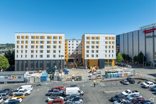
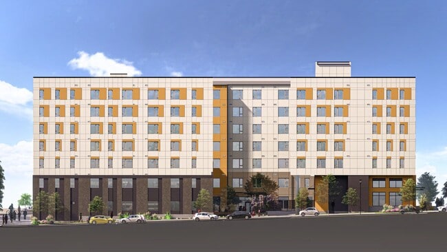
Property Record
201 N 103Rd St, Seattle, WA 98133
NEARBY LISTINGS FOR SALE OR LEASE
Property Detail
201 N 103Rd St
322604-9325
PCL X OF SEATTLE LBA #3040593- LU REC #20230908900001 SD LBA BEING POR OF E 1/2 OF SW 1/4 OF NE 1/4 OF NW 1/4 STR 32-26-04
Apartment
King
X
Washington
53033C0329G
322604
0
1.10 AC
2024
Maple Leaf
021000
Seattle/Puget Sound
150,827 SF
Seattle-Tacoma-Bellevue, WA
DEMOGRAPHICS near 201 N 103Rd St
1 Mile
3 Mile
5 Mile
2024 Total Population
28,033
229,451
429,658
2029 Population
28,229
229,378
429,567
Pop Growth 2024-2029
+ 0.70%
(0.03%)
(0.02%)
Average Age
39
39
39
2024 Total Households
12,881
100,452
189,124
HH Growth 2024-2029
+ 0.70%
(0.04%)
(0.06%)
Median Household Inc
$92,027
$108,505
$118,130
Avg Household Size
2.10
2.20
2.10
2024 Avg HH Vehicles
1.00
2.00
2.00
Median Home Value
$798,215
$869,158
$901,075
Median Year Built
1975
1969
1971
Nearby Places
Map Layers
Map Styles
 Street
 Aerial
- Restaurants
- Banks
- Shops
- Fitness
- Groceries
PUBLIC TRANSPORTATION
TRANSIT/SUBWAY
Northgate Station (Lynnwood - Angle Lake - Sound Transit, Northgate - Angle Lake - Sound Transit)
DRIVE
WALK
Distance
Northgate Station (Lynnwood - Angle Lake - Sound Transit, Northgate - Angle Lake - Sound Transit)
1 min
3 min
0.2 mi
COMMUTER RAIL
King Street (Seattle) Station (Everett - Seattle - Sound Transit, Seattle - Tacoma/Lakewood - Sound Transit, Sounder South Line - Sound Transit)
DRIVE
WALK
Distance
King Street (Seattle) Station (Everett - Seattle - Sound Transit, Seattle - Tacoma/Lakewood - Sound Transit, Sounder South Line - Sound Transit)
15 min
7.9 mi
AIRPORT
Seattle Paine Field International
DRIVE
WALK
Distance
Seattle Paine Field International
26 min
16.9 mi
Seattle-Tacoma International
DRIVE
WALK
Distance
Seattle-Tacoma International
34 min
21.2 mi
Freight Ports
Port of Seattle
DRIVE
WALK
Distance
Port of Seattle
21 min
11.7 mi
Nearby Properties
Address
Land Use
TOTAL SIZE
Lot Size
Zoning
Address
Land Use
TOTAL SIZE
Lot Size
Zoning
7,549 SF
59.34 AC
MIO-105-LR
Address
Land Use
TOTAL SIZE
Lot Size
Zoning
90,184 SF
16.66 AC
C1-75 (M)
Address
Land Use
TOTAL SIZE
Lot Size
Zoning
107.93 AC
NR3
Address
Land Use
TOTAL SIZE
Lot Size
Zoning
42,500 SF
90.92 AC
NR3
Address
Land Use
TOTAL SIZE
Lot Size
Zoning
241,955 SF
12.81 AC
LR2 (M)
Address
Land Use
TOTAL SIZE
Lot Size
Zoning
25,735 SF
1.56 AC
C1-75 (M)
Address
Land Use
TOTAL SIZE
Lot Size
Zoning
285,140 SF
0.90 AC
NC2-75 (M1
Address
Land Use
TOTAL SIZE
Lot Size
Zoning
131,790 SF
0.37 AC
SM-U 75-24
Address
Land Use
TOTAL SIZE
Lot Size
Zoning
223,047 SF
0.18 AC
NC2P-75 (M
Address
Land Use
TOTAL SIZE
Lot Size
Zoning
382,762 SF
7.14 AC
NR3
Address
Land Use
TOTAL SIZE
Lot Size
Zoning
172,297 SF
4.21 AC
NC3-95 (M)
Address
Land Use
TOTAL SIZE
Lot Size
Zoning
0.31 AC
SM-U 95-32
Address
Land Use
TOTAL SIZE
Lot Size
Zoning
10,090 SF
11.73 AC
NC3-95 (M)
Address
Land Use
TOTAL SIZE
Lot Size
Zoning
132,183 SF
0.76 AC
NC2-65
Address
Land Use
TOTAL SIZE
Lot Size
Zoning
162,182 SF
9.10 AC
LR2 (M)
Address
Land Use
TOTAL SIZE
Lot Size
Zoning
205,000 SF
13.89 AC
NR3
Address
Land Use
TOTAL SIZE
Lot Size
Zoning
215,468 SF
0.60 AC
NC2-75 (M1
Address
Land Use
TOTAL SIZE
Lot Size
Zoning
2,874 SF
21.94 AC
NR3
Address
Land Use
TOTAL SIZE
Lot Size
Zoning
207,576 SF
5.98 AC
MR (M)
Address
Land Use
TOTAL SIZE
Lot Size
Zoning
160,593 SF
1.57 AC
NC3P-75 (M
Address
Land Use
TOTAL SIZE
Lot Size
Zoning
183,056 SF
1.95 AC
C1-55 (M)
Address
Land Use
TOTAL SIZE
Lot Size
Zoning
168,619 SF
7.79 AC
NC3-145 (M
Address
Land Use
TOTAL SIZE
Lot Size
Zoning
133,896 SF
0.82 AC
SM-U 95-32
Address
Land Use
TOTAL SIZE
Lot Size
Zoning
0.75 AC
SM-U 95-32
Address
Land Use
TOTAL SIZE
Lot Size
Zoning
1,040 SF
18.74 AC
NR3
Address
Land Use
TOTAL SIZE
Lot Size
Zoning
17.65 AC
NR3
Address
Land Use
TOTAL SIZE
Lot Size
Zoning
119,405 SF
0.97 AC
NC3-95 (M)
Address
Land Use
TOTAL SIZE
Lot Size
Zoning
119,102 SF
2.59 AC
LR3 (M)
Address
Land Use
TOTAL SIZE
Lot Size
Zoning
54,224 SF
2.22 AC
NC3-55 (M)
The World's #1 Commercial Real Estate Marketplace
Connect with us
© 2025 CoStar Group
The information above has been obtained from sources believed reliable. While we do not doubt its accuracy we have not verified it and make no guarantee, warranty or representation about it. It is your responsibility to independently confirm its accuracy and completeness. Any projections, opinions, assumptions, or estimates used are for example only and do not represent the current or future performance of the property. The value of this transaction to you depends on tax and other factors which should be evaluated by your tax, financial, and legal advisors. You and your advisors should conduct a careful, independent investigation of the property to determine to your satisfaction the suitability of the property for your needs.