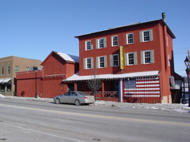
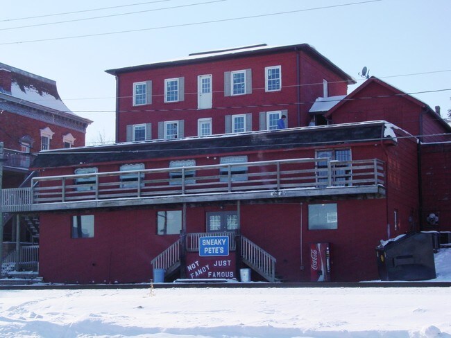
Property Record
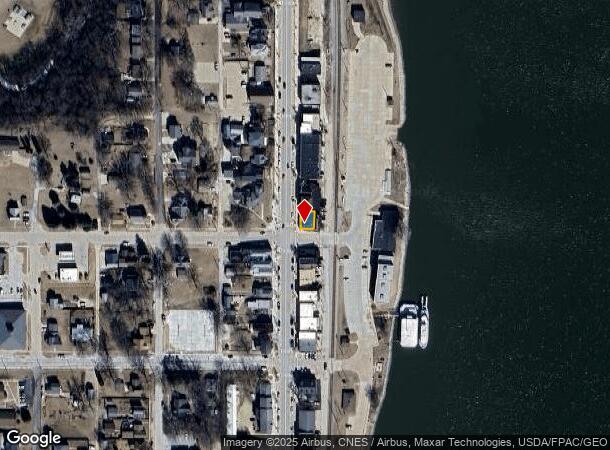
201 N Cody Rd, Le Claire, IA 52753
NEARBY LISTINGS FOR SALE OR LEASE
-
-
View all Le Claire listings for sale on LoopNet.com
Property Detail
201 N Cody Rd
Davenport-Moline-Rock Island, IA-IL
Original Town Leclaire
953559901024
ORIGINAL TOWN LECLAIRE LOT: 001 BLOCK: 002 ORIGINAL TOWN LOT 1W OF RR EX E 29'
Commercialnec
Scott
X
Iowa
19163C0402G
1w
2025
0.04 AC
2025
Outlying Scott County
010104
Davenport/Moline/Rock Island
2,880 SF
DEMOGRAPHICS near 201 N Cody Rd
1 Mile
3 Mile
5 Mile
2024 Total Population
3,684
9,090
15,101
2029 Population
3,641
8,875
14,683
Pop Growth 2024-2029
(1.17%)
(2.37%)
(2.77%)
Average Age
40
42
42
2024 Total Households
1,458
3,579
5,657
HH Growth 2024-2029
(1.30%)
(2.46%)
(2.93%)
Median Household Inc
$76,374
$87,637
$88,328
Avg Household Size
2.50
2.50
2.50
2024 Avg HH Vehicles
2.00
2.00
2.00
Median Home Value
$246,035
$274,830
$264,080
Median Year Built
1977
1977
1976
Nearby Places
Map Layers
Map Styles
 Street
 Aerial
- Restaurants
- Banks
- Shops
- Fitness
- Groceries
PUBLIC TRANSPORTATION
AIRPORT
Quad Cities International
DRIVE
WALK
Distance
Quad Cities International
30 min
16.8 mi
Nearby Properties
Address
Land Use
TOTAL SIZE
Lot Size
Zoning
Address
Land Use
TOTAL SIZE
Lot Size
Zoning
162,688 SF
57.89 AC
Address
Land Use
TOTAL SIZE
Lot Size
Zoning
3,623 SF
2.54 AC
Address
Land Use
TOTAL SIZE
Lot Size
Zoning
913 SF
8.44 AC
Address
Land Use
TOTAL SIZE
Lot Size
Zoning
27,365 SF
3.14 AC
Address
Land Use
TOTAL SIZE
Lot Size
Zoning
63,272 SF
15.49 AC
Address
Land Use
TOTAL SIZE
Lot Size
Zoning
11,960 SF
7.23 AC
Address
Land Use
TOTAL SIZE
Lot Size
Zoning
54,773 SF
12.64 AC
Address
Land Use
TOTAL SIZE
Lot Size
Zoning
13,621 SF
2.25 AC
Address
Land Use
TOTAL SIZE
Lot Size
Zoning
5,840 SF
2.26 AC
Address
Land Use
TOTAL SIZE
Lot Size
Zoning
9,601 SF
15.84 AC
Address
Land Use
TOTAL SIZE
Lot Size
Zoning
35,925 SF
2.23 AC
Address
Land Use
TOTAL SIZE
Lot Size
Zoning
7,455 SF
1.48 AC
Address
Land Use
TOTAL SIZE
Lot Size
Zoning
11,504 SF
2.10 AC
Address
Land Use
TOTAL SIZE
Lot Size
Zoning
13,757 SF
0.83 AC
Address
Land Use
TOTAL SIZE
Lot Size
Zoning
10,460 SF
0.50 AC
Address
Land Use
TOTAL SIZE
Lot Size
Zoning
5,195 SF
0.50 AC
Address
Land Use
TOTAL SIZE
Lot Size
Zoning
2,650 SF
1.48 AC
Address
Land Use
TOTAL SIZE
Lot Size
Zoning
2,368 SF
1.13 AC
Address
Land Use
TOTAL SIZE
Lot Size
Zoning
8,748 SF
1.79 AC
Address
Land Use
TOTAL SIZE
Lot Size
Zoning
4,264 SF
0.66 AC
Address
Land Use
TOTAL SIZE
Lot Size
Zoning
7,141 SF
1.95 AC
Address
Land Use
TOTAL SIZE
Lot Size
Zoning
7,365 SF
0.66 AC
Address
Land Use
TOTAL SIZE
Lot Size
Zoning
5,400 SF
7.97 AC
Address
Land Use
TOTAL SIZE
Lot Size
Zoning
10.59 AC
PB
Address
Land Use
TOTAL SIZE
Lot Size
Zoning
2,322 SF
0.65 AC
Address
Land Use
TOTAL SIZE
Lot Size
Zoning
7,774 SF
0.62 AC
Address
Land Use
TOTAL SIZE
Lot Size
Zoning
7,920 SF
1.87 AC
Address
Land Use
TOTAL SIZE
Lot Size
Zoning
5,876 SF
1.09 AC
Address
Land Use
TOTAL SIZE
Lot Size
Zoning
4,973 SF
0.09 AC
Address
Land Use
TOTAL SIZE
Lot Size
Zoning
3,342 SF
0.10 AC
The World's #1 Commercial Real Estate Marketplace
Connect with us
© 2026 CoStar Group
The information above has been obtained from sources believed reliable. While we do not doubt its accuracy we have not verified it and make no guarantee, warranty or representation about it. It is your responsibility to independently confirm its accuracy and completeness. Any projections, opinions, assumptions, or estimates used are for example only and do not represent the current or future performance of the property. The value of this transaction to you depends on tax and other factors which should be evaluated by your tax, financial, and legal advisors. You and your advisors should conduct a careful, independent investigation of the property to determine to your satisfaction the suitability of the property for your needs.