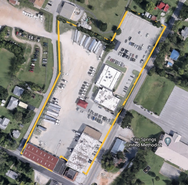
Property Record
201 N Elm St, Springdale, AR 72762
NEARBY LISTINGS FOR SALE OR LEASE
Property Detail
201 N Elm St
Fayetteville-Springdale-Rogers, AR-MO
Elm Springs Original
750-00450-000
PT LOT 2 & 4, ALL LOT 3 BLOCK 1 - .358 AC FURTHER DESCRIBED FROM 2021-20320 AS: PART OF LOTS THREE (3) AND FOUR (4), COUNCILM
Officebuilding
Washington
X
Arkansas
05143C0055G
2-4,3
0
0.50 AC
2025
Outlying Washington Cnty
010518
Fayetteville/Springdale/Rogers
14,346 SF
DEMOGRAPHICS near 201 N Elm St
1 Mile
3 Mile
5 Mile
2024 Total Population
1,274
15,280
51,303
2029 Population
1,467
17,221
57,817
Pop Growth 2024-2029
+ 15.15%
+ 12.70%
+ 12.70%
Average Age
40
38
37
2024 Total Households
455
5,460
17,692
HH Growth 2024-2029
+ 15.16%
+ 12.80%
+ 12.90%
Median Household Inc
$87,500
$92,267
$84,424
Avg Household Size
2.80
2.70
2.80
2024 Avg HH Vehicles
3.00
2.00
2.00
Median Home Value
$322,222
$305,548
$271,175
Median Year Built
2004
2007
2002
Nearby Places
Map Layers
Map Styles
 Street
 Aerial
- Restaurants
- Banks
- Shops
- Fitness
- Groceries
PUBLIC TRANSPORTATION
AIRPORT
Northwest Arkansas Ntl
DRIVE
WALK
Distance
Northwest Arkansas Ntl
21 min
8.1 mi
Freight Ports
Tulsa Port of Inola
DRIVE
WALK
Distance
Tulsa Port of Inola
97 min
83.2 mi
SALE & LEASE HISTORY
LISTING DATE
SALE/LEASE

Sep 30, 2020
For Sale
Nearby Properties
Address
Land Use
TOTAL SIZE
Lot Size
Zoning
Address
Land Use
TOTAL SIZE
Lot Size
Zoning
54,448 SF
19.43 AC
Address
Land Use
TOTAL SIZE
Lot Size
Zoning
75,774 SF
16.49 AC
Address
Land Use
TOTAL SIZE
Lot Size
Zoning
112,817 SF
9.57 AC
Address
Land Use
TOTAL SIZE
Lot Size
Zoning
196,657 SF
18.82 AC
Address
Land Use
TOTAL SIZE
Lot Size
Zoning
89,280 SF
12.22 AC
Address
Land Use
TOTAL SIZE
Lot Size
Zoning
32,124 SF
6.58 AC
Address
Land Use
TOTAL SIZE
Lot Size
Zoning
72,866 SF
7.14 AC
Address
Land Use
TOTAL SIZE
Lot Size
Zoning
39,336 SF
5.03 AC
Address
Land Use
TOTAL SIZE
Lot Size
Zoning
47,780 SF
5.15 AC
PUD
Address
Land Use
TOTAL SIZE
Lot Size
Zoning
165,271 SF
9.94 AC
Address
Land Use
TOTAL SIZE
Lot Size
Zoning
58,500 SF
3.45 AC
Address
Land Use
TOTAL SIZE
Lot Size
Zoning
53,921 SF
2.35 AC
Address
Land Use
TOTAL SIZE
Lot Size
Zoning
52,220 SF
4.53 AC
Address
Land Use
TOTAL SIZE
Lot Size
Zoning
116,940 SF
6.44 AC
Address
Land Use
TOTAL SIZE
Lot Size
Zoning
42,713 SF
13.10 AC
Address
Land Use
TOTAL SIZE
Lot Size
Zoning
31,766 SF
9.36 AC
Address
Land Use
TOTAL SIZE
Lot Size
Zoning
85,000 SF
8.54 AC
Address
Land Use
TOTAL SIZE
Lot Size
Zoning
35,230 SF
7.10 AC
Address
Land Use
TOTAL SIZE
Lot Size
Zoning
88,200 SF
1.46 AC
Address
Land Use
TOTAL SIZE
Lot Size
Zoning
52,972 SF
5.26 AC
Address
Land Use
TOTAL SIZE
Lot Size
Zoning
17,200 SF
4.80 AC
Address
Land Use
TOTAL SIZE
Lot Size
Zoning
26,240 SF
3.06 AC
Address
Land Use
TOTAL SIZE
Lot Size
Zoning
23,520 SF
5.76 AC
Address
Land Use
TOTAL SIZE
Lot Size
Zoning
31,506 SF
4.56 AC
Address
Land Use
TOTAL SIZE
Lot Size
Zoning
11,660 SF
1.91 AC
Address
Land Use
TOTAL SIZE
Lot Size
Zoning
32,280 SF
4.88 AC
Address
Land Use
TOTAL SIZE
Lot Size
Zoning
21,068 SF
3.22 AC
Address
Land Use
TOTAL SIZE
Lot Size
Zoning
15,264 SF
2.65 AC
Address
Land Use
TOTAL SIZE
Lot Size
Zoning
45,960 SF
4.73 AC
The World's #1 Commercial Real Estate Marketplace
Connect with us
© 2025 CoStar Group
The information above has been obtained from sources believed reliable. While we do not doubt its accuracy we have not verified it and make no guarantee, warranty or representation about it. It is your responsibility to independently confirm its accuracy and completeness. Any projections, opinions, assumptions, or estimates used are for example only and do not represent the current or future performance of the property. The value of this transaction to you depends on tax and other factors which should be evaluated by your tax, financial, and legal advisors. You and your advisors should conduct a careful, independent investigation of the property to determine to your satisfaction the suitability of the property for your needs.