Property Record
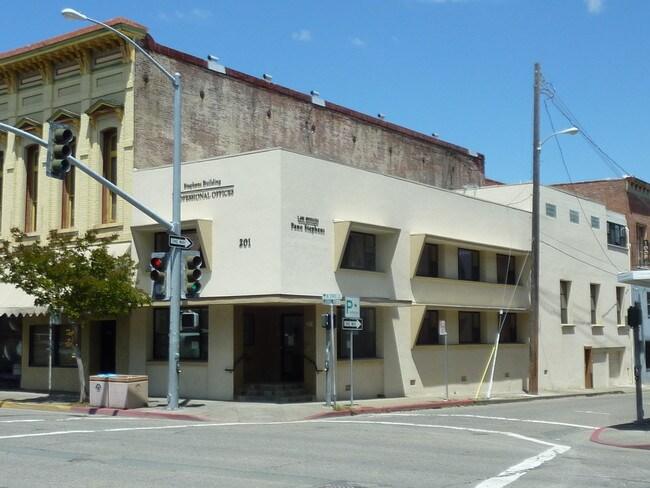
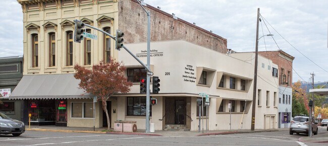
201 N State St, Ukiah, CA 95482

Property Detail
201 N State St
Ukiah, CA
BEGINNING AT THE NE CORNER OF STATE & STANDLEY STS, BEING TH E SW CORNER OF BLOCK 5 OF THE CITY OF UKIAH; THENCE FROM SAI D POB, NORTHERLY ALONG THE EASTERLY LINE OF STATE ST, 20.10; THENCE EASTERLY PARALLEL WITH THE NORTHERLY LINE OF STAND
002-227-08-00
Mendocino
Commercialnec
California
C1
8
B and X Area of moderate flood hazard, usually the area between the limits of the 100-year and 500-year floods.
0.05 AC
2024
California North Rural Area
2025
Other Market Areas
011600
NEARBY LISTINGS FOR SALE OR LEASE
DEMOGRAPHICS near 201 N State St
1 mile
3 mile
5 mile
2025 Total Population
13,340
26,365
31,311
2030 Population
13,228
26,100
30,996
Pop Growth 2025-2030
(0.84%)
(1.01%)
(1.01%)
Average Age
41
41
41
2025 Total Households
5,291
10,040
11,767
HH Growth 2025-2030
(0.85%)
(1.03%)
(1.04%)
Median Household Inc
$65,433
$69,829
$69,850
Avg Household Size
2.40
2.50
2.50
2025 Avg HH Vehicles
2.00
2.00
2.00
Median Home Value
$454,572
$494,914
$491,724
Median Year Built
1968
1971
1972
Nearby Places
Map Layers
Map Styles
 Street
 Aerial
Transit
 Traffic
 Biking
Places
Listings with unknown addresses are not visible on the map
- Restaurants
- Banks
- Shops
- Fitness
- Groceries
SALE & LEASE HISTORY
LISTING DATE
SALE/LEASE

Sep 03, 2020
For Lease
Nov 28, 2017
For Sale
Dec 01, 2017
For Sale
Nearby Properties
Address
Land Use
TOTAL SIZE
Lot Size
Zoning
Address
Land Use
TOTAL SIZE
Lot Size
Zoning
6.21 AC
CM
Address
Land Use
TOTAL SIZE
Lot Size
Zoning
Address
Land Use
TOTAL SIZE
Lot Size
Zoning
8.39 AC
Address
Land Use
TOTAL SIZE
Lot Size
Zoning
12.25 AC
Address
Land Use
TOTAL SIZE
Lot Size
Zoning
Address
Land Use
TOTAL SIZE
Lot Size
Zoning
Address
Land Use
TOTAL SIZE
Lot Size
Zoning
31.76 AC
I
Address
Land Use
TOTAL SIZE
Lot Size
Zoning
13.44 AC
PD
Address
Land Use
TOTAL SIZE
Lot Size
Zoning
4.50 AC
C
Address
Land Use
TOTAL SIZE
Lot Size
Zoning
8.75 AC
Address
Land Use
TOTAL SIZE
Lot Size
Zoning
0.89 AC
C1
Address
Land Use
TOTAL SIZE
Lot Size
Zoning
4.12 AC
Address
Land Use
TOTAL SIZE
Lot Size
Zoning
69,689 SF
9 AC
Address
Land Use
TOTAL SIZE
Lot Size
Zoning
1.50 AC
Address
Land Use
TOTAL SIZE
Lot Size
Zoning
1.38 AC
PD
Address
Land Use
TOTAL SIZE
Lot Size
Zoning
20.49 AC
Address
Land Use
TOTAL SIZE
Lot Size
Zoning
3.83 AC
R3
Address
Land Use
TOTAL SIZE
Lot Size
Zoning
2.62 AC
CM
Address
Land Use
TOTAL SIZE
Lot Size
Zoning
4 AC
C
Address
Land Use
TOTAL SIZE
Lot Size
Zoning
4.04 AC
SR
Address
Land Use
TOTAL SIZE
Lot Size
Zoning
2.55 AC
C
Address
Land Use
TOTAL SIZE
Lot Size
Zoning
2.81 AC
Address
Land Use
TOTAL SIZE
Lot Size
Zoning
16.42 AC
R3
Address
Land Use
TOTAL SIZE
Lot Size
Zoning
2.19 AC
C1
Address
Land Use
TOTAL SIZE
Lot Size
Zoning
1.13 AC
C
Address
Land Use
TOTAL SIZE
Lot Size
Zoning
Address
Land Use
TOTAL SIZE
Lot Size
Zoning
5 AC
I2
Address
Land Use
TOTAL SIZE
Lot Size
Zoning
5.14 AC
C
Address
Land Use
TOTAL SIZE
Lot Size
Zoning
The World's #1 Commercial Real Estate Marketplace
Connect with us
© 2026 CoStar Group
The information above has been obtained from sources believed reliable. While we do not doubt its accuracy we have not verified it and make no guarantee, warranty or representation about it. It is your responsibility to independently confirm its accuracy and completeness. Any projections, opinions, assumptions, or estimates used are for example only and do not represent the current or future performance of the property. The value of this transaction to you depends on tax and other factors which should be evaluated by your tax, financial, and legal advisors. You and your advisors should conduct a careful, independent investigation of the property to determine to your satisfaction the suitability of the property for your needs.