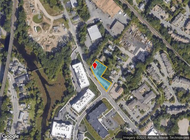
Property Record
201 Revere St, Canton, MA 02021


NEARBY LISTINGS FOR SALE OR LEASE
Property Detail
201 Revere St
Commercialofficeresidentialmixeduse
Norfolk
X
Massachusetts
25021C0192E
0.56 AC
0
Route 1 South
2025
Boston
415103
Boston-Cambridge-Newton, MA-NH
4,998 SF
CANT-000027-000000-000011
DEMOGRAPHICS near 201 Revere St
1 Mile
3 Mile
5 Mile
2024 Total Population
9,216
46,374
129,680
2029 Population
9,243
46,172
128,756
Pop Growth 2024-2029
+ 0.29%
(0.44%)
(0.71%)
Average Age
42
43
42
2024 Total Households
3,734
18,289
49,474
HH Growth 2024-2029
+ 0.40%
(0.44%)
(0.77%)
Median Household Inc
$130,144
$119,107
$116,723
Avg Household Size
2.40
2.50
2.50
2024 Avg HH Vehicles
2.00
2.00
2.00
Median Home Value
$630,488
$587,141
$600,091
Median Year Built
1975
1969
1966
Nearby Places
Map Layers
Map Styles
 Street
 Aerial
- Restaurants
- Banks
- Shops
- Fitness
- Groceries
PUBLIC TRANSPORTATION
TRANSIT/SUBWAY
Canton Center (Providence/Stoughton Line - Massachusetts Bay Transportation Authority Commuter Rail (Purple Line))
DRIVE
WALK
Distance
Canton Center (Providence/Stoughton Line - Massachusetts Bay Transportation Authority Commuter Rail (Purple Line))
2 min
10 min
0.5 mi
Canton Junction (Providence/Stoughton Line - Massachusetts Bay Transportation Authority Commuter Rail (Purple Line))
DRIVE
WALK
Distance
Canton Junction (Providence/Stoughton Line - Massachusetts Bay Transportation Authority Commuter Rail (Purple Line))
3 min
17 min
0.7 mi
COMMUTER RAIL
Canton Center (Providence/Stoughton Line - Massachusetts Bay Transportation Authority Commuter Rail (Purple Line))
DRIVE
WALK
Distance
Canton Center (Providence/Stoughton Line - Massachusetts Bay Transportation Authority Commuter Rail (Purple Line))
2 min
10 min
0.5 mi
Canton Junction (Providence/Stoughton Line - Massachusetts Bay Transportation Authority Commuter Rail (Purple Line))
DRIVE
WALK
Distance
Canton Junction (Providence/Stoughton Line - Massachusetts Bay Transportation Authority Commuter Rail (Purple Line))
3 min
19 min
0.7 mi
AIRPORT
General Edward Lawrence Logan International
DRIVE
WALK
Distance
General Edward Lawrence Logan International
36 min
19.1 mi
Rhode Island Tf Green International
DRIVE
WALK
Distance
Rhode Island Tf Green International
58 min
40.2 mi
SALE & LEASE HISTORY
LISTING DATE
SALE/LEASE

Oct 11, 2021
For Lease
Nov 21, 2022
For Sale
Jun 20, 2019
For Sale
Nearby Properties
Address
Land Use
TOTAL SIZE
Lot Size
Zoning
Address
Land Use
TOTAL SIZE
Lot Size
Zoning
544,990 SF
63.29 AC
Address
Land Use
TOTAL SIZE
Lot Size
Zoning
543,189 SF
22.90 AC
6
Address
Land Use
TOTAL SIZE
Lot Size
Zoning
417,014 SF
10 AC
6
Address
Land Use
TOTAL SIZE
Lot Size
Zoning
56,088 SF
23.94 AC
I
Address
Land Use
TOTAL SIZE
Lot Size
Zoning
30.94 AC
Address
Land Use
TOTAL SIZE
Lot Size
Zoning
198,120 SF
51 AC
3
Address
Land Use
TOTAL SIZE
Lot Size
Zoning
28,561 SF
26.30 AC
Address
Land Use
TOTAL SIZE
Lot Size
Zoning
62,043 SF
10.68 AC
6
Address
Land Use
TOTAL SIZE
Lot Size
Zoning
81,009 SF
22.16 AC
Address
Land Use
TOTAL SIZE
Lot Size
Zoning
263,007 SF
8.11 AC
Address
Land Use
TOTAL SIZE
Lot Size
Zoning
214,600 SF
20.30 AC
RU
Address
Land Use
TOTAL SIZE
Lot Size
Zoning
160,716 SF
18.87 AC
11
Address
Land Use
TOTAL SIZE
Lot Size
Zoning
7.27 AC
GB
Address
Land Use
TOTAL SIZE
Lot Size
Zoning
130,356 SF
14.70 AC
9
Address
Land Use
TOTAL SIZE
Lot Size
Zoning
12.24 AC
I
Address
Land Use
TOTAL SIZE
Lot Size
Zoning
70,216 SF
6.86 AC
7
Address
Land Use
TOTAL SIZE
Lot Size
Zoning
298,820 SF
19.65 AC
6
Address
Land Use
TOTAL SIZE
Lot Size
Zoning
140,489 SF
36.47 AC
11
Address
Land Use
TOTAL SIZE
Lot Size
Zoning
134,165 SF
24.12 AC
Address
Land Use
TOTAL SIZE
Lot Size
Zoning
77,791 SF
2.24 AC
3
Address
Land Use
TOTAL SIZE
Lot Size
Zoning
133,125 SF
16.13 AC
7
Address
Land Use
TOTAL SIZE
Lot Size
Zoning
128,760 SF
19.51 AC
6
Address
Land Use
TOTAL SIZE
Lot Size
Zoning
66,139 SF
20.30 AC
9
Address
Land Use
TOTAL SIZE
Lot Size
Zoning
100,012 SF
7.11 AC
Address
Land Use
TOTAL SIZE
Lot Size
Zoning
94,356 SF
10 AC
6
Address
Land Use
TOTAL SIZE
Lot Size
Zoning
147,498 SF
9.09 AC
Address
Land Use
TOTAL SIZE
Lot Size
Zoning
109,256 SF
13.14 AC
9
Address
Land Use
TOTAL SIZE
Lot Size
Zoning
107,467 SF
19.59 AC
Address
Land Use
TOTAL SIZE
Lot Size
Zoning
158,279 SF
8.60 AC
Address
Land Use
TOTAL SIZE
Lot Size
Zoning
55,182 SF
4.04 AC
The World's #1 Commercial Real Estate Marketplace
Connect with us
© 2025 CoStar Group
The information above has been obtained from sources believed reliable. While we do not doubt its accuracy we have not verified it and make no guarantee, warranty or representation about it. It is your responsibility to independently confirm its accuracy and completeness. Any projections, opinions, assumptions, or estimates used are for example only and do not represent the current or future performance of the property. The value of this transaction to you depends on tax and other factors which should be evaluated by your tax, financial, and legal advisors. You and your advisors should conduct a careful, independent investigation of the property to determine to your satisfaction the suitability of the property for your needs.