Property Record
201 Richland Blvd, Prosper, TX 75078
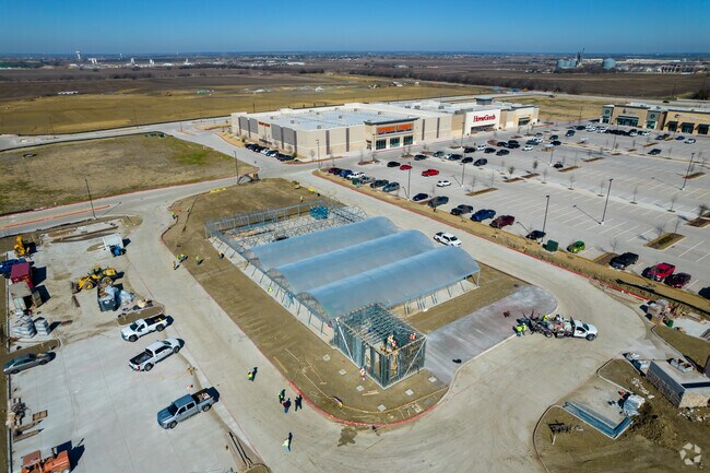

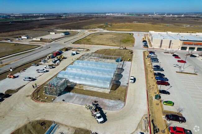
Property Detail
201 Richland Blvd
Dallas-Fort Worth-Arlington, TX
GATES OF PROSPER PHASE 2, BLK A, LOT 7R; ( (REPLAT) )
R-11804-00A-007R-1
COLLIN
Commercialnec
Texas
2025
7r
2025
2.78 AC
030303
N Collin Cty Outlying
14,100 SF
Dallas/Ft Worth
NEARBY LISTINGS FOR SALE OR LEASE
-
-
-
-
-
No Photo
-
-
-
View all Prosper listings for sale on LoopNet.com
DEMOGRAPHICS near 201 Richland Blvd
1 mile
3 mile
5 mile
2024 Total Population
3,162
57,268
169,418
2029 Population
3,853
71,002
208,755
Pop Growth 2024-2029
+ 21.85%
+ 23.98%
+ 23.22%
Average Age
36
34
34
2024 Total Households
887
17,509
51,697
HH Growth 2024-2029
+ 22.21%
+ 24.25%
+ 23.57%
Median Household Inc
$172,337
$157,427
$149,771
Avg Household Size
3.50
3.20
3.20
2024 Avg HH Vehicles
3.00
2.00
2.00
Median Home Value
$564,413
$509,812
$479,789
Median Year Built
2008
2011
2010
Nearby Places
Map Layers
Map Styles
 Street
 Aerial
Transit
 Traffic
 Biking
Places
Listings with unknown addresses are not visible on the map
- Restaurants
- Banks
- Shops
- Fitness
- Groceries
PUBLIC TRANSPORTATION
AIRPORT
Dallas Love Field
Drive
Walk
Distance
Dallas Love Field
42 min
32.0 mi
Dallas-Fort Worth International
Drive
Walk
Distance
Dallas-Fort Worth International
41 min
32.8 mi
Nearby Properties
Address
Land Use
TOTAL SIZE
Lot Size
Zoning
Address
Land Use
TOTAL SIZE
Lot Size
Zoning
479,244 SF
26.82 AC
COMM
Address
Land Use
TOTAL SIZE
Lot Size
Zoning
882,734 SF
98.26 AC
Address
Land Use
TOTAL SIZE
Lot Size
Zoning
797,358 SF
41.94 AC
Address
Land Use
TOTAL SIZE
Lot Size
Zoning
980,997 SF
93.94 AC
Address
Land Use
TOTAL SIZE
Lot Size
Zoning
491,094 SF
14.06 AC
Address
Land Use
TOTAL SIZE
Lot Size
Zoning
490,246 SF
24.39 AC
MF-M
Address
Land Use
TOTAL SIZE
Lot Size
Zoning
151,733 SF
Address
Land Use
TOTAL SIZE
Lot Size
Zoning
530,080 SF
16.91 AC
Address
Land Use
TOTAL SIZE
Lot Size
Zoning
352,470 SF
96.59 AC
Address
Land Use
TOTAL SIZE
Lot Size
Zoning
389,116 SF
9.72 AC
Address
Land Use
TOTAL SIZE
Lot Size
Zoning
357,333 SF
15.01 AC
Address
Land Use
TOTAL SIZE
Lot Size
Zoning
218,013 SF
32.85 AC
AG
Address
Land Use
TOTAL SIZE
Lot Size
Zoning
536,616 SF
23.21 AC
MF-M
Address
Land Use
TOTAL SIZE
Lot Size
Zoning
348,136 SF
23.07 AC
MF-L
Address
Land Use
TOTAL SIZE
Lot Size
Zoning
352,475 SF
16.80 AC
MF-M
Address
Land Use
TOTAL SIZE
Lot Size
Zoning
143,590 SF
30.89 AC
Address
Land Use
TOTAL SIZE
Lot Size
Zoning
275,288 SF
19.40 AC
MF-M
Address
Land Use
TOTAL SIZE
Lot Size
Zoning
262,995 SF
10.27 AC
Address
Land Use
TOTAL SIZE
Lot Size
Zoning
200,259 SF
44.76 AC
Address
Land Use
TOTAL SIZE
Lot Size
Zoning
309,073 SF
32.96 AC
Address
Land Use
TOTAL SIZE
Lot Size
Zoning
146,061 SF
49.28 AC
NS
Address
Land Use
TOTAL SIZE
Lot Size
Zoning
251,455 SF
35.62 AC
Address
Land Use
TOTAL SIZE
Lot Size
Zoning
300,566 SF
7.86 AC
Address
Land Use
TOTAL SIZE
Lot Size
Zoning
436,200 SF
24.95 AC
Address
Land Use
TOTAL SIZE
Lot Size
Zoning
208,462 SF
24.46 AC
Address
Land Use
TOTAL SIZE
Lot Size
Zoning
429,823 SF
73.82 AC
Address
Land Use
TOTAL SIZE
Lot Size
Zoning
136,969 SF
19.87 AC
Address
Land Use
TOTAL SIZE
Lot Size
Zoning
220,499 SF
35.28 AC
Address
Land Use
TOTAL SIZE
Lot Size
Zoning
201,473 SF
48.22 AC
Address
Land Use
TOTAL SIZE
Lot Size
Zoning
139,799 SF
19.66 AC
RESI
The World's #1 Commercial Real Estate Marketplace
Connect with us
© 2026 CoStar Group
The information above has been obtained from sources believed reliable. While we do not doubt its accuracy we have not verified it and make no guarantee, warranty or representation about it. It is your responsibility to independently confirm its accuracy and completeness. Any projections, opinions, assumptions, or estimates used are for example only and do not represent the current or future performance of the property. The value of this transaction to you depends on tax and other factors which should be evaluated by your tax, financial, and legal advisors. You and your advisors should conduct a careful, independent investigation of the property to determine to your satisfaction the suitability of the property for your needs.