Property Record
201 Ricks Dr, Winston Salem, NC 27103

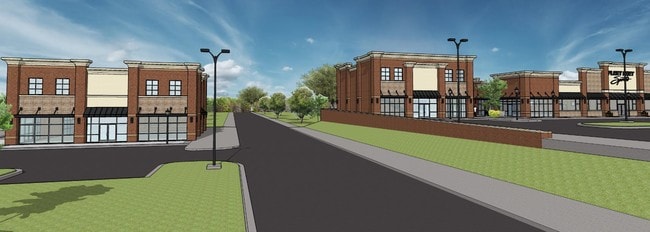
Property Detail
201 Ricks Dr
Winston-Salem, NC
LO:098 BL:3804H
6815-61-9975
FORSYTH
Commercialnec
North Carolina
PB
98
B and X Area of moderate flood hazard, usually the area between the limits of the 100-year and 500-year floods.
0.33 AC
2024
South Forsyth County
2025
Greensboro/Winston-Salem
003804
NEARBY LISTINGS FOR SALE OR LEASE
DEMOGRAPHICS near 201 Ricks Dr
1 mile
3 mile
5 mile
2025 Total Population
6,147
70,287
174,417
2030 Population
6,340
72,464
180,511
Pop Growth 2025-2030
+ 3.14%
+ 3.10%
+ 3.49%
Average Age
43
41
39
2025 Total Households
2,854
33,411
74,075
HH Growth 2025-2030
+ 3.43%
+ 3.36%
+ 3.77%
Median Household Inc
$80,692
$69,690
$62,096
Avg Household Size
2.10
2.00
2.20
2025 Avg HH Vehicles
2.00
2.00
2.00
Median Home Value
$340,269
$303,905
$270,811
Median Year Built
1959
1974
1978
Nearby Places
Map Layers
Map Styles
 Street
 Aerial
Layers
 Traffic
 Biking
Places
Listings with unknown addresses are not visible on the map
- Restaurants
- Banks
- Shops
- Fitness
- Groceries
PUBLIC TRANSPORTATION
AIRPORT
Piedmont Triad International
Drive
Walk
Distance
Piedmont Triad International
38 min
26.6 mi
SALE & LEASE HISTORY
LISTING DATE
SALE/LEASE

Oct 25, 2016
For Lease
Nearby Properties
Address
Land Use
TOTAL SIZE
Lot Size
Zoning
Address
Land Use
TOTAL SIZE
Lot Size
Zoning
133,360 SF
60.44 AC
C,RMU-S
Address
Land Use
TOTAL SIZE
Lot Size
Zoning
822,684 SF
33.33 AC
GB
Address
Land Use
TOTAL SIZE
Lot Size
Zoning
100 SF
2.59 AC
C
Address
Land Use
TOTAL SIZE
Lot Size
Zoning
123,109 SF
65.07 AC
C,HB,LO-S
Address
Land Use
TOTAL SIZE
Lot Size
Zoning
127,530 SF
2.52 AC
C
Address
Land Use
TOTAL SIZE
Lot Size
Zoning
100 SF
1.53 AC
C
Address
Land Use
TOTAL SIZE
Lot Size
Zoning
121,886 SF
3.92 AC
PB-S
Address
Land Use
TOTAL SIZE
Lot Size
Zoning
436,579 SF
72.65 AC
RM8-S
Address
Land Use
TOTAL SIZE
Lot Size
Zoning
316,648 SF
30.46 AC
GB
Address
Land Use
TOTAL SIZE
Lot Size
Zoning
100 SF
2.71 AC
C
Address
Land Use
TOTAL SIZE
Lot Size
Zoning
140,472 SF
1.33 AC
CB WO
Address
Land Use
TOTAL SIZE
Lot Size
Zoning
125,328 SF
19.14 AC
RM18-S
Address
Land Use
TOTAL SIZE
Lot Size
Zoning
117,188 SF
12.22 AC
RM18
Address
Land Use
TOTAL SIZE
Lot Size
Zoning
205,778 SF
4.75 AC
GB
Address
Land Use
TOTAL SIZE
Lot Size
Zoning
200 SF
8.16 AC
PB-S
Address
Land Use
TOTAL SIZE
Lot Size
Zoning
138,636 SF
6.34 AC
RMU-S
Address
Land Use
TOTAL SIZE
Lot Size
Zoning
181,748 SF
7.58 AC
GO,GO-S
Address
Land Use
TOTAL SIZE
Lot Size
Zoning
120,259 SF
13.68 AC
MU-S
Address
Land Use
TOTAL SIZE
Lot Size
Zoning
30,360 SF
17.09 AC
CPO-S
Address
Land Use
TOTAL SIZE
Lot Size
Zoning
112,000 SF
15.57 AC
IP
Address
Land Use
TOTAL SIZE
Lot Size
Zoning
297,487 SF
40.24 AC
RM12,RM18
Address
Land Use
TOTAL SIZE
Lot Size
Zoning
143,081 SF
4.88 AC
GB-S
Address
Land Use
TOTAL SIZE
Lot Size
Zoning
207,203 SF
4.26 AC
PB
Address
Land Use
TOTAL SIZE
Lot Size
Zoning
70,376 SF
2.86 AC
PB-S
Address
Land Use
TOTAL SIZE
Lot Size
Zoning
166,757 SF
5.89 AC
HB
Address
Land Use
TOTAL SIZE
Lot Size
Zoning
124,134 SF
2.14 AC
CB WO
Address
Land Use
TOTAL SIZE
Lot Size
Zoning
121,925 SF
1.49 AC
GO
Address
Land Use
TOTAL SIZE
Lot Size
Zoning
200,188 SF
4.99 AC
GB-S
Address
Land Use
TOTAL SIZE
Lot Size
Zoning
125,015 SF
33.69 AC
LO-S,RM8-S
Address
Land Use
TOTAL SIZE
Lot Size
Zoning
56,975 SF
0.26 AC
CB WO
The World's #1 Commercial Real Estate Marketplace
Connect with us
© 2026 CoStar Group
The information above has been obtained from sources believed reliable. While we do not doubt its accuracy we have not verified it and make no guarantee, warranty or representation about it. It is your responsibility to independently confirm its accuracy and completeness. Any projections, opinions, assumptions, or estimates used are for example only and do not represent the current or future performance of the property. The value of this transaction to you depends on tax and other factors which should be evaluated by your tax, financial, and legal advisors. You and your advisors should conduct a careful, independent investigation of the property to determine to your satisfaction the suitability of the property for your needs.