Property Record
201 S 68Th Street Pl, Lincoln, NE 68510
This Property Is For Sale
NEARBY LISTINGS FOR SALE OR LEASE
Property Detail
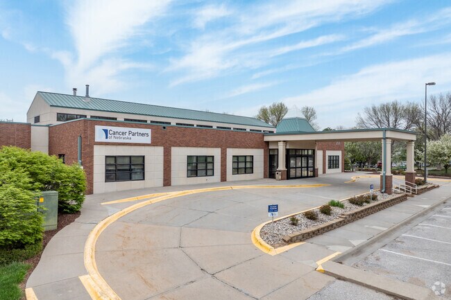
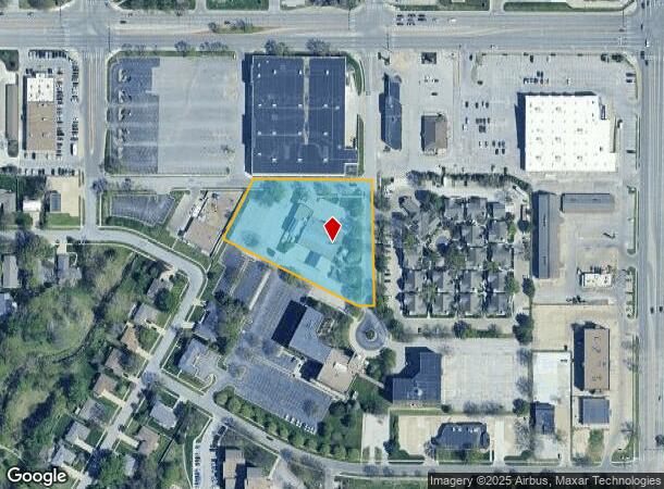
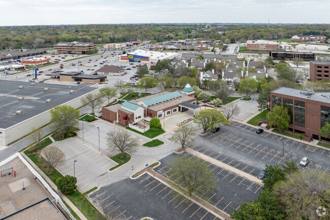
201 S 68Th Street Pl
Lincoln, NE
Executive Center 2Nd Addition
17-28-221-002-000
EXECUTIVE CENTER 2ND ADDITION, LOT 2
Officebuilding
Lancaster
X
Nebraska
31109C0317F
2
2024
2.33 AC
2025
East
001301
Lincoln
22,393 SF
DEMOGRAPHICS near 201 S 68Th Street Pl
1 Mile
3 Mile
5 Mile
2024 Total Population
12,600
103,517
206,039
2029 Population
13,114
107,462
213,655
Pop Growth 2024-2029
+ 4.08%
+ 3.81%
+ 3.70%
Average Age
41
39
38
2024 Total Households
5,517
44,441
87,883
HH Growth 2024-2029
+ 4.02%
+ 3.92%
+ 3.86%
Median Household Inc
$68,828
$62,544
$59,869
Avg Household Size
2.20
2.20
2.20
2024 Avg HH Vehicles
2.00
2.00
2.00
Median Home Value
$208,644
$197,655
$216,167
Median Year Built
1969
1970
1973
Nearby Places
Map Layers
Map Styles
 Street
 Aerial
- Restaurants
- Banks
- Shops
- Fitness
- Groceries
PUBLIC TRANSPORTATION
COMMUTER RAIL
Lincoln Amtrak Station (California Zephyr - Amtrak)
DRIVE
WALK
Distance
Lincoln Amtrak Station (California Zephyr - Amtrak)
10 min
4.7 mi
AIRPORT
Lincoln
DRIVE
WALK
Distance
Lincoln
18 min
9.5 mi
Freight Ports
Tulsa Port Of Catoosa
DRIVE
WALK
Distance
Tulsa Port Of Catoosa
467 min
390.1 mi
Nearby Properties
Address
Land Use
TOTAL SIZE
Lot Size
Zoning
Address
Land Use
TOTAL SIZE
Lot Size
Zoning
604,749 SF
20.55 AC
R2
Address
Land Use
TOTAL SIZE
Lot Size
Zoning
364,797 SF
25.06 AC
R1
Address
Land Use
TOTAL SIZE
Lot Size
Zoning
382,244 SF
44.25 AC
R6
Address
Land Use
TOTAL SIZE
Lot Size
Zoning
329,069 SF
30 AC
R6
Address
Land Use
TOTAL SIZE
Lot Size
Zoning
531,687 SF
32.18 AC
B5
Address
Land Use
TOTAL SIZE
Lot Size
Zoning
47,866 SF
10.39 AC
R3
Address
Land Use
TOTAL SIZE
Lot Size
Zoning
32,110 SF
14.60 AC
R5
Address
Land Use
TOTAL SIZE
Lot Size
Zoning
71,046 SF
23.72 AC
R5
Address
Land Use
TOTAL SIZE
Lot Size
Zoning
37,240 SF
17.06 AC
NULL
Address
Land Use
TOTAL SIZE
Lot Size
Zoning
234,103 SF
13.56 AC
R2
Address
Land Use
TOTAL SIZE
Lot Size
Zoning
36,751 SF
1.80 AC
B5
Address
Land Use
TOTAL SIZE
Lot Size
Zoning
65,064 SF
1.39 AC
R6
Address
Land Use
TOTAL SIZE
Lot Size
Zoning
179,447 SF
7.85 AC
R6
Address
Land Use
TOTAL SIZE
Lot Size
Zoning
102,739 SF
4.24 AC
B2
Address
Land Use
TOTAL SIZE
Lot Size
Zoning
119,335 SF
26.11 AC
R1
Address
Land Use
TOTAL SIZE
Lot Size
Zoning
142,179 SF
9.68 AC
R3
Address
Land Use
TOTAL SIZE
Lot Size
Zoning
225,199 SF
31.18 AC
O3
Address
Land Use
TOTAL SIZE
Lot Size
Zoning
148,760 SF
4.99 AC
R4
Address
Land Use
TOTAL SIZE
Lot Size
Zoning
10,688 SF
237.77 AC
P
Address
Land Use
TOTAL SIZE
Lot Size
Zoning
192,751 SF
18.49 AC
B5
Address
Land Use
TOTAL SIZE
Lot Size
Zoning
32,443 SF
7.20 AC
NULL
Address
Land Use
TOTAL SIZE
Lot Size
Zoning
46,906 SF
2.88 AC
Address
Land Use
TOTAL SIZE
Lot Size
Zoning
214,823 SF
19.37 AC
B5
Address
Land Use
TOTAL SIZE
Lot Size
Zoning
51,080 SF
12.42 AC
Address
Land Use
TOTAL SIZE
Lot Size
Zoning
73,737 SF
5.98 AC
B2
Address
Land Use
TOTAL SIZE
Lot Size
Zoning
68,664 SF
7 AC
NULL
Address
Land Use
TOTAL SIZE
Lot Size
Zoning
92,054 SF
6.22 AC
R5
Address
Land Use
TOTAL SIZE
Lot Size
Zoning
69,760 SF
1.81 AC
Address
Land Use
TOTAL SIZE
Lot Size
Zoning
18,506 SF
12.61 AC
NULL
Address
Land Use
TOTAL SIZE
Lot Size
Zoning
30,608 SF
25.92 AC
R4
The World's #1 Commercial Real Estate Marketplace
Connect with us
© 2026 CoStar Group
The information above has been obtained from sources believed reliable. While we do not doubt its accuracy we have not verified it and make no guarantee, warranty or representation about it. It is your responsibility to independently confirm its accuracy and completeness. Any projections, opinions, assumptions, or estimates used are for example only and do not represent the current or future performance of the property. The value of this transaction to you depends on tax and other factors which should be evaluated by your tax, financial, and legal advisors. You and your advisors should conduct a careful, independent investigation of the property to determine to your satisfaction the suitability of the property for your needs.