Property Record
201 S Main St, Clintonville, WI 54929
NEARBY LISTINGS FOR SALE OR LEASE
Property Detail
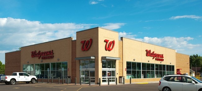
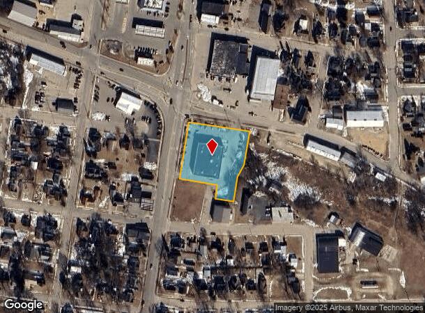
201 S Main St
30 26 74 10
Clintons 3Rd Add
Commercialnec
PRT BLK1 CLINTONS 3RD ADD & PRT RR ROW DAF LT1 CSM V27P53 EX #780375 V369P560 V407P332 V421P304 V435P512 V454P487 V455P462 V493P538 EXV503P449 V549P752 V624P693 EX V645P330 V648P76 EX V649P353 V649P720 V650P139 V774P279 V796P377 V797P511 V802P06 V807
X
Waupaca
55135C0232D
Wisconsin
2023
1
2024
1.30 AC
100300
Wisconsin North Area
13,650 SF
Other Market Areas
DEMOGRAPHICS near 201 S Main St
1 Mile
3 Mile
5 Mile
2024 Total Population
3,957
5,888
7,242
2029 Population
3,984
5,935
7,268
Pop Growth 2024-2029
+ 0.68%
+ 0.80%
+ 0.36%
Average Age
42
42
43
2024 Total Households
1,811
2,654
3,187
HH Growth 2024-2029
+ 0.77%
+ 0.87%
+ 0.41%
Median Household Inc
$54,238
$55,596
$57,499
Avg Household Size
2.10
2.20
2.20
2024 Avg HH Vehicles
2.00
2.00
2.00
Median Home Value
$114,762
$126,383
$141,139
Median Year Built
1970
1973
1973
Nearby Places
Map Layers
Map Styles
 Street
 Aerial
- Restaurants
- Banks
- Shops
- Fitness
- Groceries
PUBLIC TRANSPORTATION
AIRPORT
Appleton International
DRIVE
WALK
Distance
Appleton International
53 min
34.2 mi
Nearby Properties
Address
Land Use
TOTAL SIZE
Lot Size
Zoning
Address
Land Use
TOTAL SIZE
Lot Size
Zoning
19.95 AC
Address
Land Use
TOTAL SIZE
Lot Size
Zoning
Address
Land Use
TOTAL SIZE
Lot Size
Zoning
76,264 SF
6.27 AC
Address
Land Use
TOTAL SIZE
Lot Size
Zoning
30,128 SF
11.23 AC
Address
Land Use
TOTAL SIZE
Lot Size
Zoning
24,334 SF
22.62 AC
Address
Land Use
TOTAL SIZE
Lot Size
Zoning
40,661 SF
5.40 AC
Address
Land Use
TOTAL SIZE
Lot Size
Zoning
7.53 AC
Address
Land Use
TOTAL SIZE
Lot Size
Zoning
14.02 AC
Address
Land Use
TOTAL SIZE
Lot Size
Zoning
42 AC
A-G
Address
Land Use
TOTAL SIZE
Lot Size
Zoning
5,799 SF
2.50 AC
Address
Land Use
TOTAL SIZE
Lot Size
Zoning
20,876 SF
4.40 AC
Address
Land Use
TOTAL SIZE
Lot Size
Zoning
Address
Land Use
TOTAL SIZE
Lot Size
Zoning
16,580 SF
7.28 AC
Address
Land Use
TOTAL SIZE
Lot Size
Zoning
46,080 SF
3.39 AC
Address
Land Use
TOTAL SIZE
Lot Size
Zoning
29,670 SF
3.37 AC
Address
Land Use
TOTAL SIZE
Lot Size
Zoning
7.16 AC
Address
Land Use
TOTAL SIZE
Lot Size
Zoning
Address
Land Use
TOTAL SIZE
Lot Size
Zoning
9.52 AC
Address
Land Use
TOTAL SIZE
Lot Size
Zoning
33.22 AC
Address
Land Use
TOTAL SIZE
Lot Size
Zoning
Address
Land Use
TOTAL SIZE
Lot Size
Zoning
14,348 SF
0.52 AC
Address
Land Use
TOTAL SIZE
Lot Size
Zoning
50,610 SF
8.52 AC
Address
Land Use
TOTAL SIZE
Lot Size
Zoning
21,618 SF
4.06 AC
Address
Land Use
TOTAL SIZE
Lot Size
Zoning
9.84 AC
Address
Land Use
TOTAL SIZE
Lot Size
Zoning
8,601 SF
1.77 AC
Address
Land Use
TOTAL SIZE
Lot Size
Zoning
Address
Land Use
TOTAL SIZE
Lot Size
Zoning
55.32 AC
Address
Land Use
TOTAL SIZE
Lot Size
Zoning
9,108 SF
97.07 AC
A-G
Address
Land Use
TOTAL SIZE
Lot Size
Zoning
0.17 AC
The World's #1 Commercial Real Estate Marketplace
Connect with us
© 2026 CoStar Group
The information above has been obtained from sources believed reliable. While we do not doubt its accuracy we have not verified it and make no guarantee, warranty or representation about it. It is your responsibility to independently confirm its accuracy and completeness. Any projections, opinions, assumptions, or estimates used are for example only and do not represent the current or future performance of the property. The value of this transaction to you depends on tax and other factors which should be evaluated by your tax, financial, and legal advisors. You and your advisors should conduct a careful, independent investigation of the property to determine to your satisfaction the suitability of the property for your needs.