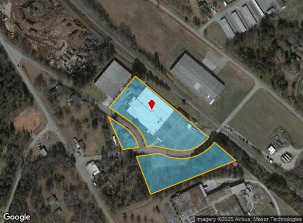
Property Record
201 Sc Elastic Rd, Landrum, SC 29356


NEARBY LISTINGS FOR SALE OR LEASE
Property Detail
201 Sc Elastic Rd
Spartanburg, SC
Boomer Holdings Llc
1-14-00-046.00
LOT 1 BOOMER HOLDINGS LLC SUR PB 180-402
Commercialnec
Spartanburg
X
South Carolina
45083C0016D
1
2024
8.51 AC
2025
Upper Spartanburg Cty
022500
Greenville/Spartanburg
79,797 SF
DEMOGRAPHICS near 201 Sc Elastic Rd
1 mile
3 mile
5 mile
2024 Total Population
1,331
6,260
14,434
2029 Population
1,509
7,121
16,263
Pop Growth 2024-2029
+ 13.37%
+ 13.75%
+ 12.67%
Average Age
44
44
46
2024 Total Households
593
2,657
6,108
HH Growth 2024-2029
+ 13.49%
+ 13.93%
+ 12.74%
Median Household Inc
$43,333
$52,772
$56,395
Avg Household Size
2.20
2.30
2.30
2024 Avg HH Vehicles
2.00
2.00
2.00
Median Home Value
$217,557
$229,541
$266,454
Median Year Built
1974
1978
1982
Nearby Places
Map Layers
Map Styles
 Street
 Aerial
Transit
 Traffic
 Biking
Places
Listings with unknown addresses are not visible on the map
- Restaurants
- Banks
- Shops
- Fitness
- Groceries
PUBLIC TRANSPORTATION
AIRPORT
Greenville Spartanburg International
Drive
Walk
Distance
Greenville Spartanburg International
38 min
21.5 mi
Asheville Regional
Drive
Walk
Distance
Asheville Regional
47 min
35.5 mi
SALE & LEASE HISTORY
LISTING DATE
SALE/LEASE

Oct 18, 2017
For Sale
Jul 26, 2018
For Lease
Jul 25, 2018
For Sale
Feb 17, 2017
For Sale
Nearby Properties
Address
Land Use
TOTAL SIZE
Lot Size
Zoning
Address
Land Use
TOTAL SIZE
Lot Size
Zoning
166.74 AC
RE5
Address
Land Use
TOTAL SIZE
Lot Size
Zoning
332.64 AC
Address
Land Use
TOTAL SIZE
Lot Size
Zoning
2,290 SF
23.19 AC
RE5
Address
Land Use
TOTAL SIZE
Lot Size
Zoning
2,135 SF
24.18 AC
RE5
Address
Land Use
TOTAL SIZE
Lot Size
Zoning
26.23 AC
RE5
Address
Land Use
TOTAL SIZE
Lot Size
Zoning
1,312 SF
86.21 AC
RE5
Address
Land Use
TOTAL SIZE
Lot Size
Zoning
1,974 SF
9.46 AC
RE5
Address
Land Use
TOTAL SIZE
Lot Size
Zoning
2,712 SF
10.53 AC
RE5
Address
Land Use
TOTAL SIZE
Lot Size
Zoning
Address
Land Use
TOTAL SIZE
Lot Size
Zoning
9.61 AC
RE5
Address
Land Use
TOTAL SIZE
Lot Size
Zoning
8.57 AC
RE5
Address
Land Use
TOTAL SIZE
Lot Size
Zoning
1,639 SF
8.85 AC
RE5
Address
Land Use
TOTAL SIZE
Lot Size
Zoning
51.65 AC
Address
Land Use
TOTAL SIZE
Lot Size
Zoning
1,440 SF
9.18 AC
RE5
Address
Land Use
TOTAL SIZE
Lot Size
Zoning
2,648 SF
9.02 AC
RE5
Address
Land Use
TOTAL SIZE
Lot Size
Zoning
1,596 SF
20.20 AC
RE5
Address
Land Use
TOTAL SIZE
Lot Size
Zoning
2,548 SF
97.14 AC
RE5
Address
Land Use
TOTAL SIZE
Lot Size
Zoning
2,410 SF
8.70 AC
RE5
Address
Land Use
TOTAL SIZE
Lot Size
Zoning
2,242 SF
26.48 AC
RE5
Address
Land Use
TOTAL SIZE
Lot Size
Zoning
2,536 SF
7.30 AC
RE5
Address
Land Use
TOTAL SIZE
Lot Size
Zoning
5,104 SF
1.19 AC
Address
Land Use
TOTAL SIZE
Lot Size
Zoning
1,244 SF
5.30 AC
RE5
Address
Land Use
TOTAL SIZE
Lot Size
Zoning
1,985 SF
8.53 AC
RE5
Address
Land Use
TOTAL SIZE
Lot Size
Zoning
3,378 SF
12 AC
Address
Land Use
TOTAL SIZE
Lot Size
Zoning
0.21 AC
Address
Land Use
TOTAL SIZE
Lot Size
Zoning
20.67 AC
Address
Land Use
TOTAL SIZE
Lot Size
Zoning
114,986 SF
29.83 AC
Address
Land Use
TOTAL SIZE
Lot Size
Zoning
1,992 SF
7.35 AC
RE5
Address
Land Use
TOTAL SIZE
Lot Size
Zoning
4.46 AC
RE5
Address
Land Use
TOTAL SIZE
Lot Size
Zoning
4,226 SF
3 AC
The World's #1 Commercial Real Estate Marketplace
Connect with us
© 2026 CoStar Group
The information above has been obtained from sources believed reliable. While we do not doubt its accuracy we have not verified it and make no guarantee, warranty or representation about it. It is your responsibility to independently confirm its accuracy and completeness. Any projections, opinions, assumptions, or estimates used are for example only and do not represent the current or future performance of the property. The value of this transaction to you depends on tax and other factors which should be evaluated by your tax, financial, and legal advisors. You and your advisors should conduct a careful, independent investigation of the property to determine to your satisfaction the suitability of the property for your needs.