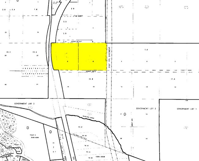
Property Record
201 Valentine Way, Longwood, FL 32750


NEARBY LISTINGS FOR SALE OR LEASE
Property Detail
201 Valentine Way
Orlando-Kissimmee-Sanford, FL
Shumans Add To Eureka Hammock
27-20-30-501-0000-0060
LOTS 5 & 6 SHUMANS ADD TO EUREKA HAMMOCK PB 2 PG 53
Countyproperty
Seminole
X
Florida
12117C0160F
5,6
0
17.62 AC
2025
Seminole County
021000
Orlando
2,668 SF
DEMOGRAPHICS near 201 Valentine Way
1 Mile
3 Mile
5 Mile
2024 Total Population
2,081
59,741
173,306
2029 Population
2,149
61,938
180,472
Pop Growth 2024-2029
+ 3.27%
+ 3.68%
+ 4.13%
Average Age
41
41
41
2024 Total Households
826
22,818
66,752
HH Growth 2024-2029
+ 3.27%
+ 3.79%
+ 4.23%
Median Household Inc
$60,214
$65,956
$69,318
Avg Household Size
2.50
2.50
2.50
2024 Avg HH Vehicles
2.00
2.00
2.00
Median Home Value
$277,297
$272,005
$293,512
Median Year Built
1980
1985
1986
Nearby Places
Map Layers
Map Styles
 Street
 Aerial
- Restaurants
- Banks
- Shops
- Fitness
- Groceries
PUBLIC TRANSPORTATION
COMMUTER RAIL
Lake Mary (SunRail - Florida Department of Transportation)
DRIVE
WALK
Distance
Lake Mary (SunRail - Florida Department of Transportation)
7 min
3.9 mi
Longwood (SunRail - Florida Department of Transportation)
DRIVE
WALK
Distance
Longwood (SunRail - Florida Department of Transportation)
8 min
4.1 mi
AIRPORT
Orlando Sanford International
DRIVE
WALK
Distance
Orlando Sanford International
13 min
7.2 mi
Orlando International
DRIVE
WALK
Distance
Orlando International
39 min
22.8 mi
Freight Ports
Port Canaveral
DRIVE
WALK
Distance
Port Canaveral
78 min
64.0 mi
Nearby Properties
Address
Land Use
TOTAL SIZE
Lot Size
Zoning
Address
Land Use
TOTAL SIZE
Lot Size
Zoning
918,847 SF
190.82 AC
MR2
Address
Land Use
TOTAL SIZE
Lot Size
Zoning
629,182 SF
1.81 AC
R1A
Address
Land Use
TOTAL SIZE
Lot Size
Zoning
314,822 SF
10.96 AC
GC2
Address
Land Use
TOTAL SIZE
Lot Size
Zoning
540 SF
7.72 AC
GC
Address
Land Use
TOTAL SIZE
Lot Size
Zoning
350,767 SF
11.12 AC
PUD
Address
Land Use
TOTAL SIZE
Lot Size
Zoning
351,501 SF
4.45 AC
TC
Address
Land Use
TOTAL SIZE
Lot Size
Zoning
3,668 SF
2.97 AC
C1
Address
Land Use
TOTAL SIZE
Lot Size
Zoning
97,888 SF
3.72 AC
IND
Address
Land Use
TOTAL SIZE
Lot Size
Zoning
387,705 SF
61.24 AC
TC
Address
Land Use
TOTAL SIZE
Lot Size
Zoning
505 SF
1.94 AC
Address
Land Use
TOTAL SIZE
Lot Size
Zoning
10,757 SF
70.59 AC
C2
Address
Land Use
TOTAL SIZE
Lot Size
Zoning
380,268 SF
14.77 AC
A1
Address
Land Use
TOTAL SIZE
Lot Size
Zoning
1,077 SF
3.17 AC
Address
Land Use
TOTAL SIZE
Lot Size
Zoning
1,518 SF
12.08 AC
PUD
Address
Land Use
TOTAL SIZE
Lot Size
Zoning
138,513 SF
14.95 AC
GC2
Address
Land Use
TOTAL SIZE
Lot Size
Zoning
1,696 SF
0.16 AC
A1
Address
Land Use
TOTAL SIZE
Lot Size
Zoning
204,151 SF
12 AC
MR2
Address
Land Use
TOTAL SIZE
Lot Size
Zoning
121,720 SF
7.20 AC
GC2
Address
Land Use
TOTAL SIZE
Lot Size
Zoning
195,936 SF
58.50 AC
PUD
Address
Land Use
TOTAL SIZE
Lot Size
Zoning
101.53 AC
PUD
Address
Land Use
TOTAL SIZE
Lot Size
Zoning
29,863 SF
6.95 AC
Address
Land Use
TOTAL SIZE
Lot Size
Zoning
2,100 SF
10.98 AC
Address
Land Use
TOTAL SIZE
Lot Size
Zoning
1,124 SF
11.01 AC
MR2
Address
Land Use
TOTAL SIZE
Lot Size
Zoning
209,331 SF
18.73 AC
GC2
Address
Land Use
TOTAL SIZE
Lot Size
Zoning
113,556 SF
74.69 AC
A1
Address
Land Use
TOTAL SIZE
Lot Size
Zoning
286,491 SF
13.96 AC
R1A
Address
Land Use
TOTAL SIZE
Lot Size
Zoning
109,610 SF
6.52 AC
Address
Land Use
TOTAL SIZE
Lot Size
Zoning
480 SF
20.56 AC
GC2
Address
Land Use
TOTAL SIZE
Lot Size
Zoning
119,483 SF
14.94 AC
A1
Address
Land Use
TOTAL SIZE
Lot Size
Zoning
40,040 SF
2.72 AC
The World's #1 Commercial Real Estate Marketplace
Connect with us
© 2026 CoStar Group
The information above has been obtained from sources believed reliable. While we do not doubt its accuracy we have not verified it and make no guarantee, warranty or representation about it. It is your responsibility to independently confirm its accuracy and completeness. Any projections, opinions, assumptions, or estimates used are for example only and do not represent the current or future performance of the property. The value of this transaction to you depends on tax and other factors which should be evaluated by your tax, financial, and legal advisors. You and your advisors should conduct a careful, independent investigation of the property to determine to your satisfaction the suitability of the property for your needs.