Property Record
201 W High St, Liberty, IN 47353
NEARBY LISTINGS FOR SALE OR LEASE
-
-
View all Liberty listings for sale on LoopNet.com
Property Detail
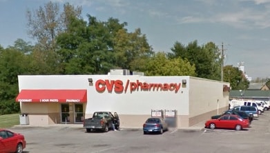
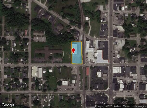
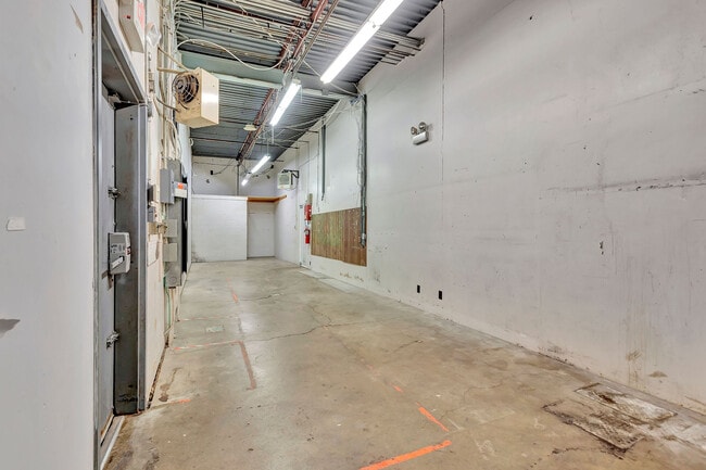
201 W High St
81-08-12-101-022.001-003
Town Liberty
Storebuilding
12-11-02 ALL OF LOT 26 & PART OF 51, ORIGINAL PLAT CVS PHARMACY
X
Union
18177C0375E
Indiana
2024
26
2024
0.61 AC
960700
Indiana South Area
7,500 SF
Other Market Areas
DEMOGRAPHICS near 201 W High St
1 Mile
3 Mile
5 Mile
2024 Total Population
2,369
3,207
4,544
2029 Population
2,340
3,162
4,475
Pop Growth 2024-2029
(1.22%)
(1.40%)
(1.52%)
Average Age
41
41
42
2024 Total Households
1,019
1,355
1,889
HH Growth 2024-2029
(1.18%)
(1.25%)
(1.43%)
Median Household Inc
$57,480
$59,071
$60,508
Avg Household Size
2.30
2.30
2.40
2024 Avg HH Vehicles
2.00
2.00
2.00
Median Home Value
$122,166
$131,796
$138,362
Median Year Built
1965
1966
1967
Nearby Places
Map Layers
Map Styles
 Street
 Aerial
- Restaurants
- Banks
- Shops
- Fitness
- Groceries
SALE & LEASE HISTORY
LISTING DATE
SALE/LEASE

Oct 02, 2023
For Sale
Nov 07, 2016
For Sale
Jan 10, 2017
For Sale
Nearby Properties
Address
Land Use
TOTAL SIZE
Lot Size
Zoning
Address
Land Use
TOTAL SIZE
Lot Size
Zoning
43,872 SF
9.58 AC
Address
Land Use
TOTAL SIZE
Lot Size
Zoning
112,744 SF
22.05 AC
Address
Land Use
TOTAL SIZE
Lot Size
Zoning
Address
Land Use
TOTAL SIZE
Lot Size
Zoning
4,150 SF
4.06 AC
Address
Land Use
TOTAL SIZE
Lot Size
Zoning
13,514 SF
4.36 AC
Address
Land Use
TOTAL SIZE
Lot Size
Zoning
19,228 SF
3.10 AC
Address
Land Use
TOTAL SIZE
Lot Size
Zoning
9,204 SF
4 AC
Address
Land Use
TOTAL SIZE
Lot Size
Zoning
146.16 AC
Address
Land Use
TOTAL SIZE
Lot Size
Zoning
6,540 SF
Address
Land Use
TOTAL SIZE
Lot Size
Zoning
5,760 SF
0.41 AC
Address
Land Use
TOTAL SIZE
Lot Size
Zoning
166.18 AC
Address
Land Use
TOTAL SIZE
Lot Size
Zoning
3,028 SF
1.65 AC
Address
Land Use
TOTAL SIZE
Lot Size
Zoning
7,000 SF
2.99 AC
Address
Land Use
TOTAL SIZE
Lot Size
Zoning
208.26 AC
Address
Land Use
TOTAL SIZE
Lot Size
Zoning
7,680 SF
0.12 AC
Address
Land Use
TOTAL SIZE
Lot Size
Zoning
600 SF
Address
Land Use
TOTAL SIZE
Lot Size
Zoning
125.09 AC
Address
Land Use
TOTAL SIZE
Lot Size
Zoning
14,856 SF
0.87 AC
Address
Land Use
TOTAL SIZE
Lot Size
Zoning
45,216 SF
5.39 AC
Address
Land Use
TOTAL SIZE
Lot Size
Zoning
155.25 AC
Address
Land Use
TOTAL SIZE
Lot Size
Zoning
7,680 SF
0.12 AC
Address
Land Use
TOTAL SIZE
Lot Size
Zoning
2,020 SF
148.14 AC
Address
Land Use
TOTAL SIZE
Lot Size
Zoning
1,500 SF
1.64 AC
Address
Land Use
TOTAL SIZE
Lot Size
Zoning
7,680 SF
2.26 AC
Address
Land Use
TOTAL SIZE
Lot Size
Zoning
24,252 SF
1.20 AC
Address
Land Use
TOTAL SIZE
Lot Size
Zoning
7,332 SF
3.37 AC
Address
Land Use
TOTAL SIZE
Lot Size
Zoning
6,180 SF
Address
Land Use
TOTAL SIZE
Lot Size
Zoning
6,180 SF
Address
Land Use
TOTAL SIZE
Lot Size
Zoning
2,330 SF
0.46 AC
Address
Land Use
TOTAL SIZE
Lot Size
Zoning
8,100 SF
1.04 AC
The World's #1 Commercial Real Estate Marketplace
Connect with us
© 2026 CoStar Group
The information above has been obtained from sources believed reliable. While we do not doubt its accuracy we have not verified it and make no guarantee, warranty or representation about it. It is your responsibility to independently confirm its accuracy and completeness. Any projections, opinions, assumptions, or estimates used are for example only and do not represent the current or future performance of the property. The value of this transaction to you depends on tax and other factors which should be evaluated by your tax, financial, and legal advisors. You and your advisors should conduct a careful, independent investigation of the property to determine to your satisfaction the suitability of the property for your needs.