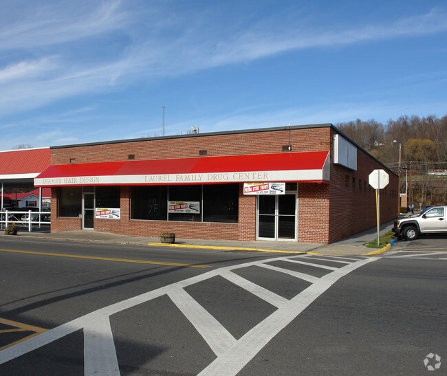
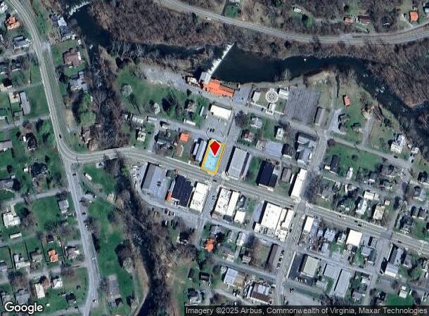
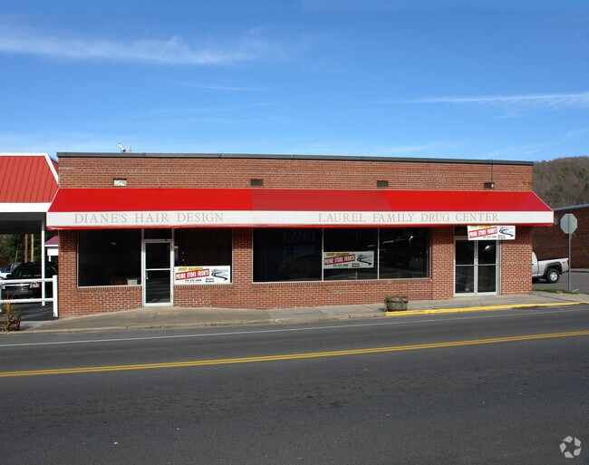
Property Record
201 W Laurel Ave, Damascus, VA 24236
NEARBY LISTINGS FOR SALE OR LEASE
-
-
View all Damascus listings for sale on LoopNet.com
Property Detail
201 W Laurel Ave
172B1-A-169
10 & 12 LAUREL AVE ACR .16
Commercialnec
Washington
AE
Virginia
51191C0320C
0.16 AC
2024
Washington County
2025
Kingsport/Bristol/Bristol
010900
Kingsport-Bristol-Bristol, TN-VA
6,800 SF
DEMOGRAPHICS near 201 W Laurel Ave
1 Mile
3 Mile
5 Mile
2024 Total Population
1,090
1,969
4,058
2029 Population
1,069
1,933
4,058
Pop Growth 2024-2029
(1.93%)
(1.83%)
0.00%
Average Age
43
44
44
2024 Total Households
469
862
1,753
HH Growth 2024-2029
(1.92%)
(1.74%)
0.00%
Median Household Inc
$29,999
$31,666
$37,678
Avg Household Size
2.20
2.20
2.30
2024 Avg HH Vehicles
2.00
2.00
2.00
Median Home Value
$158,715
$160,566
$176,113
Median Year Built
1968
1971
1977
Nearby Places
Map Layers
Map Styles
 Street
 Aerial
- Restaurants
- Banks
- Shops
- Fitness
- Groceries
PUBLIC TRANSPORTATION
AIRPORT
Tri-Cities
DRIVE
WALK
Distance
Tri-Cities
56 min
45.7 mi
Nearby Properties
Address
Land Use
TOTAL SIZE
Lot Size
Zoning
Address
Land Use
TOTAL SIZE
Lot Size
Zoning
56,898 SF
10.40 AC
A2 AGRICUL
Address
Land Use
TOTAL SIZE
Lot Size
Zoning
63,330 SF
18 AC
A1 AGRICUL
Address
Land Use
TOTAL SIZE
Lot Size
Zoning
45,018 SF
6.81 AC
DAMASCUS
Address
Land Use
TOTAL SIZE
Lot Size
Zoning
2,100 SF
6.42 AC
A2 AGRICUL
Address
Land Use
TOTAL SIZE
Lot Size
Zoning
95,492 SF
10.95 AC
M1 INDUSTR
Address
Land Use
TOTAL SIZE
Lot Size
Zoning
29,356 SF
1.62 AC
DAMASCUS
Address
Land Use
TOTAL SIZE
Lot Size
Zoning
6,180 SF
0.69 AC
DAMASCUS
Address
Land Use
TOTAL SIZE
Lot Size
Zoning
37,072 SF
1.82 AC
DAMASCUS
Address
Land Use
TOTAL SIZE
Lot Size
Zoning
21,342 SF
1.25 AC
DAMASCUS
Address
Land Use
TOTAL SIZE
Lot Size
Zoning
10,764 SF
1.45 AC
DAMASCUS
Address
Land Use
TOTAL SIZE
Lot Size
Zoning
7,205 SF
0.50 AC
DAMASCUS
Address
Land Use
TOTAL SIZE
Lot Size
Zoning
5,368 SF
2.09 AC
A2 AGRICUL
Address
Land Use
TOTAL SIZE
Lot Size
Zoning
5,088 SF
0.48 AC
DAMASCUS
Address
Land Use
TOTAL SIZE
Lot Size
Zoning
2,392 SF
0.15 AC
DAMASCUS
Address
Land Use
TOTAL SIZE
Lot Size
Zoning
11,474 SF
0.35 AC
DAMASCUS
Address
Land Use
TOTAL SIZE
Lot Size
Zoning
8,108 SF
4.51 AC
DAMASCUS
Address
Land Use
TOTAL SIZE
Lot Size
Zoning
0.92 AC
A1 AGRICUL
Address
Land Use
TOTAL SIZE
Lot Size
Zoning
2,606 SF
2.26 AC
A1 AGRICUL
Address
Land Use
TOTAL SIZE
Lot Size
Zoning
130.06 AC
A1 AGRICUL
Address
Land Use
TOTAL SIZE
Lot Size
Zoning
9,022 SF
0.22 AC
DAMASCUS
Address
Land Use
TOTAL SIZE
Lot Size
Zoning
8.02 AC
DAMASCUS
Address
Land Use
TOTAL SIZE
Lot Size
Zoning
4,800 SF
0.38 AC
DAMASCUS
Address
Land Use
TOTAL SIZE
Lot Size
Zoning
13,857 SF
1.01 AC
DAMASCUS
Address
Land Use
TOTAL SIZE
Lot Size
Zoning
6,518 SF
0.51 AC
DAMASCUS
Address
Land Use
TOTAL SIZE
Lot Size
Zoning
2,833 SF
0.45 AC
A2 AGRICUL
Address
Land Use
TOTAL SIZE
Lot Size
Zoning
8,250 SF
3 AC
DAMASCUS
Address
Land Use
TOTAL SIZE
Lot Size
Zoning
96.56 AC
A2 AGRICUL
Address
Land Use
TOTAL SIZE
Lot Size
Zoning
3,200 SF
1.81 AC
A2 AGRICUL
Address
Land Use
TOTAL SIZE
Lot Size
Zoning
5,168 SF
0.26 AC
DAMASCUS
Address
Land Use
TOTAL SIZE
Lot Size
Zoning
1,488 SF
58.04 AC
A1 AGRICUL
The World's #1 Commercial Real Estate Marketplace
Connect with us
© 2025 CoStar Group
The information above has been obtained from sources believed reliable. While we do not doubt its accuracy we have not verified it and make no guarantee, warranty or representation about it. It is your responsibility to independently confirm its accuracy and completeness. Any projections, opinions, assumptions, or estimates used are for example only and do not represent the current or future performance of the property. The value of this transaction to you depends on tax and other factors which should be evaluated by your tax, financial, and legal advisors. You and your advisors should conduct a careful, independent investigation of the property to determine to your satisfaction the suitability of the property for your needs.