Property Record
201 W Mahoning St, Punxsutawney, PA 15767

NEARBY LISTINGS FOR SALE OR LEASE
Property Detail
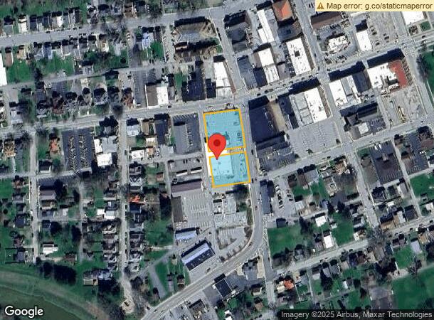
201 W Mahoning St
24-001-0908
152X288.5 CBLDGS
Commercialnec
Jefferson
X
Pennsylvania
42063C0055F
1.01 AC
2025
Pennsylvania Central Area
2025
Other Market Areas
951300
DEMOGRAPHICS near 201 W Mahoning St
1 Mile
3 Mile
5 Mile
2024 Total Population
4,782
9,197
12,614
2029 Population
4,712
9,135
12,459
Pop Growth 2024-2029
(1.46%)
(0.67%)
(1.23%)
Average Age
44
44
44
2024 Total Households
2,286
4,174
5,484
HH Growth 2024-2029
(1.44%)
(0.69%)
(1.19%)
Median Household Inc
$37,996
$43,635
$46,182
Avg Household Size
2.00
2.10
2.20
2024 Avg HH Vehicles
1.00
2.00
2.00
Median Home Value
$89,786
$119,672
$124,743
Median Year Built
1949
1956
1957
Nearby Places
Map Layers
Map Styles
 Street
 Aerial
- Restaurants
- Banks
- Shops
- Fitness
- Groceries
Nearby Properties
Address
Land Use
TOTAL SIZE
Lot Size
Zoning
Address
Land Use
TOTAL SIZE
Lot Size
Zoning
2,388,520 SF
51.90 AC
Address
Land Use
TOTAL SIZE
Lot Size
Zoning
491,530 SF
19.29 AC
Address
Land Use
TOTAL SIZE
Lot Size
Zoning
Address
Land Use
TOTAL SIZE
Lot Size
Zoning
23,584 SF
2.28 AC
Address
Land Use
TOTAL SIZE
Lot Size
Zoning
19.19 AC
Address
Land Use
TOTAL SIZE
Lot Size
Zoning
360 SF
6.70 AC
Address
Land Use
TOTAL SIZE
Lot Size
Zoning
3.72 AC
Address
Land Use
TOTAL SIZE
Lot Size
Zoning
Address
Land Use
TOTAL SIZE
Lot Size
Zoning
15,970 SF
3.11 AC
Address
Land Use
TOTAL SIZE
Lot Size
Zoning
Address
Land Use
TOTAL SIZE
Lot Size
Zoning
Address
Land Use
TOTAL SIZE
Lot Size
Zoning
8.83 AC
Address
Land Use
TOTAL SIZE
Lot Size
Zoning
Address
Land Use
TOTAL SIZE
Lot Size
Zoning
6,388 SF
4 AC
Address
Land Use
TOTAL SIZE
Lot Size
Zoning
5.65 AC
Address
Land Use
TOTAL SIZE
Lot Size
Zoning
9,270 SF
7.57 AC
Address
Land Use
TOTAL SIZE
Lot Size
Zoning
19.42 AC
Address
Land Use
TOTAL SIZE
Lot Size
Zoning
161,320 SF
2.50 AC
Address
Land Use
TOTAL SIZE
Lot Size
Zoning
313,986 SF
3 AC
Address
Land Use
TOTAL SIZE
Lot Size
Zoning
Address
Land Use
TOTAL SIZE
Lot Size
Zoning
Address
Land Use
TOTAL SIZE
Lot Size
Zoning
20,164 SF
0.52 AC
Address
Land Use
TOTAL SIZE
Lot Size
Zoning
11.70 AC
Address
Land Use
TOTAL SIZE
Lot Size
Zoning
13.02 AC
Address
Land Use
TOTAL SIZE
Lot Size
Zoning
13,214 SF
16.40 AC
Address
Land Use
TOTAL SIZE
Lot Size
Zoning
Address
Land Use
TOTAL SIZE
Lot Size
Zoning
7,502 SF
0.20 AC
Address
Land Use
TOTAL SIZE
Lot Size
Zoning
3,000 SF
1.90 AC
Address
Land Use
TOTAL SIZE
Lot Size
Zoning
1.21 AC
The World's #1 Commercial Real Estate Marketplace
Connect with us
© 2025 CoStar Group
The information above has been obtained from sources believed reliable. While we do not doubt its accuracy we have not verified it and make no guarantee, warranty or representation about it. It is your responsibility to independently confirm its accuracy and completeness. Any projections, opinions, assumptions, or estimates used are for example only and do not represent the current or future performance of the property. The value of this transaction to you depends on tax and other factors which should be evaluated by your tax, financial, and legal advisors. You and your advisors should conduct a careful, independent investigation of the property to determine to your satisfaction the suitability of the property for your needs.