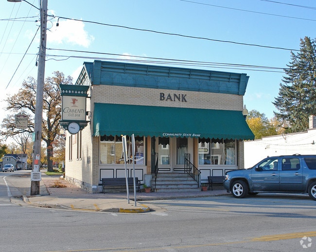
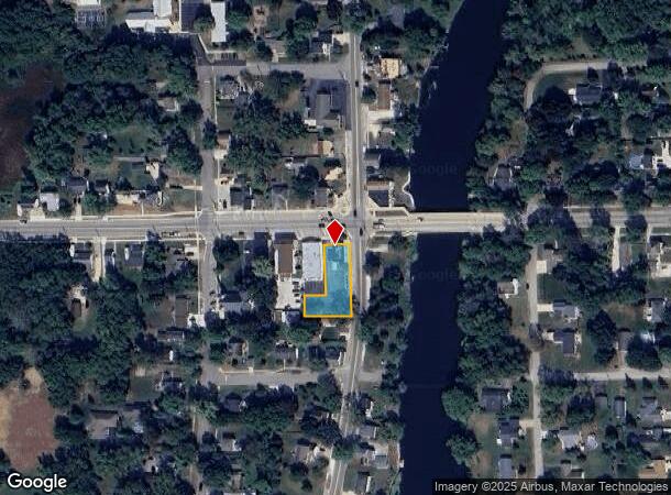
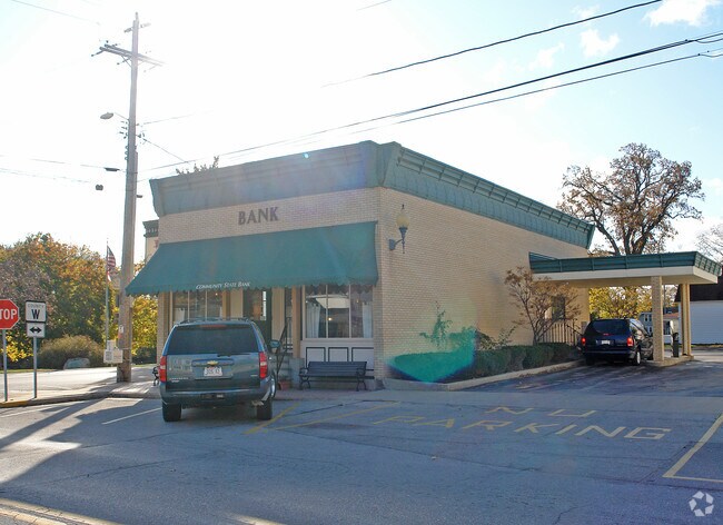
Property Record
201 W Main St W, Rochester, WI 53167
NEARBY LISTINGS FOR SALE OR LEASE
-
-
View all Rochester listings for lease on LoopNet.com
Property Detail
201 W Main St W
Racine, WI
Original Plat Of The Village Of Rocheste
176-031911201000
ORIGINAL PLAT LOT 1 BLK 23 & PT LOT 7 DAF BEGIN NE COR LOT 7 S56 W122 N56 E122 TO POB PT FROM 176031911210000 IN 08 FOR 09 RO
Commercialnec
Racine
X
Wisconsin
55101C0151E
1,7
2024
0.36 AC
2024
Racine West
002701
Milwaukee/Madison
1,680 SF
DEMOGRAPHICS near 201 W Main St W
1 Mile
3 Mile
5 Mile
2024 Total Population
1,910
11,598
23,380
2029 Population
1,896
11,541
23,333
Pop Growth 2024-2029
(0.73%)
(0.49%)
(0.20%)
Average Age
43
43
43
2024 Total Households
756
4,617
9,352
HH Growth 2024-2029
(0.66%)
(0.48%)
(0.21%)
Median Household Inc
$87,706
$88,408
$90,945
Avg Household Size
2.50
2.50
2.50
2024 Avg HH Vehicles
2.00
2.00
2.00
Median Home Value
$337,654
$330,424
$330,756
Median Year Built
1984
1987
1983
Nearby Places
Map Layers
Map Styles
 Street
 Aerial
- Restaurants
- Banks
- Shops
- Fitness
- Groceries
PUBLIC TRANSPORTATION
AIRPORT
General Mitchell International
DRIVE
WALK
Distance
General Mitchell International
42 min
24.3 mi
Freight Ports
Port Milwaukee
DRIVE
WALK
Distance
Port Milwaukee
42 min
27.2 mi
SALE & LEASE HISTORY
LISTING DATE
SALE/LEASE

May 24, 2021
For Lease
Nearby Properties
Address
Land Use
TOTAL SIZE
Lot Size
Zoning
Address
Land Use
TOTAL SIZE
Lot Size
Zoning
155,078 SF
27.98 AC
Address
Land Use
TOTAL SIZE
Lot Size
Zoning
22.08 AC
Address
Land Use
TOTAL SIZE
Lot Size
Zoning
5.24 AC
Address
Land Use
TOTAL SIZE
Lot Size
Zoning
78.27 AC
Address
Land Use
TOTAL SIZE
Lot Size
Zoning
Address
Land Use
TOTAL SIZE
Lot Size
Zoning
4.52 AC
Address
Land Use
TOTAL SIZE
Lot Size
Zoning
Address
Land Use
TOTAL SIZE
Lot Size
Zoning
Address
Land Use
TOTAL SIZE
Lot Size
Zoning
12.03 AC
Address
Land Use
TOTAL SIZE
Lot Size
Zoning
Address
Land Use
TOTAL SIZE
Lot Size
Zoning
Address
Land Use
TOTAL SIZE
Lot Size
Zoning
7.74 AC
Address
Land Use
TOTAL SIZE
Lot Size
Zoning
33.20 AC
Address
Land Use
TOTAL SIZE
Lot Size
Zoning
24.67 AC
Address
Land Use
TOTAL SIZE
Lot Size
Zoning
1.66 AC
Address
Land Use
TOTAL SIZE
Lot Size
Zoning
16,573 SF
0.35 AC
Address
Land Use
TOTAL SIZE
Lot Size
Zoning
32,400 SF
22.55 AC
Address
Land Use
TOTAL SIZE
Lot Size
Zoning
1.30 AC
Address
Land Use
TOTAL SIZE
Lot Size
Zoning
22,244 SF
2.05 AC
Address
Land Use
TOTAL SIZE
Lot Size
Zoning
Address
Land Use
TOTAL SIZE
Lot Size
Zoning
15,540 SF
2.19 AC
Address
Land Use
TOTAL SIZE
Lot Size
Zoning
2.39 AC
Address
Land Use
TOTAL SIZE
Lot Size
Zoning
107.06 AC
Address
Land Use
TOTAL SIZE
Lot Size
Zoning
1.31 AC
Address
Land Use
TOTAL SIZE
Lot Size
Zoning
3.69 AC
Address
Land Use
TOTAL SIZE
Lot Size
Zoning
4.78 AC
Address
Land Use
TOTAL SIZE
Lot Size
Zoning
1.53 AC
Address
Land Use
TOTAL SIZE
Lot Size
Zoning
2,792 SF
16.50 AC
Address
Land Use
TOTAL SIZE
Lot Size
Zoning
0.05 AC
Address
Land Use
TOTAL SIZE
Lot Size
Zoning
1.46 AC
The World's #1 Commercial Real Estate Marketplace
Connect with us
© 2025 CoStar Group
The information above has been obtained from sources believed reliable. While we do not doubt its accuracy we have not verified it and make no guarantee, warranty or representation about it. It is your responsibility to independently confirm its accuracy and completeness. Any projections, opinions, assumptions, or estimates used are for example only and do not represent the current or future performance of the property. The value of this transaction to you depends on tax and other factors which should be evaluated by your tax, financial, and legal advisors. You and your advisors should conduct a careful, independent investigation of the property to determine to your satisfaction the suitability of the property for your needs.