Property Record
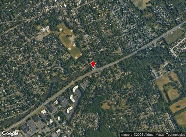
201 W Route 38, Moorestown, NJ 08057

NEARBY LISTINGS FOR SALE OR LEASE
Property Detail
201 W Route 38
22-03301-0000-00052
Burlington
Servicestation
New Jersey
AE
52
34005C0229F
0.97 AC
2024
North Burlington County
2025
Philadelphia
700501
Philadelphia-Camden-Wilmington, PA-NJ-DE-MD
1,568 SF
DEMOGRAPHICS near 201 W Route 38
1 mile
3 mile
5 mile
2024 Total Population
7,455
63,224
196,286
2029 Population
7,607
64,475
199,372
Pop Growth 2024-2029
+ 2.04%
+ 1.98%
+ 1.57%
Average Age
42
43
42
2024 Total Households
2,695
25,357
77,062
HH Growth 2024-2029
+ 2.04%
+ 1.89%
+ 1.57%
Median Household Inc
$133,370
$100,806
$107,056
Avg Household Size
2.70
2.40
2.50
2024 Avg HH Vehicles
2.00
2.00
2.00
Median Home Value
$447,377
$348,488
$312,339
Median Year Built
1958
1974
1975
Nearby Places
Map Layers
Map Styles
 Street
 Aerial
Transit
 Traffic
 Biking
Places
Listings with unknown addresses are not visible on the map
- Restaurants
- Banks
- Shops
- Fitness
- Groceries
PUBLIC TRANSPORTATION
COMMUTER RAIL
Cherry Hill (Atlantic City Line - NJ Transit Commuter Rail (NJ Transit))
Drive
Walk
Distance
Cherry Hill (Atlantic City Line - NJ Transit Commuter Rail (NJ Transit))
13 min
7.4 mi
Drive
Walk
Distance
14 min
8.0 mi
AIRPORT
Philadelphia International
Drive
Walk
Distance
Philadelphia International
36 min
20.6 mi
Trenton Mercer
Drive
Walk
Distance
Trenton Mercer
46 min
31.9 mi
Atlantic City International
Drive
Walk
Distance
Atlantic City International
82 min
45.5 mi
Freight Ports
South Jersey Port
Drive
Walk
Distance
South Jersey Port
19 min
10.4 mi
SALE & LEASE HISTORY
LISTING DATE
SALE/LEASE

Jan 27, 2020
For Sale
Nearby Properties
Address
Land Use
TOTAL SIZE
Lot Size
Zoning
Address
Land Use
TOTAL SIZE
Lot Size
Zoning
90.41 AC
Address
Land Use
TOTAL SIZE
Lot Size
Zoning
120.80 AC
Address
Land Use
TOTAL SIZE
Lot Size
Zoning
38.76 AC
Address
Land Use
TOTAL SIZE
Lot Size
Zoning
1 SF
42.23 AC
Address
Land Use
TOTAL SIZE
Lot Size
Zoning
39.71 AC
Address
Land Use
TOTAL SIZE
Lot Size
Zoning
40.92 AC
Address
Land Use
TOTAL SIZE
Lot Size
Zoning
199,049 SF
15.90 AC
Address
Land Use
TOTAL SIZE
Lot Size
Zoning
74.17 AC
BRMF
Address
Land Use
TOTAL SIZE
Lot Size
Zoning
16.69 AC
Address
Land Use
TOTAL SIZE
Lot Size
Zoning
6.25 AC
Address
Land Use
TOTAL SIZE
Lot Size
Zoning
25.84 AC
Address
Land Use
TOTAL SIZE
Lot Size
Zoning
79.67 AC
I
Address
Land Use
TOTAL SIZE
Lot Size
Zoning
43.20 AC
Address
Land Use
TOTAL SIZE
Lot Size
Zoning
999,999,999 SF
21.10 AC
Address
Land Use
TOTAL SIZE
Lot Size
Zoning
15.02 AC
Address
Land Use
TOTAL SIZE
Lot Size
Zoning
28.96 AC
Address
Land Use
TOTAL SIZE
Lot Size
Zoning
22.45 AC
MD
Address
Land Use
TOTAL SIZE
Lot Size
Zoning
19.79 AC
Address
Land Use
TOTAL SIZE
Lot Size
Zoning
15.10 AC
Address
Land Use
TOTAL SIZE
Lot Size
Zoning
27.77 AC
Address
Land Use
TOTAL SIZE
Lot Size
Zoning
Address
Land Use
TOTAL SIZE
Lot Size
Zoning
14.46 AC
Address
Land Use
TOTAL SIZE
Lot Size
Zoning
79.78 AC
Address
Land Use
TOTAL SIZE
Lot Size
Zoning
26.25 AC
Address
Land Use
TOTAL SIZE
Lot Size
Zoning
22,125 SF
15.01 AC
Address
Land Use
TOTAL SIZE
Lot Size
Zoning
13.98 AC
Address
Land Use
TOTAL SIZE
Lot Size
Zoning
13.15 AC
Address
Land Use
TOTAL SIZE
Lot Size
Zoning
Address
Land Use
TOTAL SIZE
Lot Size
Zoning
15.49 AC
Address
Land Use
TOTAL SIZE
Lot Size
Zoning
22.91 AC
The World's #1 Commercial Real Estate Marketplace
Connect with us
© 2026 CoStar Group
The information above has been obtained from sources believed reliable. While we do not doubt its accuracy we have not verified it and make no guarantee, warranty or representation about it. It is your responsibility to independently confirm its accuracy and completeness. Any projections, opinions, assumptions, or estimates used are for example only and do not represent the current or future performance of the property. The value of this transaction to you depends on tax and other factors which should be evaluated by your tax, financial, and legal advisors. You and your advisors should conduct a careful, independent investigation of the property to determine to your satisfaction the suitability of the property for your needs.