Property Record
201 W Whitestone Blvd, Cedar Park, TX 78613
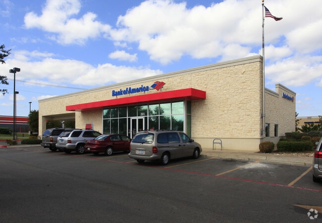

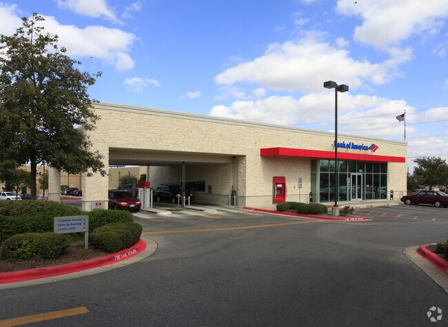
Property Detail
201 W Whitestone Blvd
R442409
S8397 - WHITESTONE PLAZA (LTS 2-5 & 8 BLK 2 RESUB), BLOCK 2, LOT 10, ACRES 1.0777
Commercialnec
Williamson
4-GR
Texas
B and X Area of moderate flood hazard, usually the area between the limits of the 100-year and 500-year floods.
10
2024
1.08 AC
2025
Cedar Park
020327
Austin
4,891 SF
Austin-Round Rock-San Marcos, TX
NEARBY LISTINGS FOR SALE OR LEASE
DEMOGRAPHICS near 201 W Whitestone Blvd
1 mile
3 mile
5 mile
2024 Total Population
10,807
91,928
213,663
2029 Population
12,291
103,460
241,095
Pop Growth 2024-2029
+ 13.73%
+ 12.54%
+ 12.84%
Average Age
38
38
37
2024 Total Households
4,203
33,178
77,967
HH Growth 2024-2029
+ 14.32%
+ 13.09%
+ 13.44%
Median Household Inc
$89,650
$121,064
$128,129
Avg Household Size
2.50
2.70
2.70
2024 Avg HH Vehicles
2.00
2.00
2.00
Median Home Value
$442,995
$474,529
$534,715
Median Year Built
2005
2004
2007
Nearby Places
Map Layers
Map Styles
 Street
 Aerial
Transit
 Traffic
 Biking
Places
Listings with unknown addresses are not visible on the map
- Restaurants
- Banks
- Shops
- Fitness
- Groceries
PUBLIC TRANSPORTATION
AIRPORT
Austin-Bergstrom International
Drive
Walk
Distance
Austin-Bergstrom International
45 min
32.7 mi
Nearby Properties
Address
Land Use
TOTAL SIZE
Lot Size
Zoning
Address
Land Use
TOTAL SIZE
Lot Size
Zoning
676,868 SF
13.54 AC
3-PD
Address
Land Use
TOTAL SIZE
Lot Size
Zoning
338,919 SF
42.88 AC
Address
Land Use
TOTAL SIZE
Lot Size
Zoning
277,152 SF
45.29 AC
Address
Land Use
TOTAL SIZE
Lot Size
Zoning
320,454 SF
19.56 AC
Address
Land Use
TOTAL SIZE
Lot Size
Zoning
313,727 SF
6.64 AC
Address
Land Use
TOTAL SIZE
Lot Size
Zoning
324,508 SF
24.08 AC
Address
Land Use
TOTAL SIZE
Lot Size
Zoning
197,066 SF
16.10 AC
Address
Land Use
TOTAL SIZE
Lot Size
Zoning
338,434 SF
40.57 AC
3-PD
Address
Land Use
TOTAL SIZE
Lot Size
Zoning
365,955 SF
22.84 AC
Address
Land Use
TOTAL SIZE
Lot Size
Zoning
329,104 SF
19.97 AC
Address
Land Use
TOTAL SIZE
Lot Size
Zoning
181,000 SF
30.14 AC
Address
Land Use
TOTAL SIZE
Lot Size
Zoning
275,271 SF
14.14 AC
Address
Land Use
TOTAL SIZE
Lot Size
Zoning
335,765 SF
4.10 AC
Address
Land Use
TOTAL SIZE
Lot Size
Zoning
241,094 SF
13.80 AC
Address
Land Use
TOTAL SIZE
Lot Size
Zoning
223,681 SF
7.78 AC
Address
Land Use
TOTAL SIZE
Lot Size
Zoning
241,374 SF
12.69 AC
Address
Land Use
TOTAL SIZE
Lot Size
Zoning
250,556 SF
17.51 AC
Address
Land Use
TOTAL SIZE
Lot Size
Zoning
205,563 SF
18.24 AC
4-GR
Address
Land Use
TOTAL SIZE
Lot Size
Zoning
180,799 SF
22.90 AC
Address
Land Use
TOTAL SIZE
Lot Size
Zoning
316,408 SF
15 AC
Address
Land Use
TOTAL SIZE
Lot Size
Zoning
149,429 SF
16.98 AC
Address
Land Use
TOTAL SIZE
Lot Size
Zoning
94,861 SF
12.72 AC
Address
Land Use
TOTAL SIZE
Lot Size
Zoning
276,029 SF
7.63 AC
Address
Land Use
TOTAL SIZE
Lot Size
Zoning
151,181 SF
6 AC
Address
Land Use
TOTAL SIZE
Lot Size
Zoning
89,872 SF
45.29 AC
Address
Land Use
TOTAL SIZE
Lot Size
Zoning
240,800 SF
17.16 AC
Address
Land Use
TOTAL SIZE
Lot Size
Zoning
264,140 SF
21.37 AC
Address
Land Use
TOTAL SIZE
Lot Size
Zoning
111,518 SF
15.55 AC
Address
Land Use
TOTAL SIZE
Lot Size
Zoning
173,199 SF
7.66 AC
Address
Land Use
TOTAL SIZE
Lot Size
Zoning
47,009 SF
1.59 AC
The World's #1 Commercial Real Estate Marketplace
Connect with us
© 2026 CoStar Group
The information above has been obtained from sources believed reliable. While we do not doubt its accuracy we have not verified it and make no guarantee, warranty or representation about it. It is your responsibility to independently confirm its accuracy and completeness. Any projections, opinions, assumptions, or estimates used are for example only and do not represent the current or future performance of the property. The value of this transaction to you depends on tax and other factors which should be evaluated by your tax, financial, and legal advisors. You and your advisors should conduct a careful, independent investigation of the property to determine to your satisfaction the suitability of the property for your needs.