Property Record
201 W Willard Ave, Strathmere, NJ 08248

NEARBY LISTINGS FOR SALE OR LEASE
-
-
View all Strathmere listings for sale on LoopNet.com
Property Detail
201 W Willard Ave
Ocean City, NJ
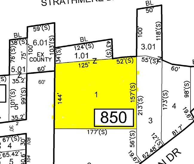
1.01
11-00850-0000-00001
Cape May
Restaurantbuilding
New Jersey
VE
1
34009C0159F
0.39 AC
2024
South Shore/Vineland
2025
Other Market Areas
020302
DEMOGRAPHICS near 201 W Willard Ave
1 Mile
3 Mile
5 Mile
2024 Total Population
48
4,091
14,688
2029 Population
34
4,026
14,930
Pop Growth 2024-2029
(29.17%)
(1.59%)
+ 1.65%
Average Age
55
49
50
2024 Total Households
25
1,812
6,425
HH Growth 2024-2029
(36.00%)
(1.21%)
+ 1.99%
Median Household Inc
$116,666
$100,843
$97,701
Avg Household Size
1.90
2.20
2.20
2024 Avg HH Vehicles
2.00
2.00
2.00
Median Home Value
$675,000
$389,977
$444,712
Median Year Built
1969
1985
1986
Nearby Places
Map Layers
Map Styles
 Street
 Aerial
- Restaurants
- Banks
- Shops
- Fitness
- Groceries
PUBLIC TRANSPORTATION
AIRPORT
Atlantic City International
DRIVE
WALK
Distance
Atlantic City International
54 min
25.5 mi
Freight Ports
Broadway Terminal - Pier 5
DRIVE
WALK
Distance
Broadway Terminal - Pier 5
86 min
67.4 mi
Nearby Properties
Address
Land Use
TOTAL SIZE
Lot Size
Zoning
Address
Land Use
TOTAL SIZE
Lot Size
Zoning
Address
Land Use
TOTAL SIZE
Lot Size
Zoning
1,176 SF
31.34 AC
CR
Address
Land Use
TOTAL SIZE
Lot Size
Zoning
8.66 AC
TCC
Address
Land Use
TOTAL SIZE
Lot Size
Zoning
Address
Land Use
TOTAL SIZE
Lot Size
Zoning
20.97 AC
TCC
Address
Land Use
TOTAL SIZE
Lot Size
Zoning
1,792 SF
20.90 AC
TCC
Address
Land Use
TOTAL SIZE
Lot Size
Zoning
1.32 AC
Address
Land Use
TOTAL SIZE
Lot Size
Zoning
2.95 AC
TCC
Address
Land Use
TOTAL SIZE
Lot Size
Zoning
3,386 SF
0.49 AC
RR
Address
Land Use
TOTAL SIZE
Lot Size
Zoning
52.35 AC
R
Address
Land Use
TOTAL SIZE
Lot Size
Zoning
0.16 AC
Address
Land Use
TOTAL SIZE
Lot Size
Zoning
1.38 AC
RR
Address
Land Use
TOTAL SIZE
Lot Size
Zoning
2.72 AC
TC
Address
Land Use
TOTAL SIZE
Lot Size
Zoning
2,992 SF
0.19 AC
RR
Address
Land Use
TOTAL SIZE
Lot Size
Zoning
Address
Land Use
TOTAL SIZE
Lot Size
Zoning
1.29 AC
Address
Land Use
TOTAL SIZE
Lot Size
Zoning
1.30 AC
CM2
Address
Land Use
TOTAL SIZE
Lot Size
Zoning
1,320 SF
0.12 AC
RRC
Address
Land Use
TOTAL SIZE
Lot Size
Zoning
1.44 AC
TCC
Address
Land Use
TOTAL SIZE
Lot Size
Zoning
0.09 AC
Address
Land Use
TOTAL SIZE
Lot Size
Zoning
1,008 SF
0.12 AC
Address
Land Use
TOTAL SIZE
Lot Size
Zoning
3.45 AC
CM2
Address
Land Use
TOTAL SIZE
Lot Size
Zoning
2.76 AC
TCC
Address
Land Use
TOTAL SIZE
Lot Size
Zoning
0.21 AC
Address
Land Use
TOTAL SIZE
Lot Size
Zoning
0.24 AC
RC
Address
Land Use
TOTAL SIZE
Lot Size
Zoning
2,976 SF
0.23 AC
RCRR
Address
Land Use
TOTAL SIZE
Lot Size
Zoning
2.45 AC
R
Address
Land Use
TOTAL SIZE
Lot Size
Zoning
2.36 AC
TCC
Address
Land Use
TOTAL SIZE
Lot Size
Zoning
3,273 SF
0.08 AC
The World's #1 Commercial Real Estate Marketplace
Connect with us
© 2025 CoStar Group
The information above has been obtained from sources believed reliable. While we do not doubt its accuracy we have not verified it and make no guarantee, warranty or representation about it. It is your responsibility to independently confirm its accuracy and completeness. Any projections, opinions, assumptions, or estimates used are for example only and do not represent the current or future performance of the property. The value of this transaction to you depends on tax and other factors which should be evaluated by your tax, financial, and legal advisors. You and your advisors should conduct a careful, independent investigation of the property to determine to your satisfaction the suitability of the property for your needs.