Property Record
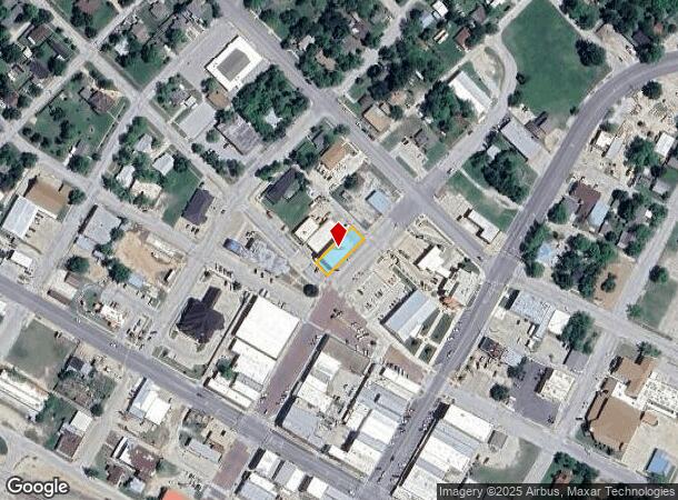
201 Walnut St, Bowie, TX 76230


Property Detail
201 Walnut St
R000000801
Jg Cummins Add
Commercialnec
PART OF LOTS 13 & 14 BLK 35 COWAN (CUMMINS)
X
Montague
48337C0415D
Texas
2025
13,14
2025
0.25 AC
950501
Bowie
10,706 SF
Other Market Areas
NEARBY LISTINGS FOR SALE OR LEASE
-
-
View all Bowie listings for sale on LoopNet.com
DEMOGRAPHICS near 201 Walnut St
1 mile
3 mile
5 mile
2024 Total Population
4,907
7,504
8,721
2029 Population
5,595
8,483
9,826
Pop Growth 2024-2029
+ 14.02%
+ 13.05%
+ 12.67%
Average Age
39
40
41
2024 Total Households
1,972
3,028
3,517
HH Growth 2024-2029
+ 14.00%
+ 12.98%
+ 12.65%
Median Household Inc
$53,781
$54,767
$56,152
Avg Household Size
2.50
2.40
2.40
2024 Avg HH Vehicles
2.00
2.00
2.00
Median Home Value
$134,417
$152,922
$156,811
Median Year Built
1974
1974
1975
Nearby Places
Map Layers
Map Styles
 Street
 Aerial
Transit
 Traffic
 Biking
Places
Listings with unknown addresses are not visible on the map
- Restaurants
- Banks
- Shops
- Fitness
- Groceries
SALE & LEASE HISTORY
LISTING DATE
SALE/LEASE

Sep 25, 2016
For Lease
Nov 22, 2021
For Sale
Jun 29, 2017
For Sale
Jun 29, 2017
For Sale
Jun 19, 2017
For Sale
Jun 12, 2018
For Sale
Jan 29, 2020
For Lease
Nearby Properties
Address
Land Use
TOTAL SIZE
Lot Size
Zoning
Address
Land Use
TOTAL SIZE
Lot Size
Zoning
99,704 SF
17.83 AC
Address
Land Use
TOTAL SIZE
Lot Size
Zoning
22,721 SF
0.52 AC
Address
Land Use
TOTAL SIZE
Lot Size
Zoning
52,474 SF
28.55 AC
Address
Land Use
TOTAL SIZE
Lot Size
Zoning
61,747 SF
13.68 AC
Address
Land Use
TOTAL SIZE
Lot Size
Zoning
31,216 SF
148.31 AC
Address
Land Use
TOTAL SIZE
Lot Size
Zoning
66,482 SF
22.60 AC
Address
Land Use
TOTAL SIZE
Lot Size
Zoning
72,914 SF
3.44 AC
Address
Land Use
TOTAL SIZE
Lot Size
Zoning
31,710 SF
19.11 AC
Address
Land Use
TOTAL SIZE
Lot Size
Zoning
38,230 SF
4.59 AC
Address
Land Use
TOTAL SIZE
Lot Size
Zoning
33,310 SF
1.91 AC
Address
Land Use
TOTAL SIZE
Lot Size
Zoning
42,020 SF
8.09 AC
Address
Land Use
TOTAL SIZE
Lot Size
Zoning
11,653 SF
0.11 AC
Address
Land Use
TOTAL SIZE
Lot Size
Zoning
36,812 SF
4.54 AC
Address
Land Use
TOTAL SIZE
Lot Size
Zoning
6,667 SF
3.01 AC
Address
Land Use
TOTAL SIZE
Lot Size
Zoning
24,294 SF
1.43 AC
Address
Land Use
TOTAL SIZE
Lot Size
Zoning
20,444 SF
1.12 AC
Address
Land Use
TOTAL SIZE
Lot Size
Zoning
22,700 SF
2.22 AC
Address
Land Use
TOTAL SIZE
Lot Size
Zoning
40,000 SF
3.11 AC
Address
Land Use
TOTAL SIZE
Lot Size
Zoning
19,498 SF
8.33 AC
Address
Land Use
TOTAL SIZE
Lot Size
Zoning
16,544 SF
1.82 AC
Address
Land Use
TOTAL SIZE
Lot Size
Zoning
17,632 SF
3.51 AC
Address
Land Use
TOTAL SIZE
Lot Size
Zoning
6,744 SF
1.42 AC
Address
Land Use
TOTAL SIZE
Lot Size
Zoning
4,904 SF
97.38 AC
Address
Land Use
TOTAL SIZE
Lot Size
Zoning
12,211 SF
8.84 AC
Address
Land Use
TOTAL SIZE
Lot Size
Zoning
8,860 SF
30.87 AC
Address
Land Use
TOTAL SIZE
Lot Size
Zoning
12,310 SF
0.27 AC
Address
Land Use
TOTAL SIZE
Lot Size
Zoning
8,216 SF
1.61 AC
Address
Land Use
TOTAL SIZE
Lot Size
Zoning
16,269 SF
1.25 AC
Address
Land Use
TOTAL SIZE
Lot Size
Zoning
810 SF
107.99 AC
Address
Land Use
TOTAL SIZE
Lot Size
Zoning
14,245 SF
2.55 AC
The World's #1 Commercial Real Estate Marketplace
Connect with us
© 2026 CoStar Group
The information above has been obtained from sources believed reliable. While we do not doubt its accuracy we have not verified it and make no guarantee, warranty or representation about it. It is your responsibility to independently confirm its accuracy and completeness. Any projections, opinions, assumptions, or estimates used are for example only and do not represent the current or future performance of the property. The value of this transaction to you depends on tax and other factors which should be evaluated by your tax, financial, and legal advisors. You and your advisors should conduct a careful, independent investigation of the property to determine to your satisfaction the suitability of the property for your needs.