Property Record
201 Washburne Ave, Paynesville, MN 56362
NEARBY LISTINGS FOR SALE OR LEASE
-
-
View all Paynesville listings for sale on LoopNet.com
Property Detail
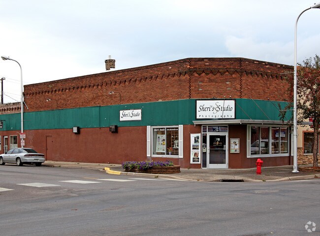
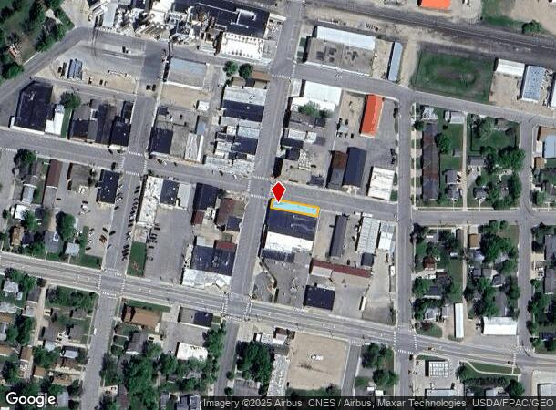
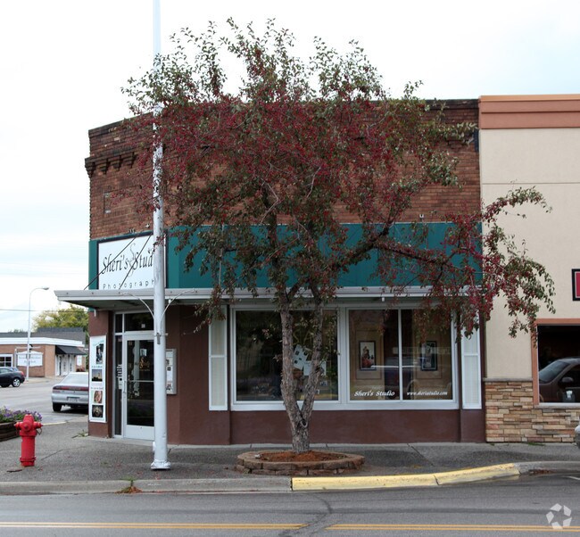
201 Washburne Ave
St. Cloud, MN
Haines Add
70.39091.0000
LOT 018 BLK 010 HAINES ADD SECTION 16 TOWNSHIP 122 RANGE 032 SECTION 16 TOWNSHIP 122 RANGE 032
Officebuilding
Stearns
X
Minnesota
27145C0764E
18
2024
0.08 AC
2025
Stearns County
011000
Minneapolis/St Paul
3,526 SF
DEMOGRAPHICS near 201 Washburne Ave
1 Mile
3 Mile
5 Mile
2024 Total Population
2,938
4,028
5,526
2029 Population
3,102
4,266
5,839
Pop Growth 2024-2029
+ 5.58%
+ 5.91%
+ 5.66%
Average Age
42
42
43
2024 Total Households
1,254
1,725
2,327
HH Growth 2024-2029
+ 5.74%
+ 6.14%
+ 5.93%
Median Household Inc
$62,378
$64,591
$68,505
Avg Household Size
2.30
2.30
2.30
2024 Avg HH Vehicles
2.00
2.00
2.00
Median Home Value
$223,793
$236,083
$248,376
Median Year Built
1974
1974
1975
Nearby Places
Map Layers
Map Styles
 Street
 Aerial
- Restaurants
- Banks
- Shops
- Fitness
- Groceries
Nearby Properties
Address
Land Use
TOTAL SIZE
Lot Size
Zoning
Address
Land Use
TOTAL SIZE
Lot Size
Zoning
221,297 SF
45.96 AC
Address
Land Use
TOTAL SIZE
Lot Size
Zoning
199,025 SF
5 AC
Address
Land Use
TOTAL SIZE
Lot Size
Zoning
86,320 SF
10.61 AC
Address
Land Use
TOTAL SIZE
Lot Size
Zoning
1,260 SF
14.18 AC
Address
Land Use
TOTAL SIZE
Lot Size
Zoning
10.46 AC
Address
Land Use
TOTAL SIZE
Lot Size
Zoning
2,080 SF
3.16 AC
Address
Land Use
TOTAL SIZE
Lot Size
Zoning
35,512 SF
5.62 AC
Address
Land Use
TOTAL SIZE
Lot Size
Zoning
Address
Land Use
TOTAL SIZE
Lot Size
Zoning
59,829 SF
1.65 AC
Address
Land Use
TOTAL SIZE
Lot Size
Zoning
33,442 SF
199.20 AC
Address
Land Use
TOTAL SIZE
Lot Size
Zoning
40,735 SF
4 AC
Address
Land Use
TOTAL SIZE
Lot Size
Zoning
68,446 SF
10.24 AC
Address
Land Use
TOTAL SIZE
Lot Size
Zoning
96,083 SF
1.57 AC
Address
Land Use
TOTAL SIZE
Lot Size
Zoning
51.28 AC
T20
Address
Land Use
TOTAL SIZE
Lot Size
Zoning
10,245 SF
3.94 AC
Address
Land Use
TOTAL SIZE
Lot Size
Zoning
17,357 SF
1.10 AC
Address
Land Use
TOTAL SIZE
Lot Size
Zoning
51,147 SF
21.71 AC
Address
Land Use
TOTAL SIZE
Lot Size
Zoning
26,300 SF
5.50 AC
Address
Land Use
TOTAL SIZE
Lot Size
Zoning
48,673 SF
1.85 AC
Address
Land Use
TOTAL SIZE
Lot Size
Zoning
21,337 SF
4.38 AC
Address
Land Use
TOTAL SIZE
Lot Size
Zoning
23,214 SF
2.46 AC
Address
Land Use
TOTAL SIZE
Lot Size
Zoning
40,351 SF
4.54 AC
Address
Land Use
TOTAL SIZE
Lot Size
Zoning
1.71 AC
Address
Land Use
TOTAL SIZE
Lot Size
Zoning
7,860 SF
1.26 AC
Address
Land Use
TOTAL SIZE
Lot Size
Zoning
47,728 SF
2.14 AC
Address
Land Use
TOTAL SIZE
Lot Size
Zoning
3,316 SF
157.55 AC
2AIMP
Address
Land Use
TOTAL SIZE
Lot Size
Zoning
1,368 SF
150 AC
2A
Address
Land Use
TOTAL SIZE
Lot Size
Zoning
1,638 SF
187.99 AC
Address
Land Use
TOTAL SIZE
Lot Size
Zoning
10,054 SF
2 AC
Address
Land Use
TOTAL SIZE
Lot Size
Zoning
120 AC
2AIMP
The World's #1 Commercial Real Estate Marketplace
Connect with us
© 2025 CoStar Group
The information above has been obtained from sources believed reliable. While we do not doubt its accuracy we have not verified it and make no guarantee, warranty or representation about it. It is your responsibility to independently confirm its accuracy and completeness. Any projections, opinions, assumptions, or estimates used are for example only and do not represent the current or future performance of the property. The value of this transaction to you depends on tax and other factors which should be evaluated by your tax, financial, and legal advisors. You and your advisors should conduct a careful, independent investigation of the property to determine to your satisfaction the suitability of the property for your needs.