Property Record
2010 16Th St, Greeley, CO 80631
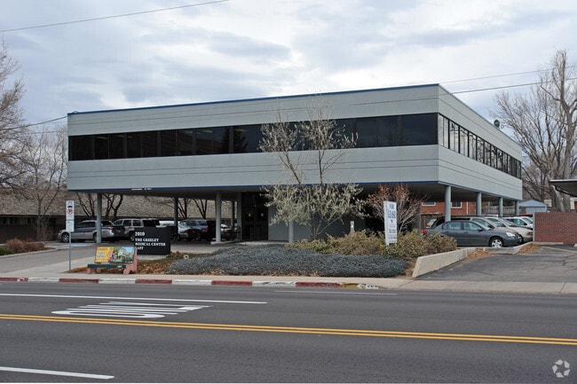

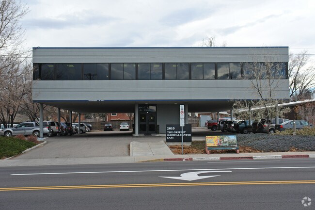
Property Detail
2010 16Th St
Greeley, CO
GR 1992-A L11-12 BLK1 MONTVIEW HEIGHTS
R0038293
Weld
Charitableorganization
Colorado
B and X Area of moderate flood hazard, usually the area between the limits of the 100-year and 500-year floods.
11
2021
1.14 AC
2025
Weld County
000401
Denver
8,646 SF
NEARBY LISTINGS FOR SALE OR LEASE
DEMOGRAPHICS near 2010 16Th St
1 mile
3 mile
5 mile
2025 Total Population
21,036
116,845
151,523
2030 Population
23,317
128,704
166,919
Pop Growth 2025-2030
+ 10.84%
+ 10.15%
+ 10.16%
Average Age
35
36
37
2025 Total Households
7,784
41,431
54,264
HH Growth 2025-2030
+ 11.86%
+ 10.84%
+ 10.80%
Median Household Inc
$58,935
$61,372
$67,011
Avg Household Size
2.50
2.70
2.70
2025 Avg HH Vehicles
2.00
2.00
2.00
Median Home Value
$381,399
$359,293
$377,071
Median Year Built
1970
1983
1991
Nearby Places
Map Layers
Map Styles
 Street
 Aerial
Transit
 Traffic
 Biking
Places
Listings with unknown addresses are not visible on the map
- Restaurants
- Banks
- Shops
- Fitness
- Groceries
SALE & LEASE HISTORY
LISTING DATE
SALE/LEASE

May 01, 2025
For Lease
The World's #1 Commercial Real Estate Marketplace
Connect with us
© 2026 CoStar Group
The information above has been obtained from sources believed reliable. While we do not doubt its accuracy we have not verified it and make no guarantee, warranty or representation about it. It is your responsibility to independently confirm its accuracy and completeness. Any projections, opinions, assumptions, or estimates used are for example only and do not represent the current or future performance of the property. The value of this transaction to you depends on tax and other factors which should be evaluated by your tax, financial, and legal advisors. You and your advisors should conduct a careful, independent investigation of the property to determine to your satisfaction the suitability of the property for your needs.