Property Record
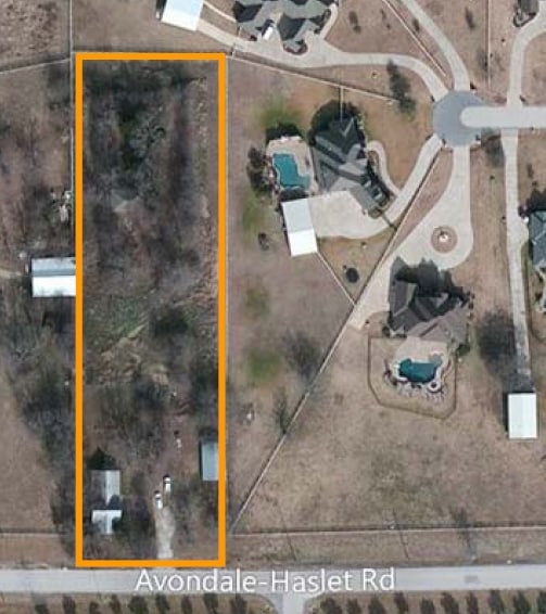
2010 Avondale Haslet Rd, Haslet, TX 76052

Property Detail
2010 Avondale Haslet Rd
04064704
M E P & P RR CO SURVEY ABSTRACT 1136 TRACT 3A
Commercialnec
Tarrant
B and X Area of moderate flood hazard, usually the area between the limits of the 100-year and 500-year floods.
Texas
2024
1.99 AC
2025
Alliance
114112
Dallas/Ft Worth
22,900 SF
Dallas-Fort Worth-Arlington, TX
NEARBY LISTINGS FOR SALE OR LEASE
DEMOGRAPHICS near 2010 Avondale Haslet Rd
1 mile
3 mile
5 mile
2025 Total Population
4,577
31,037
56,645
2030 Population
5,043
34,727
63,181
Pop Growth 2025-2030
+ 10.18%
+ 11.89%
+ 11.54%
Average Age
36
35
36
2025 Total Households
1,367
9,551
17,794
HH Growth 2025-2030
+ 10.46%
+ 12.09%
+ 11.76%
Median Household Inc
$167,180
$151,878
$140,455
Avg Household Size
3.20
3.20
3.20
2025 Avg HH Vehicles
3.00
2.00
2.00
Median Home Value
$672,727
$458,197
$441,103
Median Year Built
2010
2010
2010
Nearby Places
Map Layers
Map Styles
 Street
 Aerial
Transit
 Traffic
 Biking
Places
Listings with unknown addresses are not visible on the map
- Restaurants
- Banks
- Shops
- Fitness
- Groceries
PUBLIC TRANSPORTATION
AIRPORT
Dallas-Fort Worth International
Drive
Walk
Distance
Dallas-Fort Worth International
38 min
27.0 mi
Dallas Love Field
Drive
Walk
Distance
Dallas Love Field
54 min
42.4 mi
Nearby Properties
Address
Land Use
TOTAL SIZE
Lot Size
Zoning
Address
Land Use
TOTAL SIZE
Lot Size
Zoning
348,270 SF
39.34 AC
Address
Land Use
TOTAL SIZE
Lot Size
Zoning
830,399 SF
11.02 AC
Address
Land Use
TOTAL SIZE
Lot Size
Zoning
553,605 SF
81.10 AC
Address
Land Use
TOTAL SIZE
Lot Size
Zoning
422,682 SF
22.66 AC
Address
Land Use
TOTAL SIZE
Lot Size
Zoning
175,000 SF
14.48 AC
Address
Land Use
TOTAL SIZE
Lot Size
Zoning
731,548 SF
56.18 AC
Address
Land Use
TOTAL SIZE
Lot Size
Zoning
184,400 SF
19.75 AC
Address
Land Use
TOTAL SIZE
Lot Size
Zoning
436,589 SF
32.43 AC
Address
Land Use
TOTAL SIZE
Lot Size
Zoning
74,825 SF
13.41 AC
Address
Land Use
TOTAL SIZE
Lot Size
Zoning
46,464 SF
15.24 AC
Address
Land Use
TOTAL SIZE
Lot Size
Zoning
247,070 SF
5.79 AC
Address
Land Use
TOTAL SIZE
Lot Size
Zoning
72,713 SF
10.88 AC
Address
Land Use
TOTAL SIZE
Lot Size
Zoning
181,074 SF
14 AC
Address
Land Use
TOTAL SIZE
Lot Size
Zoning
53,619 SF
14.34 AC
Address
Land Use
TOTAL SIZE
Lot Size
Zoning
154,434 SF
17.47 AC
Address
Land Use
TOTAL SIZE
Lot Size
Zoning
147,806 SF
21.60 AC
Address
Land Use
TOTAL SIZE
Lot Size
Zoning
212,388 SF
28.94 AC
Address
Land Use
TOTAL SIZE
Lot Size
Zoning
55,000 SF
13.80 AC
Address
Land Use
TOTAL SIZE
Lot Size
Zoning
111,532 SF
6.75 AC
Address
Land Use
TOTAL SIZE
Lot Size
Zoning
53,064 SF
27.41 AC
Address
Land Use
TOTAL SIZE
Lot Size
Zoning
30,788 SF
3.29 AC
Address
Land Use
TOTAL SIZE
Lot Size
Zoning
90,987 SF
6.34 AC
Address
Land Use
TOTAL SIZE
Lot Size
Zoning
39.90 AC
Address
Land Use
TOTAL SIZE
Lot Size
Zoning
186,280 SF
36.20 AC
Address
Land Use
TOTAL SIZE
Lot Size
Zoning
25,015 SF
15.01 AC
Address
Land Use
TOTAL SIZE
Lot Size
Zoning
19,985 SF
2.52 AC
Address
Land Use
TOTAL SIZE
Lot Size
Zoning
96,110 SF
8 AC
Address
Land Use
TOTAL SIZE
Lot Size
Zoning
54,510 SF
5 AC
Address
Land Use
TOTAL SIZE
Lot Size
Zoning
305,697 SF
42.24 AC
Address
Land Use
TOTAL SIZE
Lot Size
Zoning
20,774 SF
2.64 AC
The World's #1 Commercial Real Estate Marketplace
Connect with us
© 2026 CoStar Group
The information above has been obtained from sources believed reliable. While we do not doubt its accuracy we have not verified it and make no guarantee, warranty or representation about it. It is your responsibility to independently confirm its accuracy and completeness. Any projections, opinions, assumptions, or estimates used are for example only and do not represent the current or future performance of the property. The value of this transaction to you depends on tax and other factors which should be evaluated by your tax, financial, and legal advisors. You and your advisors should conduct a careful, independent investigation of the property to determine to your satisfaction the suitability of the property for your needs.