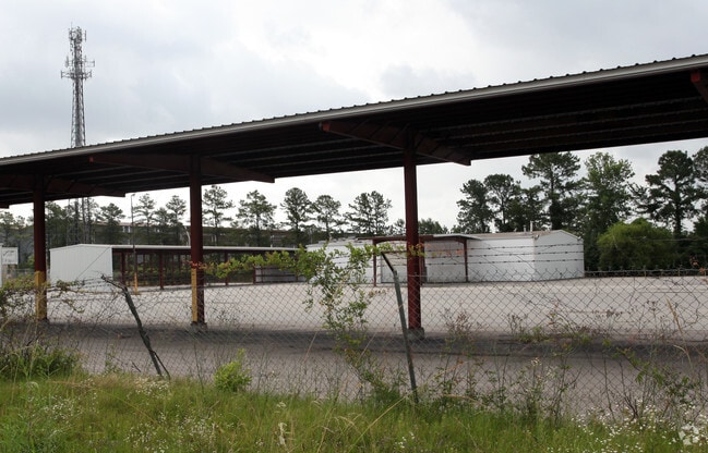
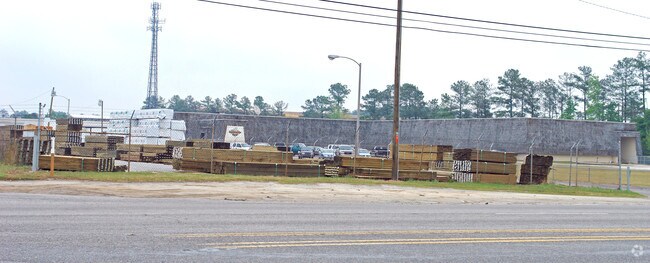
Property Record
2010 Bluff Rd, Columbia, SC 29201

Property Detail
2010 Bluff Rd
13602-03-01
#SU #PR X-2814 RB2177-726
Commercialnec
Richland
HI
South Carolina
B and X Area of moderate flood hazard, usually the area between the limits of the 100-year and 500-year floods.
8.11 AC
2025
Southeast Columbia
2024
Columbia
011701
Columbia, SC
35,037 SF
NEARBY LISTINGS FOR SALE OR LEASE
DEMOGRAPHICS near 2010 Bluff Rd
1 mile
3 mile
5 mile
2025 Total Population
3,461
38,951
116,819
2030 Population
3,594
40,605
121,087
Pop Growth 2025-2030
+ 3.84%
+ 4.25%
+ 3.65%
Average Age
29
36
36
2025 Total Households
1,615
18,425
49,445
HH Growth 2025-2030
+ 4.95%
+ 4.60%
+ 4.09%
Median Household Inc
$24,779
$58,881
$56,458
Avg Household Size
2.10
2.00
2.00
2025 Avg HH Vehicles
2.00
2.00
2.00
Median Home Value
$147,798
$278,503
$270,733
Median Year Built
2000
1978
1974
Nearby Places
Map Layers
Map Styles
 Street
 Aerial
Layers
 Traffic
 Biking
Places
Listings with unknown addresses are not visible on the map
- Restaurants
- Banks
- Shops
- Fitness
- Groceries
PUBLIC TRANSPORTATION
COMMUTER RAIL
Columbia Amtrak Station (Silver Star - Amtrak)
Drive
Walk
Distance
Columbia Amtrak Station (Silver Star - Amtrak)
9 min
4.5 mi
AIRPORT
Columbia Metro
Drive
Walk
Distance
Columbia Metro
23 min
12.1 mi
Freight Ports
North Charleston Terminal
Drive
Walk
Distance
North Charleston Terminal
117 min
103.5 mi
Nearby Properties
Address
Land Use
TOTAL SIZE
Lot Size
Zoning
Address
Land Use
TOTAL SIZE
Lot Size
Zoning
603,525 SF
26.45 AC
RM-HD
Address
Land Use
TOTAL SIZE
Lot Size
Zoning
604,350 SF
10.33 AC
EC
Address
Land Use
TOTAL SIZE
Lot Size
Zoning
316,116 SF
21.73 AC
RG-2
Address
Land Use
TOTAL SIZE
Lot Size
Zoning
241,878 SF
14.03 AC
C-3
Address
Land Use
TOTAL SIZE
Lot Size
Zoning
3,000 SF
52.49 AC
O-I
Address
Land Use
TOTAL SIZE
Lot Size
Zoning
300,636 SF
21.58 AC
LI
Address
Land Use
TOTAL SIZE
Lot Size
Zoning
95.26 AC
C-1
Address
Land Use
TOTAL SIZE
Lot Size
Zoning
486,050 SF
24.18 AC
RM-HD
Address
Land Use
TOTAL SIZE
Lot Size
Zoning
254,900 SF
14 AC
M-1
Address
Land Use
TOTAL SIZE
Lot Size
Zoning
216,180 SF
15.66 AC
C-1
Address
Land Use
TOTAL SIZE
Lot Size
Zoning
230,053 SF
18.35 AC
C-3
Address
Land Use
TOTAL SIZE
Lot Size
Zoning
32,640 SF
23.73 AC
RSF-2
Address
Land Use
TOTAL SIZE
Lot Size
Zoning
2,908 SF
87.03 AC
C-3
Address
Land Use
TOTAL SIZE
Lot Size
Zoning
239,827 SF
22.35 AC
HI
Address
Land Use
TOTAL SIZE
Lot Size
Zoning
174,424 SF
7.66 AC
LI
Address
Land Use
TOTAL SIZE
Lot Size
Zoning
9.66 AC
C-1
Address
Land Use
TOTAL SIZE
Lot Size
Zoning
55,003 SF
4.26 AC
M-1
Address
Land Use
TOTAL SIZE
Lot Size
Zoning
285,760 SF
16.12 AC
RG-2
Address
Land Use
TOTAL SIZE
Lot Size
Zoning
237 AC
HI
Address
Land Use
TOTAL SIZE
Lot Size
Zoning
62,250 SF
8.15 AC
GC
Address
Land Use
TOTAL SIZE
Lot Size
Zoning
100 SF
16.95 AC
C-3
Address
Land Use
TOTAL SIZE
Lot Size
Zoning
69,770 SF
3.79 AC
RM-HD
Address
Land Use
TOTAL SIZE
Lot Size
Zoning
160,954 SF
24.03 AC
C-3
Address
Land Use
TOTAL SIZE
Lot Size
Zoning
247,744 SF
15.32 AC
RM-HD
Address
Land Use
TOTAL SIZE
Lot Size
Zoning
59,864 SF
24.97 AC
M-1
Address
Land Use
TOTAL SIZE
Lot Size
Zoning
129,820 SF
11.12 AC
HI
Address
Land Use
TOTAL SIZE
Lot Size
Zoning
125,486 SF
9.97 AC
C-3
Address
Land Use
TOTAL SIZE
Lot Size
Zoning
68,216 SF
1.84 AC
C-3
Address
Land Use
TOTAL SIZE
Lot Size
Zoning
89,639 SF
14.68 AC
C-3
Address
Land Use
TOTAL SIZE
Lot Size
Zoning
97,324 SF
9.29 AC
C-3
The World's #1 Commercial Real Estate Marketplace
Connect with us
© 2026 CoStar Group
The information above has been obtained from sources believed reliable. While we do not doubt its accuracy we have not verified it and make no guarantee, warranty or representation about it. It is your responsibility to independently confirm its accuracy and completeness. Any projections, opinions, assumptions, or estimates used are for example only and do not represent the current or future performance of the property. The value of this transaction to you depends on tax and other factors which should be evaluated by your tax, financial, and legal advisors. You and your advisors should conduct a careful, independent investigation of the property to determine to your satisfaction the suitability of the property for your needs.