Property Record
2010 E High St, Jackson, MI 49203


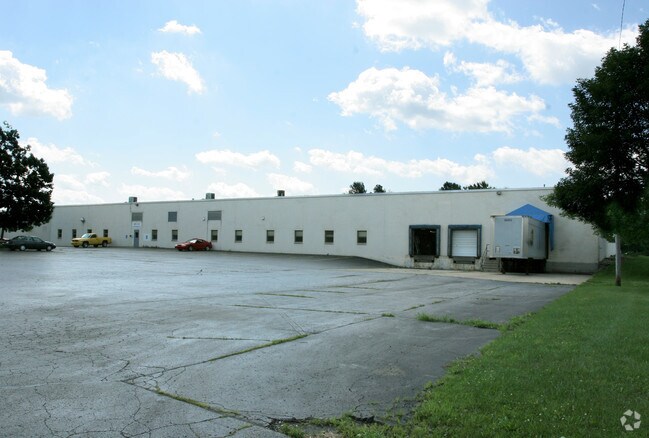
Property Detail
2010 E High St
6-1832.3100
1830, 1831, 1832.3 LAND OWNED AND USED AS ONE PARCEL AND DESC AS LOT 3 MICOR SUB DIV ALSO S 33 FT OF LOT 19 AND ALL OF LOTS
Manufacturinglight
Jackson
I-2
Michigan
C and X Area of minimal flood hazard, usually depicted on FIRMs as above the 500-year flood level.
3,19-26
2024
4.06 AC
2025
Jackson County
001200
West Michigan
73,977 SF
Jackson, MI
NEARBY LISTINGS FOR SALE OR LEASE
-
-
-
-
-
No Photo
-
-
-
View all Jackson listings for sale on LoopNet.com
DEMOGRAPHICS near 2010 E High St
1 mile
3 mile
5 mile
2025 Total Population
2,413
44,869
74,602
2030 Population
2,393
44,751
74,344
Pop Growth 2025-2030
(0.83%)
(0.26%)
(0.35%)
Average Age
37
39
41
2025 Total Households
941
18,349
31,316
HH Growth 2025-2030
(1.06%)
(0.27%)
(0.36%)
Median Household Inc
$40,959
$45,458
$51,519
Avg Household Size
2.40
2.30
2.30
2025 Avg HH Vehicles
1.00
2.00
2.00
Median Home Value
$74,109
$121,237
$155,856
Median Year Built
1947
1948
1955
Nearby Places
Map Layers
Map Styles
 Street
 Aerial
Layers
 Traffic
 Biking
Places
Listings with unknown addresses are not visible on the map
- Restaurants
- Banks
- Shops
- Fitness
- Groceries
PUBLIC TRANSPORTATION
COMMUTER RAIL
Jackson (Wolverine - Amtrak)
Drive
Walk
Distance
Jackson (Wolverine - Amtrak)
5 min
2.0 mi
Freight Ports
Port of Toledo
Drive
Walk
Distance
Port of Toledo
103 min
76.8 mi
Nearby Properties
Address
Land Use
TOTAL SIZE
Lot Size
Zoning
Address
Land Use
TOTAL SIZE
Lot Size
Zoning
392,155 SF
7.01 AC
C-3
Address
Land Use
TOTAL SIZE
Lot Size
Zoning
332,493 SF
145.86 AC
B-4 GEN
Address
Land Use
TOTAL SIZE
Lot Size
Zoning
463,815 SF
168.74 AC
GI
Address
Land Use
TOTAL SIZE
Lot Size
Zoning
401,234 SF
23.40 AC
I-2
Address
Land Use
TOTAL SIZE
Lot Size
Zoning
13,124 SF
23.61 AC
I-2
Address
Land Use
TOTAL SIZE
Lot Size
Zoning
64,257 SF
1.90 AC
R-4
Address
Land Use
TOTAL SIZE
Lot Size
Zoning
252,659 SF
35 AC
M HEAVY
Address
Land Use
TOTAL SIZE
Lot Size
Zoning
223,693 SF
27.35 AC
B-4 GEN
Address
Land Use
TOTAL SIZE
Lot Size
Zoning
189,680 SF
6.90 AC
R-4
Address
Land Use
TOTAL SIZE
Lot Size
Zoning
74,254 SF
12.64 AC
I-2
Address
Land Use
TOTAL SIZE
Lot Size
Zoning
136,221 SF
8.04 AC
R-3
Address
Land Use
TOTAL SIZE
Lot Size
Zoning
136,221 SF
6.78 AC
R-3
Address
Land Use
TOTAL SIZE
Lot Size
Zoning
67,146 SF
0.80 AC
C-3
Address
Land Use
TOTAL SIZE
Lot Size
Zoning
444,936 SF
19.65 AC
I-2
Address
Land Use
TOTAL SIZE
Lot Size
Zoning
171,368 SF
18.90 AC
I-2
Address
Land Use
TOTAL SIZE
Lot Size
Zoning
111,312 SF
3.27 AC
R-2
Address
Land Use
TOTAL SIZE
Lot Size
Zoning
35,908 SF
6.60 AC
R-4
Address
Land Use
TOTAL SIZE
Lot Size
Zoning
55,209 SF
5.67 AC
C-2
Address
Land Use
TOTAL SIZE
Lot Size
Zoning
154,448 SF
12.97 AC
PR-1
Address
Land Use
TOTAL SIZE
Lot Size
Zoning
71,815 SF
3.42 AC
I-2
Address
Land Use
TOTAL SIZE
Lot Size
Zoning
196,525 SF
4.22 AC
I-2
Address
Land Use
TOTAL SIZE
Lot Size
Zoning
126,176 SF
19.62 AC
PR-1
Address
Land Use
TOTAL SIZE
Lot Size
Zoning
57,804 SF
3.77 AC
C-4
Address
Land Use
TOTAL SIZE
Lot Size
Zoning
89,888 SF
8 AC
R-3
Address
Land Use
TOTAL SIZE
Lot Size
Zoning
174,184 SF
14.01 AC
M HEAVY
Address
Land Use
TOTAL SIZE
Lot Size
Zoning
71,985 SF
7.89 AC
I-2
Address
Land Use
TOTAL SIZE
Lot Size
Zoning
742,023 SF
53.77 AC
M HEAVY
Address
Land Use
TOTAL SIZE
Lot Size
Zoning
66,963 SF
0.80 AC
C-3
Address
Land Use
TOTAL SIZE
Lot Size
Zoning
94,819 SF
12.15 AC
R-3
Address
Land Use
TOTAL SIZE
Lot Size
Zoning
45,827 SF
2.71 AC
C-3
The World's #1 Commercial Real Estate Marketplace
Connect with us
© 2026 CoStar Group
The information above has been obtained from sources believed reliable. While we do not doubt its accuracy we have not verified it and make no guarantee, warranty or representation about it. It is your responsibility to independently confirm its accuracy and completeness. Any projections, opinions, assumptions, or estimates used are for example only and do not represent the current or future performance of the property. The value of this transaction to you depends on tax and other factors which should be evaluated by your tax, financial, and legal advisors. You and your advisors should conduct a careful, independent investigation of the property to determine to your satisfaction the suitability of the property for your needs.