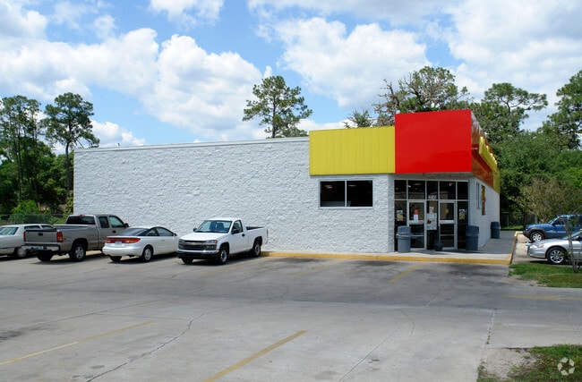
Property Record
2010 N State Road 19, Eustis, FL 32736


NEARBY LISTINGS FOR SALE OR LEASE
Property Detail
2010 N State Road 19
35-18-26-0003-000-05900
FROM INTERSECTION OF N R/W LINE OF CR 44 WITH W R/W LINE OF SR 19 IN SW 1/4 RUN N 01DEG 54MIN 00SEC E 220.50 FT FOR POB CONT N 01DEG 54MIN 00SEC E 280.90 FT S 88DEG 13MIN 05SEC W 325 FT S 01DEG 53MIN 33SEC W 281.96 FT N 88DEG 01MIN 52SEC E 325.03 FT
Storemultistory
Lake
X
Florida
12069C0215E
59
2024
2.18 AC
2026
Lake County
030108
Orlando
6,759 SF
Orlando-Kissimmee-Sanford, FL
DEMOGRAPHICS near 2010 N State Road 19
1 Mile
3 Mile
5 Mile
2024 Total Population
2,932
23,259
60,739
2029 Population
3,372
27,030
70,805
Pop Growth 2024-2029
+ 15.01%
+ 16.21%
+ 16.57%
Average Age
47
42
45
2024 Total Households
1,397
9,328
25,673
HH Growth 2024-2029
+ 14.75%
+ 15.97%
+ 16.40%
Median Household Inc
$52,806
$60,457
$60,442
Avg Household Size
2.10
2.40
2.30
2024 Avg HH Vehicles
2.00
2.00
2.00
Median Home Value
$154,687
$228,486
$238,294
Median Year Built
1983
1981
1985
Nearby Places
Map Layers
Map Styles
 Street
 Aerial
- Restaurants
- Banks
- Shops
- Fitness
- Groceries
PUBLIC TRANSPORTATION
AIRPORT
Orlando Sanford International
DRIVE
WALK
Distance
Orlando Sanford International
58 min
36.6 mi
Nearby Properties
Address
Land Use
TOTAL SIZE
Lot Size
Zoning
Address
Land Use
TOTAL SIZE
Lot Size
Zoning
174,744 SF
38.45 AC
GI
Address
Land Use
TOTAL SIZE
Lot Size
Zoning
60,476 SF
6.76 AC
MCR
Address
Land Use
TOTAL SIZE
Lot Size
Zoning
70,525 SF
37.62 AC
R2
Address
Land Use
TOTAL SIZE
Lot Size
Zoning
12,573 SF
43.71 AC
A
Address
Land Use
TOTAL SIZE
Lot Size
Zoning
494,946 SF
57.60 AC
LM
Address
Land Use
TOTAL SIZE
Lot Size
Zoning
2,000 SF
44.77 AC
CFD
Address
Land Use
TOTAL SIZE
Lot Size
Zoning
46,374 SF
6.96 AC
GC
Address
Land Use
TOTAL SIZE
Lot Size
Zoning
48,624 SF
12.01 AC
MCR
Address
Land Use
TOTAL SIZE
Lot Size
Zoning
2,000 SF
21.47 AC
SR
Address
Land Use
TOTAL SIZE
Lot Size
Zoning
113,572 SF
21.17 AC
LM
Address
Land Use
TOTAL SIZE
Lot Size
Zoning
43,472 SF
3.52 AC
UR
Address
Land Use
TOTAL SIZE
Lot Size
Zoning
65,868 SF
9.33 AC
MCR
Address
Land Use
TOTAL SIZE
Lot Size
Zoning
2,000 SF
35.84 AC
PI
Address
Land Use
TOTAL SIZE
Lot Size
Zoning
71.58 AC
Address
Land Use
TOTAL SIZE
Lot Size
Zoning
2,000 SF
37.70 AC
PI
Address
Land Use
TOTAL SIZE
Lot Size
Zoning
62,342 SF
5.12 AC
SR
Address
Land Use
TOTAL SIZE
Lot Size
Zoning
90,584 SF
11.14 AC
HM
Address
Land Use
TOTAL SIZE
Lot Size
Zoning
479.02 AC
A
Address
Land Use
TOTAL SIZE
Lot Size
Zoning
20,680 SF
0.47 AC
Address
Land Use
TOTAL SIZE
Lot Size
Zoning
776.54 AC
A
Address
Land Use
TOTAL SIZE
Lot Size
Zoning
34.62 AC
C2
Address
Land Use
TOTAL SIZE
Lot Size
Zoning
31,806 SF
9.46 AC
GI
Address
Land Use
TOTAL SIZE
Lot Size
Zoning
41,670 SF
2.93 AC
CP
Address
Land Use
TOTAL SIZE
Lot Size
Zoning
60,524 SF
9.61 AC
RP
Address
Land Use
TOTAL SIZE
Lot Size
Zoning
40,130 SF
4.88 AC
R6
Address
Land Use
TOTAL SIZE
Lot Size
Zoning
24,800 SF
13.08 AC
Address
Land Use
TOTAL SIZE
Lot Size
Zoning
23,424 SF
3.05 AC
Address
Land Use
TOTAL SIZE
Lot Size
Zoning
28,020 SF
4.48 AC
UR
Address
Land Use
TOTAL SIZE
Lot Size
Zoning
15,111 SF
2.14 AC
NC
Address
Land Use
TOTAL SIZE
Lot Size
Zoning
23,855 SF
1.61 AC
RT
The World's #1 Commercial Real Estate Marketplace
Connect with us
© 2026 CoStar Group
The information above has been obtained from sources believed reliable. While we do not doubt its accuracy we have not verified it and make no guarantee, warranty or representation about it. It is your responsibility to independently confirm its accuracy and completeness. Any projections, opinions, assumptions, or estimates used are for example only and do not represent the current or future performance of the property. The value of this transaction to you depends on tax and other factors which should be evaluated by your tax, financial, and legal advisors. You and your advisors should conduct a careful, independent investigation of the property to determine to your satisfaction the suitability of the property for your needs.