Property Record
2010 S Highway 40 E, Vernal, UT 84078
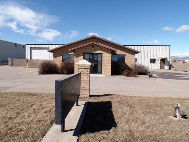

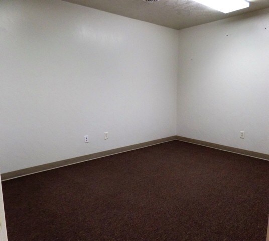
Property Detail
2010 S Highway 40 E
Vernal, UT
BEGINNING AT A POINT THAT IS ON THE WEST RIGHT-OF-WAY LINE OF U.S. HIGHWAY 40 SAID POINT BEING - 56 FT WEST PARALLEL TO TE
05-113-0030
UINTAH
Industrialgeneral
Utah
B and X Area of moderate flood hazard, usually the area between the limits of the 100-year and 500-year floods.
1
2025
3 AC
2025
Utah North Area
968403
Other Market Areas
2,133 SF
NEARBY LISTINGS FOR SALE OR LEASE
DEMOGRAPHICS near 2010 S Highway 40 E
1 mile
3 mile
5 mile
2025 Total Population
1,269
16,861
28,908
2030 Population
1,364
18,259
31,125
Pop Growth 2025-2030
+ 7.49%
+ 8.29%
+ 7.67%
Average Age
36
34
34
2025 Total Households
403
5,861
9,942
HH Growth 2025-2030
+ 7.44%
+ 8.26%
+ 7.60%
Median Household Inc
$91,139
$70,008
$71,626
Avg Household Size
3.10
2.90
2.90
2025 Avg HH Vehicles
3.00
2.00
2.00
Median Home Value
$397,825
$326,629
$329,144
Median Year Built
2001
1996
1993
Nearby Places
Map Layers
Map Styles
 Street
 Aerial
Layers
 Traffic
 Biking
Places
Listings with unknown addresses are not visible on the map
- Restaurants
- Banks
- Shops
- Fitness
- Groceries
SALE & LEASE HISTORY
LISTING DATE
SALE/LEASE

May 30, 2017
For Sale
Apr 17, 2017
For Sale
Nearby Properties
Address
Land Use
TOTAL SIZE
Lot Size
Zoning
Address
Land Use
TOTAL SIZE
Lot Size
Zoning
115,697 SF
4.23 AC
Address
Land Use
TOTAL SIZE
Lot Size
Zoning
10,000 SF
30 AC
Address
Land Use
TOTAL SIZE
Lot Size
Zoning
5.16 AC
Address
Land Use
TOTAL SIZE
Lot Size
Zoning
Address
Land Use
TOTAL SIZE
Lot Size
Zoning
6.66 AC
Address
Land Use
TOTAL SIZE
Lot Size
Zoning
3.07 AC
Address
Land Use
TOTAL SIZE
Lot Size
Zoning
3.70 AC
Address
Land Use
TOTAL SIZE
Lot Size
Zoning
34,089 SF
1.06 AC
Address
Land Use
TOTAL SIZE
Lot Size
Zoning
Address
Land Use
TOTAL SIZE
Lot Size
Zoning
Address
Land Use
TOTAL SIZE
Lot Size
Zoning
Address
Land Use
TOTAL SIZE
Lot Size
Zoning
1.40 AC
Address
Land Use
TOTAL SIZE
Lot Size
Zoning
19.36 AC
Address
Land Use
TOTAL SIZE
Lot Size
Zoning
3.03 AC
Address
Land Use
TOTAL SIZE
Lot Size
Zoning
14,599 SF
16.17 AC
Address
Land Use
TOTAL SIZE
Lot Size
Zoning
2,027 SF
1.37 AC
Address
Land Use
TOTAL SIZE
Lot Size
Zoning
37,156 SF
2.71 AC
Address
Land Use
TOTAL SIZE
Lot Size
Zoning
31,246 SF
5.23 AC
Address
Land Use
TOTAL SIZE
Lot Size
Zoning
6.08 AC
Address
Land Use
TOTAL SIZE
Lot Size
Zoning
4.79 AC
Address
Land Use
TOTAL SIZE
Lot Size
Zoning
4.71 AC
Address
Land Use
TOTAL SIZE
Lot Size
Zoning
2.30 AC
Address
Land Use
TOTAL SIZE
Lot Size
Zoning
7,200 SF
3.82 AC
Address
Land Use
TOTAL SIZE
Lot Size
Zoning
20,380 SF
1.03 AC
Address
Land Use
TOTAL SIZE
Lot Size
Zoning
Address
Land Use
TOTAL SIZE
Lot Size
Zoning
4,026 SF
4 AC
Address
Land Use
TOTAL SIZE
Lot Size
Zoning
8.99 AC
Address
Land Use
TOTAL SIZE
Lot Size
Zoning
812 SF
5.32 AC
Address
Land Use
TOTAL SIZE
Lot Size
Zoning
23,150 SF
9.08 AC
Address
Land Use
TOTAL SIZE
Lot Size
Zoning
21,858 SF
3.24 AC
The World's #1 Commercial Real Estate Marketplace
Connect with us
© 2026 CoStar Group
The information above has been obtained from sources believed reliable. While we do not doubt its accuracy we have not verified it and make no guarantee, warranty or representation about it. It is your responsibility to independently confirm its accuracy and completeness. Any projections, opinions, assumptions, or estimates used are for example only and do not represent the current or future performance of the property. The value of this transaction to you depends on tax and other factors which should be evaluated by your tax, financial, and legal advisors. You and your advisors should conduct a careful, independent investigation of the property to determine to your satisfaction the suitability of the property for your needs.