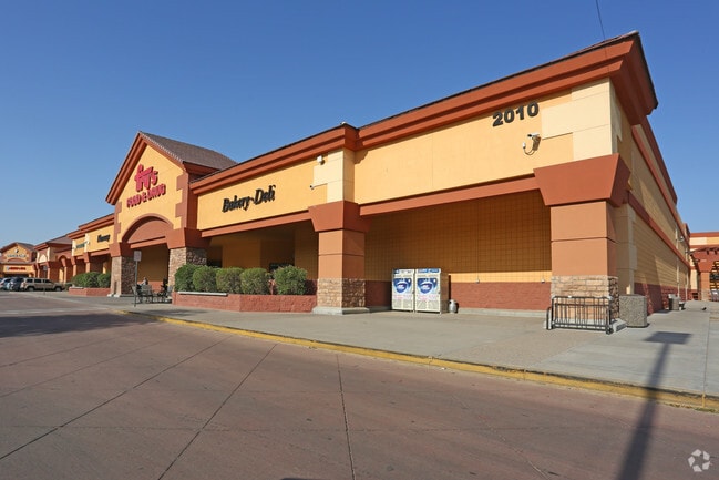
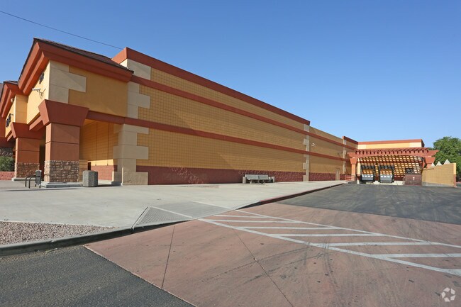
Property Record
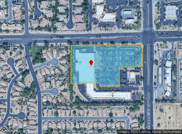
2010 S Alma School Rd, Chandler, AZ 85286
NEARBY LISTINGS FOR SALE OR LEASE
Property Detail
2010 S Alma School Rd
Phoenix-Mesa-Scottsdale, AZ
Frys Shopping Center Lot 2 Block 1 Repla
303-77-557A
FRYS SHOPPING CENTER LOT 2 BLOCK 1 REPLAT MCR 994-06
Regionalshoppingcenterormallwithanchorstore
Maricopa
X
Arizona
04013C2740M
2
2025
6.73 AC
2025
Chandler
812200
Phoenix
62,220 SF
DEMOGRAPHICS near 2010 S Alma School Rd
1 Mile
3 Mile
5 Mile
2024 Total Population
16,905
99,945
259,495
2029 Population
18,254
108,366
280,177
Pop Growth 2024-2029
+ 7.98%
+ 8.43%
+ 7.97%
Average Age
36
37
40
2024 Total Households
6,007
37,025
98,716
HH Growth 2024-2029
+ 7.96%
+ 8.55%
+ 8.13%
Median Household Inc
$107,712
$94,741
$94,757
Avg Household Size
2.70
2.60
2.60
2024 Avg HH Vehicles
2.00
2.00
2.00
Median Home Value
$518,904
$458,013
$418,586
Median Year Built
2001
1999
1995
Nearby Places
Map Layers
Map Styles
 Street
 Aerial
- Restaurants
- Banks
- Shops
- Fitness
- Groceries
PUBLIC TRANSPORTATION
AIRPORT
Phoenix-Mesa Gateway
DRIVE
WALK
Distance
Phoenix-Mesa Gateway
21 min
13.2 mi
Phoenix Sky Harbor International
DRIVE
WALK
Distance
Phoenix Sky Harbor International
27 min
19.6 mi
Freight Ports
Port of San Diego
DRIVE
WALK
Distance
Port of San Diego
396 min
362.5 mi
Nearby Properties
Address
Land Use
TOTAL SIZE
Lot Size
Zoning
Address
Land Use
TOTAL SIZE
Lot Size
Zoning
221,091 SF
14.76 AC
I-1
Address
Land Use
TOTAL SIZE
Lot Size
Zoning
1,420,114 SF
66.08 AC
PAD
Address
Land Use
TOTAL SIZE
Lot Size
Zoning
71,100 SF
9.07 AC
PAD
Address
Land Use
TOTAL SIZE
Lot Size
Zoning
733,019 SF
13.13 AC
PAD
Address
Land Use
TOTAL SIZE
Lot Size
Zoning
10.02 AC
Address
Land Use
TOTAL SIZE
Lot Size
Zoning
24,739 SF
5.39 AC
PAD
Address
Land Use
TOTAL SIZE
Lot Size
Zoning
1.13 AC
Address
Land Use
TOTAL SIZE
Lot Size
Zoning
51,091 SF
3.59 AC
PAD
Address
Land Use
TOTAL SIZE
Lot Size
Zoning
3,688,548 SF
285.19 AC
PAD
Address
Land Use
TOTAL SIZE
Lot Size
Zoning
687,690 SF
44.05 AC
PAD
Address
Land Use
TOTAL SIZE
Lot Size
Zoning
30,414 SF
97.19 AC
PAD
Address
Land Use
TOTAL SIZE
Lot Size
Zoning
724,125 SF
41.62 AC
PAD
Address
Land Use
TOTAL SIZE
Lot Size
Zoning
434,857 SF
36.73 AC
PF
Address
Land Use
TOTAL SIZE
Lot Size
Zoning
724,125 SF
39.23 AC
Address
Land Use
TOTAL SIZE
Lot Size
Zoning
43,044 SF
3.46 AC
PAD
Address
Land Use
TOTAL SIZE
Lot Size
Zoning
774,482 SF
25.50 AC
PAD
Address
Land Use
TOTAL SIZE
Lot Size
Zoning
519,664 SF
20.95 AC
PAD
Address
Land Use
TOTAL SIZE
Lot Size
Zoning
2.57 AC
Address
Land Use
TOTAL SIZE
Lot Size
Zoning
1.83 AC
Address
Land Use
TOTAL SIZE
Lot Size
Zoning
456,122 SF
25.97 AC
PAD
Address
Land Use
TOTAL SIZE
Lot Size
Zoning
24,038 SF
40.27 AC
AG1
Address
Land Use
TOTAL SIZE
Lot Size
Zoning
498,377 SF
29.12 AC
Address
Land Use
TOTAL SIZE
Lot Size
Zoning
1.64 AC
Address
Land Use
TOTAL SIZE
Lot Size
Zoning
263,599 SF
18.33 AC
PAD
Address
Land Use
TOTAL SIZE
Lot Size
Zoning
416,954 SF
9.59 AC
PF
Address
Land Use
TOTAL SIZE
Lot Size
Zoning
416,098 SF
22.48 AC
Address
Land Use
TOTAL SIZE
Lot Size
Zoning
395,055 SF
8.33 AC
PAD
Address
Land Use
TOTAL SIZE
Lot Size
Zoning
331,556 SF
19.73 AC
PAD
Address
Land Use
TOTAL SIZE
Lot Size
Zoning
348,249 SF
6.42 AC
M-H
The World's #1 Commercial Real Estate Marketplace
Connect with us
© 2026 CoStar Group
The information above has been obtained from sources believed reliable. While we do not doubt its accuracy we have not verified it and make no guarantee, warranty or representation about it. It is your responsibility to independently confirm its accuracy and completeness. Any projections, opinions, assumptions, or estimates used are for example only and do not represent the current or future performance of the property. The value of this transaction to you depends on tax and other factors which should be evaluated by your tax, financial, and legal advisors. You and your advisors should conduct a careful, independent investigation of the property to determine to your satisfaction the suitability of the property for your needs.