Property Record
2010 S Assembly Rd, Spokane, WA 99224
NEARBY LISTINGS FOR SALE OR LEASE
-
-
View all Spokane listings for sale on LoopNet.com
Property Detail
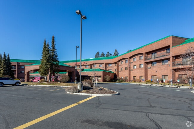
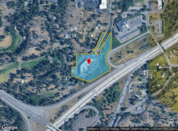
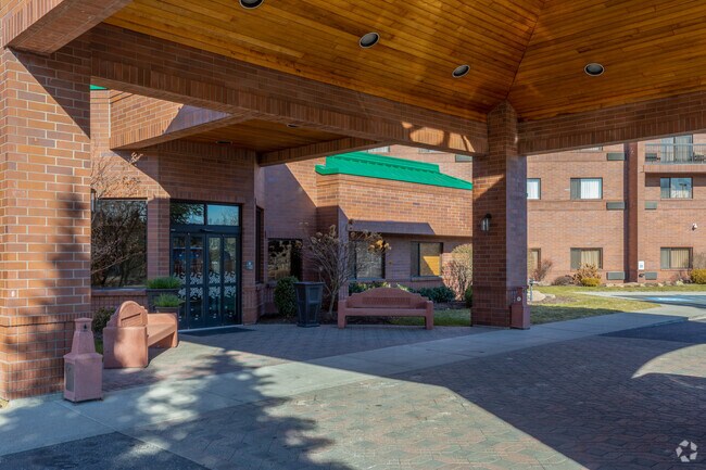
2010 S Assembly Rd
25271.0002
NE1/4 27-25-42 BEG @ ELY 1/4 COR SD SEC TH W ALG SLY LN OF NE1/4 349.40 TH N 81 TH N72DEG26MINW 14.79 TO POB TH N72DEG26MINW 347.08 TH N3DEG46MIN46SECE 7.65 TH ALG TAN CUR TO L W/RAD OF 407 THRU CEN ANG OF 10DEG35MIN14SEC 75.21 T H N7DEG20MINE 82.05
Hotel
Spokane
X
Washington
53063C0538D
a
2025
7.58 AC
2025
Spokane
003800
Spokane
85,258 SF
Spokane-Spokane Valley, WA
DEMOGRAPHICS near 2010 S Assembly Rd
1 Mile
3 Mile
5 Mile
2024 Total Population
3,197
37,292
130,750
2029 Population
3,498
40,000
139,358
Pop Growth 2024-2029
+ 9.42%
+ 7.26%
+ 6.58%
Average Age
40
40
39
2024 Total Households
1,488
18,153
55,150
HH Growth 2024-2029
+ 9.74%
+ 7.68%
+ 6.98%
Median Household Inc
$73,665
$55,267
$59,924
Avg Household Size
2.10
2.00
2.20
2024 Avg HH Vehicles
2.00
2.00
2.00
Median Home Value
$409,066
$389,429
$358,784
Median Year Built
1998
1964
1958
Nearby Places
Map Layers
Map Styles
 Street
 Aerial
- Restaurants
- Banks
- Shops
- Fitness
- Groceries
PUBLIC TRANSPORTATION
COMMUTER RAIL
DRIVE
WALK
Distance
10 min
3.6 mi
AIRPORT
Spokane International
DRIVE
WALK
Distance
Spokane International
9 min
3.7 mi
Nearby Properties
Address
Land Use
TOTAL SIZE
Lot Size
Zoning
Address
Land Use
TOTAL SIZE
Lot Size
Zoning
831,429 SF
119.79 AC
Address
Land Use
TOTAL SIZE
Lot Size
Zoning
702,957 SF
277.93 AC
Address
Land Use
TOTAL SIZE
Lot Size
Zoning
107,800 SF
3.20 AC
CB
Address
Land Use
TOTAL SIZE
Lot Size
Zoning
91,882 SF
2.07 AC
OR
Address
Land Use
TOTAL SIZE
Lot Size
Zoning
314,149 SF
1.07 AC
DTC
Address
Land Use
TOTAL SIZE
Lot Size
Zoning
118,996 SF
8.21 AC
LI
Address
Land Use
TOTAL SIZE
Lot Size
Zoning
289,705 SF
3.36 AC
OR
Address
Land Use
TOTAL SIZE
Lot Size
Zoning
50,869 SF
0.61 AC
DTC
Address
Land Use
TOTAL SIZE
Lot Size
Zoning
228,981 SF
5.32 AC
RHD
Address
Land Use
TOTAL SIZE
Lot Size
Zoning
53,748 SF
1.26 AC
DTC
Address
Land Use
TOTAL SIZE
Lot Size
Zoning
259,221 SF
5.06 AC
DTC
Address
Land Use
TOTAL SIZE
Lot Size
Zoning
197,933 SF
37.51 AC
UR
Address
Land Use
TOTAL SIZE
Lot Size
Zoning
236,105 SF
5.01 AC
OR
Address
Land Use
TOTAL SIZE
Lot Size
Zoning
314,707 SF
16 AC
LI
Address
Land Use
TOTAL SIZE
Lot Size
Zoning
91,048 SF
3.81 AC
OR
Address
Land Use
TOTAL SIZE
Lot Size
Zoning
16,384 SF
1.21 AC
DTC
Address
Land Use
TOTAL SIZE
Lot Size
Zoning
177,707 SF
44.44 AC
LI
Address
Land Use
TOTAL SIZE
Lot Size
Zoning
30,250 SF
1.05 AC
DTC
Address
Land Use
TOTAL SIZE
Lot Size
Zoning
122,949 SF
11.07 AC
LI
Address
Land Use
TOTAL SIZE
Lot Size
Zoning
177,044 SF
14.71 AC
LDR
Address
Land Use
TOTAL SIZE
Lot Size
Zoning
159,706 SF
918.26 AC
LI
Address
Land Use
TOTAL SIZE
Lot Size
Zoning
19,994 SF
0.63 AC
DTG
Address
Land Use
TOTAL SIZE
Lot Size
Zoning
107,490 SF
0.52 AC
DTG
Address
Land Use
TOTAL SIZE
Lot Size
Zoning
34,045 SF
1 AC
DTC
Address
Land Use
TOTAL SIZE
Lot Size
Zoning
172,140 SF
70.04 AC
RHD
Address
Land Use
TOTAL SIZE
Lot Size
Zoning
129,828 SF
3.17 AC
CB
Address
Land Use
TOTAL SIZE
Lot Size
Zoning
238,830 SF
19.75 AC
LI
Address
Land Use
TOTAL SIZE
Lot Size
Zoning
18,850 SF
0.64 AC
OR
Address
Land Use
TOTAL SIZE
Lot Size
Zoning
80,076 SF
0.49 AC
OR
Address
Land Use
TOTAL SIZE
Lot Size
Zoning
49,300 SF
2.07 AC
CB
The World's #1 Commercial Real Estate Marketplace
Connect with us
© 2026 CoStar Group
The information above has been obtained from sources believed reliable. While we do not doubt its accuracy we have not verified it and make no guarantee, warranty or representation about it. It is your responsibility to independently confirm its accuracy and completeness. Any projections, opinions, assumptions, or estimates used are for example only and do not represent the current or future performance of the property. The value of this transaction to you depends on tax and other factors which should be evaluated by your tax, financial, and legal advisors. You and your advisors should conduct a careful, independent investigation of the property to determine to your satisfaction the suitability of the property for your needs.