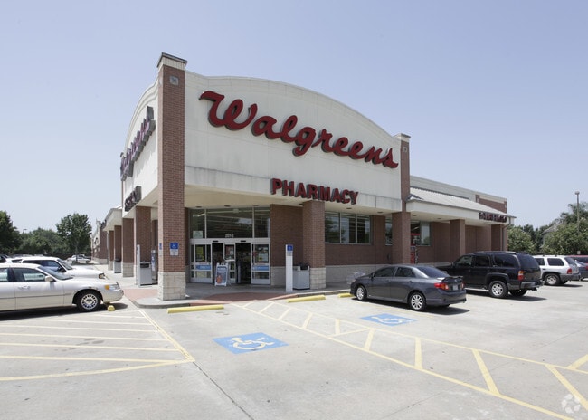
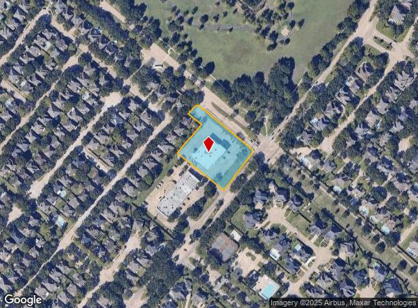
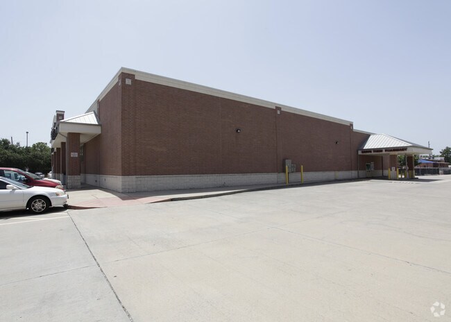
Property Record
2010 S Fry Rd, Katy, TX 77450
NEARBY LISTINGS FOR SALE OR LEASE
Property Detail
2010 S Fry Rd
1195920010001
Debbie Mcclure
Storebuilding
RES A BLK 1 DEBBIE MCCLURE
X
Harris
48201C0615M
Texas
2024
1.84 AC
2025
Far Katy South
454901
Houston
13,822 SF
Houston-The Woodlands-Sugar Land, TX
DEMOGRAPHICS near 2010 S Fry Rd
1 Mile
3 Mile
5 Mile
2024 Total Population
11,296
80,978
279,331
2029 Population
11,382
84,853
304,308
Pop Growth 2024-2029
+ 0.76%
+ 4.79%
+ 8.94%
Average Age
39
38
37
2024 Total Households
3,570
28,280
94,839
HH Growth 2024-2029
+ 0.70%
+ 4.81%
+ 8.75%
Median Household Inc
$130,337
$92,269
$85,203
Avg Household Size
3.10
2.80
2.90
2024 Avg HH Vehicles
2.00
2.00
2.00
Median Home Value
$355,296
$322,341
$274,385
Median Year Built
1993
1994
2001
Nearby Places
Map Layers
Map Styles
 Street
 Aerial
- Restaurants
- Banks
- Shops
- Fitness
- Groceries
PUBLIC TRANSPORTATION
AIRPORT
William P Hobby
DRIVE
WALK
Distance
William P Hobby
55 min
36.4 mi
George Bush Intcntl/Houston
DRIVE
WALK
Distance
George Bush Intcntl/Houston
50 min
38.6 mi
Freight Ports
Port of Houston
DRIVE
WALK
Distance
Port of Houston
49 min
34.1 mi
Nearby Properties
Address
Land Use
TOTAL SIZE
Lot Size
Zoning
Address
Land Use
TOTAL SIZE
Lot Size
Zoning
451,973 SF
19.47 AC
Address
Land Use
TOTAL SIZE
Lot Size
Zoning
417,092 SF
17.58 AC
Address
Land Use
TOTAL SIZE
Lot Size
Zoning
375,486 SF
12.36 AC
Address
Land Use
TOTAL SIZE
Lot Size
Zoning
168,051 SF
12.68 AC
Address
Land Use
TOTAL SIZE
Lot Size
Zoning
319,717 SF
10.45 AC
Address
Land Use
TOTAL SIZE
Lot Size
Zoning
492,836 SF
30.20 AC
Address
Land Use
TOTAL SIZE
Lot Size
Zoning
278,684 SF
13 AC
Address
Land Use
TOTAL SIZE
Lot Size
Zoning
384,260 SF
18 AC
Address
Land Use
TOTAL SIZE
Lot Size
Zoning
351,505 SF
13.38 AC
Address
Land Use
TOTAL SIZE
Lot Size
Zoning
307,596 SF
9.62 AC
Address
Land Use
TOTAL SIZE
Lot Size
Zoning
214,347 SF
30.70 AC
Address
Land Use
TOTAL SIZE
Lot Size
Zoning
26,631 SF
10.61 AC
Address
Land Use
TOTAL SIZE
Lot Size
Zoning
420,671 SF
23.29 AC
Address
Land Use
TOTAL SIZE
Lot Size
Zoning
183,216 SF
10.84 AC
Address
Land Use
TOTAL SIZE
Lot Size
Zoning
375,895 SF
14 AC
Address
Land Use
TOTAL SIZE
Lot Size
Zoning
101,783 SF
14.43 AC
Address
Land Use
TOTAL SIZE
Lot Size
Zoning
367,873 SF
15.75 AC
Address
Land Use
TOTAL SIZE
Lot Size
Zoning
101,443 SF
11.60 AC
S
Address
Land Use
TOTAL SIZE
Lot Size
Zoning
377,890 SF
12.68 AC
Address
Land Use
TOTAL SIZE
Lot Size
Zoning
334,971 SF
18.43 AC
Address
Land Use
TOTAL SIZE
Lot Size
Zoning
349,634 SF
16.31 AC
Address
Land Use
TOTAL SIZE
Lot Size
Zoning
265,842 SF
11 AC
Address
Land Use
TOTAL SIZE
Lot Size
Zoning
209,455 SF
6.61 AC
Address
Land Use
TOTAL SIZE
Lot Size
Zoning
147,341 SF
22.08 AC
Address
Land Use
TOTAL SIZE
Lot Size
Zoning
119,940 SF
6.13 AC
Address
Land Use
TOTAL SIZE
Lot Size
Zoning
199,791 SF
7.79 AC
Address
Land Use
TOTAL SIZE
Lot Size
Zoning
311,008 SF
12.86 AC
Address
Land Use
TOTAL SIZE
Lot Size
Zoning
252,194 SF
7.45 AC
Address
Land Use
TOTAL SIZE
Lot Size
Zoning
238,217 SF
9.06 AC
Address
Land Use
TOTAL SIZE
Lot Size
Zoning
206,020 SF
8.98 AC
The World's #1 Commercial Real Estate Marketplace
Connect with us
© 2025 CoStar Group
The information above has been obtained from sources believed reliable. While we do not doubt its accuracy we have not verified it and make no guarantee, warranty or representation about it. It is your responsibility to independently confirm its accuracy and completeness. Any projections, opinions, assumptions, or estimates used are for example only and do not represent the current or future performance of the property. The value of this transaction to you depends on tax and other factors which should be evaluated by your tax, financial, and legal advisors. You and your advisors should conduct a careful, independent investigation of the property to determine to your satisfaction the suitability of the property for your needs.