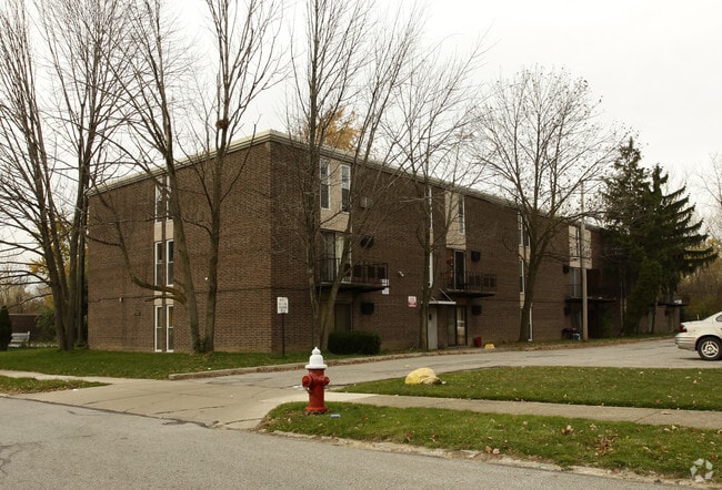
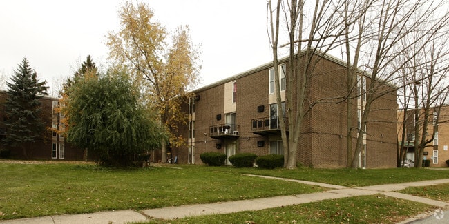
Property Record
20101 Clare Ave, Maple Heights, OH 44137
NEARBY LISTINGS FOR SALE OR LEASE
Property Detail
20101 Clare Ave
Cleveland-Elyria, OH
Harvard Investment Cos Resub
782-22-071
5 BLKA EP 78222072 TO78222077
Apartment
Cuyahoga
X
Ohio
39035C0216E
5
2024
1.58 AC
2024
Maple Heights
171104
Cleveland
57,186 SF
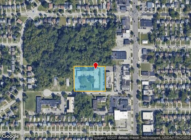
DEMOGRAPHICS near 20101 Clare Ave
1 Mile
3 Mile
5 Mile
2024 Total Population
12,652
91,660
197,189
2029 Population
12,391
89,880
192,541
Pop Growth 2024-2029
(2.06%)
(1.94%)
(2.36%)
Average Age
40
42
42
2024 Total Households
5,406
40,784
84,663
HH Growth 2024-2029
(2.33%)
(2.10%)
(2.51%)
Median Household Inc
$47,458
$46,508
$50,853
Avg Household Size
2.30
2.20
2.20
2024 Avg HH Vehicles
1.00
1.00
2.00
Median Home Value
$64,597
$83,997
$112,465
Median Year Built
1954
1956
1954
Nearby Places
Map Layers
Map Styles
 Street
 Aerial
- Restaurants
- Banks
- Shops
- Fitness
- Groceries
PUBLIC TRANSPORTATION
COMMUTER RAIL
Canal Exploration Center (National Park Scenic Railway - Cuyahoga Valley Scenic Railroad)
DRIVE
WALK
Distance
Canal Exploration Center (National Park Scenic Railway - Cuyahoga Valley Scenic Railroad)
15 min
6.6 mi
Rockside (National Park Scenic Railway - Cuyahoga Valley Scenic Railroad)
DRIVE
WALK
Distance
Rockside (National Park Scenic Railway - Cuyahoga Valley Scenic Railroad)
14 min
7.0 mi
AIRPORT
Cleveland-Hopkins International
DRIVE
WALK
Distance
Cleveland-Hopkins International
29 min
18.5 mi
Freight Ports
Port of Toledo
DRIVE
WALK
Distance
Port of Toledo
143 min
119.4 mi
Nearby Properties
Address
Land Use
TOTAL SIZE
Lot Size
Zoning
Address
Land Use
TOTAL SIZE
Lot Size
Zoning
68.97 AC
C-1
Address
Land Use
TOTAL SIZE
Lot Size
Zoning
682,144 SF
99.58 AC
C-2
Address
Land Use
TOTAL SIZE
Lot Size
Zoning
323,733 SF
106.35 AC
MRC2
Address
Land Use
TOTAL SIZE
Lot Size
Zoning
233,767 SF
36.30 AC
U-1A1
Address
Land Use
TOTAL SIZE
Lot Size
Zoning
333,582 SF
3.67 AC
U-1A1
Address
Land Use
TOTAL SIZE
Lot Size
Zoning
360,712 SF
55.30 AC
INS
Address
Land Use
TOTAL SIZE
Lot Size
Zoning
144,978 SF
31.14 AC
R-3
Address
Land Use
TOTAL SIZE
Lot Size
Zoning
289,009 SF
25.27 AC
I/O
Address
Land Use
TOTAL SIZE
Lot Size
Zoning
232,078 SF
24.89 AC
U-7
Address
Land Use
TOTAL SIZE
Lot Size
Zoning
92,058 SF
31.37 AC
INS
Address
Land Use
TOTAL SIZE
Lot Size
Zoning
143,512 SF
16 AC
Address
Land Use
TOTAL SIZE
Lot Size
Zoning
11,808 SF
900.50 AC
1F-2
Address
Land Use
TOTAL SIZE
Lot Size
Zoning
204,701 SF
10.12 AC
Address
Land Use
TOTAL SIZE
Lot Size
Zoning
99,919 SF
17.91 AC
U-1A1
Address
Land Use
TOTAL SIZE
Lot Size
Zoning
18.38 AC
R2
Address
Land Use
TOTAL SIZE
Lot Size
Zoning
120,722 SF
20.55 AC
I/O
Address
Land Use
TOTAL SIZE
Lot Size
Zoning
838,521 SF
5.70 AC
I
Address
Land Use
TOTAL SIZE
Lot Size
Zoning
105,215 SF
5.42 AC
PF
Address
Land Use
TOTAL SIZE
Lot Size
Zoning
137,795 SF
37.09 AC
R-4
Address
Land Use
TOTAL SIZE
Lot Size
Zoning
155,896 SF
16.38 AC
Address
Land Use
TOTAL SIZE
Lot Size
Zoning
324,644 SF
15.13 AC
I
Address
Land Use
TOTAL SIZE
Lot Size
Zoning
347,218 SF
0.23 AC
O/I
Address
Land Use
TOTAL SIZE
Lot Size
Zoning
65,108 SF
24.93 AC
I/O
Address
Land Use
TOTAL SIZE
Lot Size
Zoning
69,033 SF
8.85 AC
R-3
Address
Land Use
TOTAL SIZE
Lot Size
Zoning
164,109 SF
8.89 AC
U-1A1
Address
Land Use
TOTAL SIZE
Lot Size
Zoning
191,322 SF
23.60 AC
1F
Address
Land Use
TOTAL SIZE
Lot Size
Zoning
15,154 SF
9.24 AC
SI
Address
Land Use
TOTAL SIZE
Lot Size
Zoning
350,592 SF
25.29 AC
O/I
Address
Land Use
TOTAL SIZE
Lot Size
Zoning
146,006 SF
8.38 AC
R-1
Address
Land Use
TOTAL SIZE
Lot Size
Zoning
187,774 SF
15.57 AC
MPUD
The World's #1 Commercial Real Estate Marketplace
Connect with us
© 2026 CoStar Group
The information above has been obtained from sources believed reliable. While we do not doubt its accuracy we have not verified it and make no guarantee, warranty or representation about it. It is your responsibility to independently confirm its accuracy and completeness. Any projections, opinions, assumptions, or estimates used are for example only and do not represent the current or future performance of the property. The value of this transaction to you depends on tax and other factors which should be evaluated by your tax, financial, and legal advisors. You and your advisors should conduct a careful, independent investigation of the property to determine to your satisfaction the suitability of the property for your needs.