Property Record
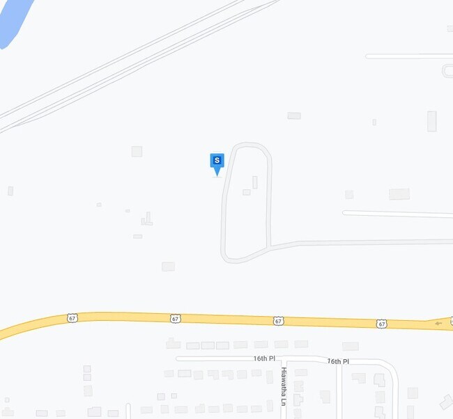
2011 7Th Ave, Camanche, IA 52730

Property Detail
2011 7Th Ave
10-1908-0000
28-81-6 PRT N 1/2 NE & 21-81-6 PRT S 1/2 SE PARCELS B , C , D , E & F AS SHOWN ON PLAT OF SURVEY 2023-00632
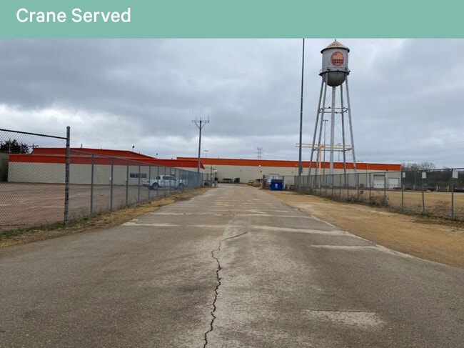
Officebuilding
Clinton
AE The base floodplain where base flood elevations are provided. AE Zones are now used on new format FIRMs instead of A1-A30 Zones.
Iowa
2025
83.75 AC
2025
Iowa Southeast Area
000800
Other Market Areas
8,568 SF
Clinton, IA
NEARBY LISTINGS FOR SALE OR LEASE
-
-
View all Camanche listings for lease on LoopNet.com
DEMOGRAPHICS near 2011 7Th Ave
1 mile
3 mile
5 mile
2025 Total Population
2,607
8,740
23,097
2030 Population
2,578
8,702
23,135
Pop Growth 2025-2030
(1.11%)
(0.43%)
+ 0.16%
Average Age
43
43
42
2025 Total Households
1,133
3,761
9,952
HH Growth 2025-2030
(1.06%)
(0.51%)
+ 0.17%
Median Household Inc
$70,536
$67,867
$58,011
Avg Household Size
2.30
2.30
2.20
2025 Avg HH Vehicles
2.00
2.00
2.00
Median Home Value
$186,373
$166,888
$143,011
Median Year Built
1975
1971
1959
Nearby Places
Map Layers
Map Styles
 Street
 Aerial
Layers
 Traffic
 Biking
Places
Listings with unknown addresses are not visible on the map
- Restaurants
- Banks
- Shops
- Fitness
- Groceries
PUBLIC TRANSPORTATION
AIRPORT
Quad Cities International
Drive
Walk
Distance
Quad Cities International
58 min
41.1 mi
Freight Ports
Port Milwaukee
Drive
Walk
Distance
Port Milwaukee
226 min
188.4 mi
SALE & LEASE HISTORY
LISTING DATE
SALE/LEASE

Jun 10, 2022
For Sale
Jan 09, 2023
For Lease
Nearby Properties
Address
Land Use
TOTAL SIZE
Lot Size
Zoning
Address
Land Use
TOTAL SIZE
Lot Size
Zoning
27,616 SF
93.19 AC
Address
Land Use
TOTAL SIZE
Lot Size
Zoning
57.49 AC
Address
Land Use
TOTAL SIZE
Lot Size
Zoning
6,900 SF
22.90 AC
Address
Land Use
TOTAL SIZE
Lot Size
Zoning
288 SF
73.70 AC
Address
Land Use
TOTAL SIZE
Lot Size
Zoning
27,943 SF
22.53 AC
Address
Land Use
TOTAL SIZE
Lot Size
Zoning
200,102 SF
20.14 AC
Address
Land Use
TOTAL SIZE
Lot Size
Zoning
33,000 SF
60.78 AC
Address
Land Use
TOTAL SIZE
Lot Size
Zoning
7,344 SF
75.50 AC
Address
Land Use
TOTAL SIZE
Lot Size
Zoning
9,028 SF
9.36 AC
Address
Land Use
TOTAL SIZE
Lot Size
Zoning
392,800 SF
31.40 AC
Address
Land Use
TOTAL SIZE
Lot Size
Zoning
105,050 SF
10.43 AC
Address
Land Use
TOTAL SIZE
Lot Size
Zoning
480 SF
29.74 AC
Address
Land Use
TOTAL SIZE
Lot Size
Zoning
Address
Land Use
TOTAL SIZE
Lot Size
Zoning
92,418 SF
5.65 AC
Address
Land Use
TOTAL SIZE
Lot Size
Zoning
62,262 SF
11.09 AC
Address
Land Use
TOTAL SIZE
Lot Size
Zoning
10,085 SF
6.82 AC
Address
Land Use
TOTAL SIZE
Lot Size
Zoning
45,275 SF
1.92 AC
Address
Land Use
TOTAL SIZE
Lot Size
Zoning
91,012 SF
8.10 AC
Address
Land Use
TOTAL SIZE
Lot Size
Zoning
2,100 SF
35.85 AC
Address
Land Use
TOTAL SIZE
Lot Size
Zoning
50,436 SF
3.11 AC
Address
Land Use
TOTAL SIZE
Lot Size
Zoning
3,000 SF
Address
Land Use
TOTAL SIZE
Lot Size
Zoning
912 SF
8.78 AC
Address
Land Use
TOTAL SIZE
Lot Size
Zoning
50,276 SF
1.19 AC
Address
Land Use
TOTAL SIZE
Lot Size
Zoning
1,200 SF
13.09 AC
Address
Land Use
TOTAL SIZE
Lot Size
Zoning
Address
Land Use
TOTAL SIZE
Lot Size
Zoning
40,846 SF
5.27 AC
Address
Land Use
TOTAL SIZE
Lot Size
Zoning
30,000 SF
6.73 AC
The World's #1 Commercial Real Estate Marketplace
Connect with us
© 2026 CoStar Group
The information above has been obtained from sources believed reliable. While we do not doubt its accuracy we have not verified it and make no guarantee, warranty or representation about it. It is your responsibility to independently confirm its accuracy and completeness. Any projections, opinions, assumptions, or estimates used are for example only and do not represent the current or future performance of the property. The value of this transaction to you depends on tax and other factors which should be evaluated by your tax, financial, and legal advisors. You and your advisors should conduct a careful, independent investigation of the property to determine to your satisfaction the suitability of the property for your needs.