Property Record
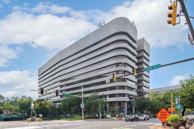
2011 Crystal Dr, Arlington, VA 22202


Current Lease Availabilities
Property Detail
2011 Crystal Dr
34-020-233
PARCEL 5 CRYSTAL PARK SITE OF OFFICE BLDG # 1 1ST CRYSTAL PARK LEASE 137,272 SQ FT
Officebuilding
Arlington
C-O-1.5
Virginia
B and X Area of moderate flood hazard, usually the area between the limits of the 100-year and 500-year floods.
233
2025
3.15 AC
2025
Crystal City
103404
Washington, DC
467,500 SF
Washington-Arlington-Alexandria, DC-VA-MD-WV
NEARBY LISTINGS FOR SALE OR LEASE
DEMOGRAPHICS near 2011 Crystal Dr
1 mile
3 mile
5 mile
2025 Total Population
27,064
209,734
797,003
2030 Population
28,295
220,185
836,825
Pop Growth 2025-2030
+ 4.55%
+ 4.98%
+ 5.00%
Average Age
38
37
38
2025 Total Households
15,400
103,593
384,809
HH Growth 2025-2030
+ 4.86%
+ 5.61%
+ 5.56%
Median Household Inc
$135,210
$124,204
$118,259
Avg Household Size
1.70
1.90
2.00
2025 Avg HH Vehicles
1.00
1.00
1.00
Median Home Value
$881,666
$704,970
$516,761
Median Year Built
1995
1979
1971
Nearby Places
Map Layers
Map Styles
 Street
 Aerial
Transit
 Traffic
 Biking
Places
Listings with unknown addresses are not visible on the map
- Restaurants
- Banks
- Shops
- Fitness
- Groceries
PUBLIC TRANSPORTATION
TRANSIT/SUBWAY
Crystal City (Blue Line - Washington Metropolitan Area Transit Authority Metrorail (Metrorail), Yellow Line - Washington Metropolitan Area Transit Authority Metrorail (Metrorail))
Drive
Walk
Distance
Crystal City (Blue Line - Washington Metropolitan Area Transit Authority Metrorail (Metrorail), Yellow Line - Washington Metropolitan Area Transit Authority Metrorail (Metrorail))
1 min
5 min
0.3 mi
Pentagon City (Blue Line - Washington Metropolitan Area Transit Authority Metrorail (Metrorail), Yellow Line - Washington Metropolitan Area Transit Authority Metrorail (Metrorail))
Drive
Walk
Distance
Pentagon City (Blue Line - Washington Metropolitan Area Transit Authority Metrorail (Metrorail), Yellow Line - Washington Metropolitan Area Transit Authority Metrorail (Metrorail))
2 min
19 min
1.0 mi
COMMUTER RAIL
4 (Fredericksburg Line - Virginia Railway Express, Manassas Line - Virginia Railway Express)
Drive
Walk
Distance
4 (Fredericksburg Line - Virginia Railway Express, Manassas Line - Virginia Railway Express)
5 min
3.2 mi
Alexandria (Fredericksburg Line - Virginia Railway Express, Manassas Line - Virginia Railway Express)
Drive
Walk
Distance
Alexandria (Fredericksburg Line - Virginia Railway Express, Manassas Line - Virginia Railway Express)
11 min
4.1 mi
AIRPORT
Ronald Reagan Washington Ntl
Drive
Walk
Distance
Ronald Reagan Washington Ntl
4 min
1.6 mi
Washington Dulles International
Drive
Walk
Distance
Washington Dulles International
44 min
28.2 mi
Freight Ports
Port of Baltimore
Drive
Walk
Distance
Port of Baltimore
62 min
42.5 mi
Nearby Properties
Address
Land Use
TOTAL SIZE
Lot Size
Zoning
Address
Land Use
TOTAL SIZE
Lot Size
Zoning
900,000 SF
11.10 AC
S-3A
Address
Land Use
TOTAL SIZE
Lot Size
Zoning
2,052,109 SF
90.60 AC
UNZONED
Address
Land Use
TOTAL SIZE
Lot Size
Zoning
128,439 SF
373.22 AC
UNZONED
Address
Land Use
TOTAL SIZE
Lot Size
Zoning
533,778 SF
18.08 AC
UNZONED
Address
Land Use
TOTAL SIZE
Lot Size
Zoning
1,517,010 SF
70.25 AC
UNZONED
Address
Land Use
TOTAL SIZE
Lot Size
Zoning
2,493,936 SF
8.99 AC
UNZONED
Address
Land Use
TOTAL SIZE
Lot Size
Zoning
3.71 AC
UNZONED
Address
Land Use
TOTAL SIZE
Lot Size
Zoning
19.46 AC
CG-4
Address
Land Use
TOTAL SIZE
Lot Size
Zoning
3,750,395 SF
10.82 AC
UNZONED
Address
Land Use
TOTAL SIZE
Lot Size
Zoning
1,530,865 SF
6.05 AC
D-6;UNZONE
Address
Land Use
TOTAL SIZE
Lot Size
Zoning
6,500,000 SF
92.03 AC
S-3A
Address
Land Use
TOTAL SIZE
Lot Size
Zoning
2,369,428 SF
7.93 AC
MU-10;SEFC
Address
Land Use
TOTAL SIZE
Lot Size
Zoning
2,455,000 SF
11.08 AC
MU-2
Address
Land Use
TOTAL SIZE
Lot Size
Zoning
52.44 AC
UNZONED
Address
Land Use
TOTAL SIZE
Lot Size
Zoning
1,336,013 SF
5.41 AC
D-5
Address
Land Use
TOTAL SIZE
Lot Size
Zoning
1,081,367 SF
6.46 AC
UNZONED
Address
Land Use
TOTAL SIZE
Lot Size
Zoning
1,719,751 SF
39.48 AC
PDR-3;UNZO
Address
Land Use
TOTAL SIZE
Lot Size
Zoning
782,765 SF
94.06 AC
CG-5;CG-6;
Address
Land Use
TOTAL SIZE
Lot Size
Zoning
4.95 AC
UNZONED
Address
Land Use
TOTAL SIZE
Lot Size
Zoning
1,375,218 SF
3.55 AC
D-4
Address
Land Use
TOTAL SIZE
Lot Size
Zoning
900,000 SF
260 AC
S-3A
Address
Land Use
TOTAL SIZE
Lot Size
Zoning
437,938 SF
11.28 AC
CG-4
Address
Land Use
TOTAL SIZE
Lot Size
Zoning
4,000,000 SF
352.96 AC
UNZONED
Address
Land Use
TOTAL SIZE
Lot Size
Zoning
5.26 AC
UNZONED
Address
Land Use
TOTAL SIZE
Lot Size
Zoning
1,386,522 SF
5.17 AC
D-8
Address
Land Use
TOTAL SIZE
Lot Size
Zoning
930,547 SF
1.90 AC
D-5
Address
Land Use
TOTAL SIZE
Lot Size
Zoning
1,796,880 SF
5.49 AC
D-4
Address
Land Use
TOTAL SIZE
Lot Size
Zoning
471,810 SF
1.03 AC
D-7
The World's #1 Commercial Real Estate Marketplace
Connect with us
© 2026 CoStar Group
The information above has been obtained from sources believed reliable. While we do not doubt its accuracy we have not verified it and make no guarantee, warranty or representation about it. It is your responsibility to independently confirm its accuracy and completeness. Any projections, opinions, assumptions, or estimates used are for example only and do not represent the current or future performance of the property. The value of this transaction to you depends on tax and other factors which should be evaluated by your tax, financial, and legal advisors. You and your advisors should conduct a careful, independent investigation of the property to determine to your satisfaction the suitability of the property for your needs.