Property Record
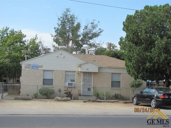
2011 Flower St, Bakersfield, CA 93305


Property Detail
2011 Flower St
138-021-05-00-2
TRACT 1073 , BLOCK 375, LOT 5&6
Multifamilydwelling
Kern
R-3
California
B and X Area of moderate flood hazard, usually the area between the limits of the 100-year and 500-year floods.
5,6
2024
0.39 AC
2025
East Bakersfield
001202
Bakersfield
1,532 SF
Bakersfield-Delano, CA
NEARBY LISTINGS FOR SALE OR LEASE
DEMOGRAPHICS near 2011 Flower St
1 mile
3 mile
5 mile
2025 Total Population
23,683
139,677
242,408
2030 Population
23,766
141,220
245,361
Pop Growth 2025-2030
+ 0.35%
+ 1.10%
+ 1.22%
Average Age
33
34
34
2025 Total Households
6,773
41,890
75,395
HH Growth 2025-2030
+ 0.49%
+ 1.17%
+ 1.26%
Median Household Inc
$39,978
$47,884
$52,458
Avg Household Size
3.40
3.20
3.10
2025 Avg HH Vehicles
2.00
2.00
2.00
Median Home Value
$250,096
$277,108
$279,604
Median Year Built
1961
1969
1968
Nearby Places
Map Layers
Map Styles
 Street
 Aerial
Layers
 Traffic
 Biking
Places
Listings with unknown addresses are not visible on the map
- Restaurants
- Banks
- Shops
- Fitness
- Groceries
PUBLIC TRANSPORTATION
COMMUTER RAIL
Drive
Walk
Distance
7 min
3.1 mi
AIRPORT
Meadows Field
Drive
Walk
Distance
Meadows Field
19 min
8.6 mi
SALE & LEASE HISTORY
LISTING DATE
SALE/LEASE

Sep 24, 2016
For Sale
Jun 21, 2017
For Sale
Nearby Properties
Address
Land Use
TOTAL SIZE
Lot Size
Zoning
Address
Land Use
TOTAL SIZE
Lot Size
Zoning
18,000 SF
35.01 AC
M-2
Address
Land Use
TOTAL SIZE
Lot Size
Zoning
402,037 SF
17.72 AC
R1
Address
Land Use
TOTAL SIZE
Lot Size
Zoning
104,693 SF
2.09 AC
HOSP
Address
Land Use
TOTAL SIZE
Lot Size
Zoning
59,242 SF
3.01 AC
C2
Address
Land Use
TOTAL SIZE
Lot Size
Zoning
1.38 AC
C-2
Address
Land Use
TOTAL SIZE
Lot Size
Zoning
16.64 AC
Address
Land Use
TOTAL SIZE
Lot Size
Zoning
825 SF
9.60 AC
M-3
Address
Land Use
TOTAL SIZE
Lot Size
Zoning
188,976 SF
4.92 AC
Address
Land Use
TOTAL SIZE
Lot Size
Zoning
87,389 SF
1.76 AC
M1
Address
Land Use
TOTAL SIZE
Lot Size
Zoning
112,052 SF
3.14 AC
R3
Address
Land Use
TOTAL SIZE
Lot Size
Zoning
66,139 SF
4.48 AC
CO
Address
Land Use
TOTAL SIZE
Lot Size
Zoning
161,946 SF
17.84 AC
C2 PD
Address
Land Use
TOTAL SIZE
Lot Size
Zoning
78,140 SF
2.52 AC
CC
Address
Land Use
TOTAL SIZE
Lot Size
Zoning
105,513 SF
1.60 AC
C-B
Address
Land Use
TOTAL SIZE
Lot Size
Zoning
79,987 SF
3.22 AC
SP
Address
Land Use
TOTAL SIZE
Lot Size
Zoning
103,536 SF
6.31 AC
R-3
Address
Land Use
TOTAL SIZE
Lot Size
Zoning
102,262 SF
3.93 AC
Address
Land Use
TOTAL SIZE
Lot Size
Zoning
10.31 AC
Address
Land Use
TOTAL SIZE
Lot Size
Zoning
0.96 AC
Address
Land Use
TOTAL SIZE
Lot Size
Zoning
141,662 SF
9.39 AC
R-2
Address
Land Use
TOTAL SIZE
Lot Size
Zoning
2.14 AC
C2
Address
Land Use
TOTAL SIZE
Lot Size
Zoning
127,224 SF
7 AC
R-2/PUD
Address
Land Use
TOTAL SIZE
Lot Size
Zoning
127,504 SF
1.46 AC
CB
Address
Land Use
TOTAL SIZE
Lot Size
Zoning
43,124 SF
0.44 AC
C2
Address
Land Use
TOTAL SIZE
Lot Size
Zoning
17,567 SF
19.39 AC
M2
Address
Land Use
TOTAL SIZE
Lot Size
Zoning
137,900 SF
15.69 AC
C2
Address
Land Use
TOTAL SIZE
Lot Size
Zoning
19,350 SF
2.05 AC
Address
Land Use
TOTAL SIZE
Lot Size
Zoning
115,058 SF
13.02 AC
C2
Address
Land Use
TOTAL SIZE
Lot Size
Zoning
1.50 AC
Address
Land Use
TOTAL SIZE
Lot Size
Zoning
1.06 AC
R-1
The World's #1 Commercial Real Estate Marketplace
Connect with us
© 2026 CoStar Group
The information above has been obtained from sources believed reliable. While we do not doubt its accuracy we have not verified it and make no guarantee, warranty or representation about it. It is your responsibility to independently confirm its accuracy and completeness. Any projections, opinions, assumptions, or estimates used are for example only and do not represent the current or future performance of the property. The value of this transaction to you depends on tax and other factors which should be evaluated by your tax, financial, and legal advisors. You and your advisors should conduct a careful, independent investigation of the property to determine to your satisfaction the suitability of the property for your needs.