Property Record
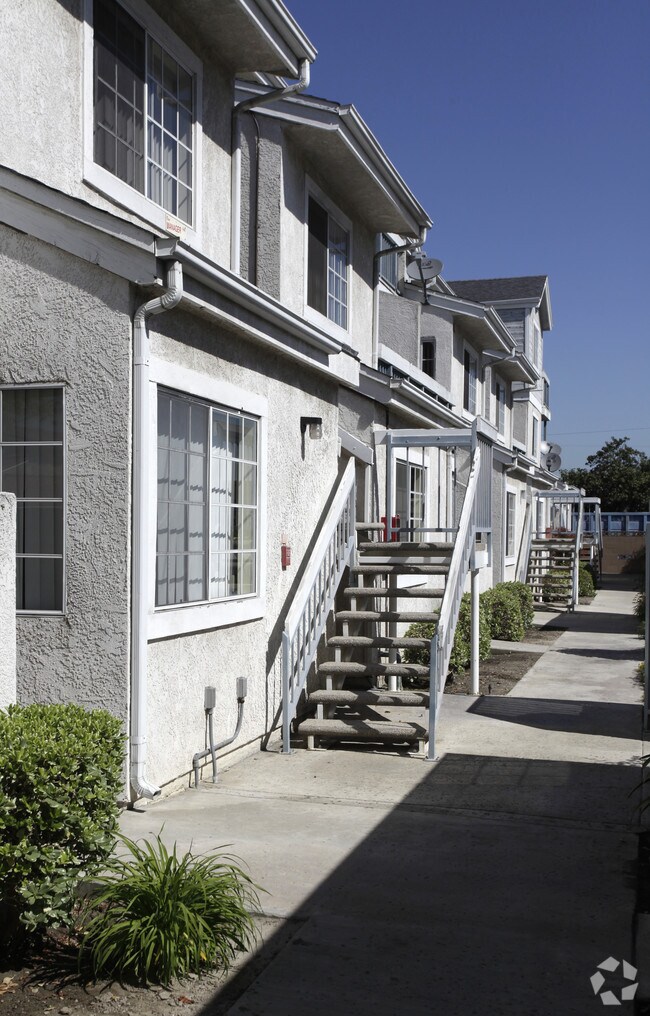
2011 W Ball Rd, Anaheim, CA 92804


NEARBY LISTINGS FOR SALE OR LEASE
Property Detail
2011 W Ball Rd
Anaheim-Santa Ana-Irvine, CA
Rancho Los Coyotes
128-314-26
S TWP 4 RGE 10 SEC 17 SEC 17 T 4 R 10 E POR OF SE1/4,SW1/4
Multifamilydwelling
Orange
X
California
06059C0129J
0.80 AC
2024
South Anaheim
2025
Orange County (California)
087701
DEMOGRAPHICS near 2011 W Ball Rd
1 Mile
3 Mile
5 Mile
2024 Total Population
33,866
293,306
731,662
2029 Population
33,428
290,143
723,061
Pop Growth 2024-2029
(1.29%)
(1.08%)
(1.18%)
Average Age
38
38
39
2024 Total Households
9,762
83,264
212,600
HH Growth 2024-2029
(1.57%)
(1.22%)
(1.29%)
Median Household Inc
$75,723
$75,460
$79,531
Avg Household Size
3.30
3.30
3.30
2024 Avg HH Vehicles
2.00
2.00
2.00
Median Home Value
$724,698
$689,647
$699,668
Median Year Built
1963
1965
1967
Nearby Places
Map Layers
Map Styles
 Street
 Aerial
- Restaurants
- Banks
- Shops
- Fitness
- Groceries
PUBLIC TRANSPORTATION
COMMUTER RAIL
Fullerton (91 Line - Southern California Regional Rail Authority (Metrolink), Orange County Line - Southern California Regional Rail Authority (Metrolink))
DRIVE
WALK
Distance
Fullerton (91 Line - Southern California Regional Rail Authority (Metrolink), Orange County Line - Southern California Regional Rail Authority (Metrolink))
11 min
5.3 mi
Anaheim-Artic Metrolink Station (Metrolink Orange County Line - Metrolink Trains)
DRIVE
WALK
Distance
Anaheim-Artic Metrolink Station (Metrolink Orange County Line - Metrolink Trains)
10 min
5.7 mi
AIRPORT
Long Beach (Daugherty Field)
DRIVE
WALK
Distance
Long Beach (Daugherty Field)
23 min
14.5 mi
John Wayne/Orange County
DRIVE
WALK
Distance
John Wayne/Orange County
20 min
15.2 mi
Ontario International
DRIVE
WALK
Distance
Ontario International
46 min
34.7 mi
Freight Ports
Port of Long Beach
DRIVE
WALK
Distance
Port of Long Beach
29 min
17.1 mi
Nearby Properties
Address
Land Use
TOTAL SIZE
Lot Size
Zoning
Address
Land Use
TOTAL SIZE
Lot Size
Zoning
24.50 AC
Address
Land Use
TOTAL SIZE
Lot Size
Zoning
16.07 AC
Address
Land Use
TOTAL SIZE
Lot Size
Zoning
Address
Land Use
TOTAL SIZE
Lot Size
Zoning
615,528 SF
17.93 AC
Address
Land Use
TOTAL SIZE
Lot Size
Zoning
2.86 AC
Address
Land Use
TOTAL SIZE
Lot Size
Zoning
6.45 AC
Address
Land Use
TOTAL SIZE
Lot Size
Zoning
860 SF
13 AC
Address
Land Use
TOTAL SIZE
Lot Size
Zoning
Address
Land Use
TOTAL SIZE
Lot Size
Zoning
Address
Land Use
TOTAL SIZE
Lot Size
Zoning
2.17 AC
Address
Land Use
TOTAL SIZE
Lot Size
Zoning
52.51 AC
Address
Land Use
TOTAL SIZE
Lot Size
Zoning
8.80 AC
Address
Land Use
TOTAL SIZE
Lot Size
Zoning
7,939 SF
9.37 AC
Address
Land Use
TOTAL SIZE
Lot Size
Zoning
9.36 AC
Address
Land Use
TOTAL SIZE
Lot Size
Zoning
9.28 AC
Address
Land Use
TOTAL SIZE
Lot Size
Zoning
4.29 AC
Address
Land Use
TOTAL SIZE
Lot Size
Zoning
Address
Land Use
TOTAL SIZE
Lot Size
Zoning
10.90 AC
Address
Land Use
TOTAL SIZE
Lot Size
Zoning
3.43 AC
Address
Land Use
TOTAL SIZE
Lot Size
Zoning
0.37 AC
Address
Land Use
TOTAL SIZE
Lot Size
Zoning
Address
Land Use
TOTAL SIZE
Lot Size
Zoning
3.19 AC
Address
Land Use
TOTAL SIZE
Lot Size
Zoning
Address
Land Use
TOTAL SIZE
Lot Size
Zoning
215,384 SF
8.82 AC
Address
Land Use
TOTAL SIZE
Lot Size
Zoning
5.92 AC
Address
Land Use
TOTAL SIZE
Lot Size
Zoning
10.83 AC
Address
Land Use
TOTAL SIZE
Lot Size
Zoning
25.81 AC
Address
Land Use
TOTAL SIZE
Lot Size
Zoning
2.24 AC
Address
Land Use
TOTAL SIZE
Lot Size
Zoning
46.74 AC
Address
Land Use
TOTAL SIZE
Lot Size
Zoning
5.10 AC
The World's #1 Commercial Real Estate Marketplace
Connect with us
© 2026 CoStar Group
The information above has been obtained from sources believed reliable. While we do not doubt its accuracy we have not verified it and make no guarantee, warranty or representation about it. It is your responsibility to independently confirm its accuracy and completeness. Any projections, opinions, assumptions, or estimates used are for example only and do not represent the current or future performance of the property. The value of this transaction to you depends on tax and other factors which should be evaluated by your tax, financial, and legal advisors. You and your advisors should conduct a careful, independent investigation of the property to determine to your satisfaction the suitability of the property for your needs.