Property Record
2012 Last St, Statham, GA 30666

This Property Is For Sale
Current Lease Availabilities
NEARBY LISTINGS FOR SALE OR LEASE
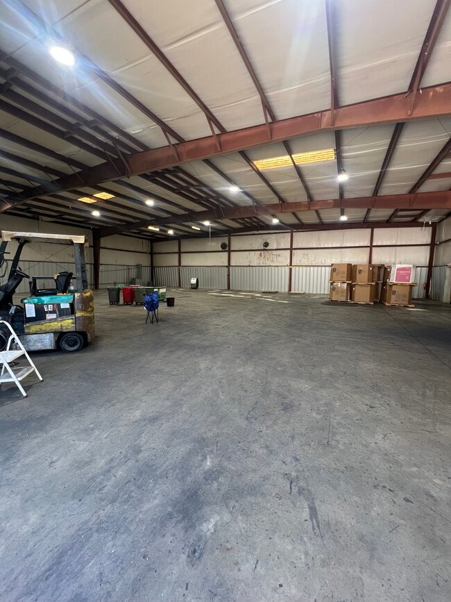
Property Detail
2012 Last St
Atlanta-Sandy Springs-Roswell, GA
Wynfield Unit 1
ST06A-001F
Barrow
Warehouse
Georgia
X
0.50 AC
13013C0155D
S Barrow
6,450 SF
Atlanta
DEMOGRAPHICS near 2012 Last St
1 mile
3 mile
5 mile
2024 Total Population
2,284
12,440
27,226
2029 Population
2,695
14,538
31,535
Pop Growth 2024-2029
+ 17.99%
+ 16.86%
+ 15.83%
Average Age
38
39
38
2024 Total Households
815
4,386
9,474
HH Growth 2024-2029
+ 18.28%
+ 17.15%
+ 15.92%
Median Household Inc
$65,702
$71,789
$76,787
Avg Household Size
2.80
2.80
2.80
2024 Avg HH Vehicles
2.00
2.00
2.00
Median Home Value
$208,673
$259,415
$263,164
Median Year Built
2003
2004
2003
Nearby Places
Map Layers
Map Styles
 Street
 Aerial
Transit
 Traffic
 Biking
Places
Listings with unknown addresses are not visible on the map
- Restaurants
- Banks
- Shops
- Fitness
- Groceries
Nearby Properties
Address
Land Use
TOTAL SIZE
Lot Size
Zoning
Address
Land Use
TOTAL SIZE
Lot Size
Zoning
87,278 SF
43.43 AC
A-1
Address
Land Use
TOTAL SIZE
Lot Size
Zoning
398,490 SF
56.68 AC
M-1
Address
Land Use
TOTAL SIZE
Lot Size
Zoning
Address
Land Use
TOTAL SIZE
Lot Size
Zoning
160,000 SF
29.44 AC
O-I
Address
Land Use
TOTAL SIZE
Lot Size
Zoning
30,056 SF
311.73 AC
R-2
Address
Land Use
TOTAL SIZE
Lot Size
Zoning
224,093 SF
17.12 AC
LI
Address
Land Use
TOTAL SIZE
Lot Size
Zoning
12,032 SF
6.30 AC
MFR
Address
Land Use
TOTAL SIZE
Lot Size
Zoning
33,704 SF
14.25 AC
O-I
Address
Land Use
TOTAL SIZE
Lot Size
Zoning
41,916 SF
16.11 AC
LI
Address
Land Use
TOTAL SIZE
Lot Size
Zoning
2,800 SF
5.32 AC
O-I
Address
Land Use
TOTAL SIZE
Lot Size
Zoning
8,584 SF
2.69 AC
R-1-MPD
Address
Land Use
TOTAL SIZE
Lot Size
Zoning
25,044 SF
9.01 AC
M-1
Address
Land Use
TOTAL SIZE
Lot Size
Zoning
199.34 AC
AG
Address
Land Use
TOTAL SIZE
Lot Size
Zoning
24,222 SF
3.81 AC
O-I
Address
Land Use
TOTAL SIZE
Lot Size
Zoning
5,364 SF
5 AC
AG
Address
Land Use
TOTAL SIZE
Lot Size
Zoning
82,500 SF
10.27 AC
001
Address
Land Use
TOTAL SIZE
Lot Size
Zoning
7,783 SF
2.78 AC
A-1
Address
Land Use
TOTAL SIZE
Lot Size
Zoning
6,454 SF
1.05 AC
R-1-MPD
Address
Land Use
TOTAL SIZE
Lot Size
Zoning
6,857 SF
4.04 AC
AR-3
Address
Land Use
TOTAL SIZE
Lot Size
Zoning
5,883 SF
0.86 AC
R-1-MPD
Address
Land Use
TOTAL SIZE
Lot Size
Zoning
9,811 SF
11.40 AC
AG
Address
Land Use
TOTAL SIZE
Lot Size
Zoning
7,162 SF
1.08 AC
Address
Land Use
TOTAL SIZE
Lot Size
Zoning
5,510 SF
1.97 AC
R-1-MPD
Address
Land Use
TOTAL SIZE
Lot Size
Zoning
20,891 SF
3.10 AC
HB
Address
Land Use
TOTAL SIZE
Lot Size
Zoning
1,248 SF
102.90 AC
AG
Address
Land Use
TOTAL SIZE
Lot Size
Zoning
5,771 SF
1.22 AC
R-1-MPD
Address
Land Use
TOTAL SIZE
Lot Size
Zoning
1,421 SF
6.09 AC
R-2
Address
Land Use
TOTAL SIZE
Lot Size
Zoning
6,063 SF
3.78 AC
AR-3
Address
Land Use
TOTAL SIZE
Lot Size
Zoning
4,441 SF
1.10 AC
R-1-MPD
Address
Land Use
TOTAL SIZE
Lot Size
Zoning
5,506 SF
0.98 AC
R-1-MPD
The World's #1 Commercial Real Estate Marketplace
Connect with us
© 2026 CoStar Group
The information above has been obtained from sources believed reliable. While we do not doubt its accuracy we have not verified it and make no guarantee, warranty or representation about it. It is your responsibility to independently confirm its accuracy and completeness. Any projections, opinions, assumptions, or estimates used are for example only and do not represent the current or future performance of the property. The value of this transaction to you depends on tax and other factors which should be evaluated by your tax, financial, and legal advisors. You and your advisors should conduct a careful, independent investigation of the property to determine to your satisfaction the suitability of the property for your needs.