Property Record
2018 Skyline Blvd, Cape Coral, FL 33991


NEARBY LISTINGS FOR SALE OR LEASE
Property Detail
2018 Skyline Blvd
Cape Coral-Fort Myers, FL
Cape Coral
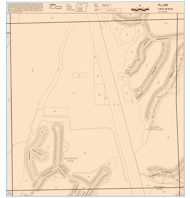
27-44-23-C3-04385.0300
CAPE CORAL UNIT 63 BLK 4385 PB 21 PG 56 LOTS 30 THRU 32 + VAC OF ALLEY INST 2020000047821
Residentialacreage
Lee
X
Florida
12071C0401G
30-32
2024
0.40 AC
2025
Cape Coral
010419
Southwest Florida
DEMOGRAPHICS near 2018 Skyline Blvd
1 Mile
3 Mile
5 Mile
2024 Total Population
8,067
79,166
175,375
2029 Population
9,478
93,684
208,547
Pop Growth 2024-2029
+ 17.49%
+ 18.34%
+ 18.91%
Average Age
40
43
45
2024 Total Households
2,918
29,937
69,724
HH Growth 2024-2029
+ 17.07%
+ 17.82%
+ 18.47%
Median Household Inc
$66,975
$67,866
$67,414
Avg Household Size
2.70
2.60
2.40
2024 Avg HH Vehicles
2.00
2.00
2.00
Median Home Value
$263,870
$279,078
$294,253
Median Year Built
1997
1999
1996
Nearby Places
Map Layers
Map Styles
 Street
 Aerial
- Restaurants
- Banks
- Shops
- Fitness
- Groceries
PUBLIC TRANSPORTATION
AIRPORT
Southwest Florida International
DRIVE
WALK
Distance
Southwest Florida International
34 min
20.8 mi
Punta Gorda
DRIVE
WALK
Distance
Punta Gorda
42 min
27.9 mi
SALE & LEASE HISTORY
LISTING DATE
SALE/LEASE

Nov 21, 2023
For Sale
Nearby Properties
Address
Land Use
TOTAL SIZE
Lot Size
Zoning
Address
Land Use
TOTAL SIZE
Lot Size
Zoning
441,999 SF
19.96 AC
R-3
Address
Land Use
TOTAL SIZE
Lot Size
Zoning
476,419 SF
36.49 AC
C1
Address
Land Use
TOTAL SIZE
Lot Size
Zoning
263,280 SF
19.99 AC
RML
Address
Land Use
TOTAL SIZE
Lot Size
Zoning
25.99 AC
RML
Address
Land Use
TOTAL SIZE
Lot Size
Zoning
340,032 SF
30.58 AC
R1-A
Address
Land Use
TOTAL SIZE
Lot Size
Zoning
231,454 SF
14.53 AC
CC
Address
Land Use
TOTAL SIZE
Lot Size
Zoning
300,366 SF
10.61 AC
RPUD
Address
Land Use
TOTAL SIZE
Lot Size
Zoning
96,539 SF
74.71 AC
INST
Address
Land Use
TOTAL SIZE
Lot Size
Zoning
7.82 AC
CORR
Address
Land Use
TOTAL SIZE
Lot Size
Zoning
212,112 SF
33.92 AC
RD-D
Address
Land Use
TOTAL SIZE
Lot Size
Zoning
264,848 SF
10.36 AC
CORR
Address
Land Use
TOTAL SIZE
Lot Size
Zoning
4.89 AC
C-1
Address
Land Use
TOTAL SIZE
Lot Size
Zoning
282,066 SF
39.45 AC
INS
Address
Land Use
TOTAL SIZE
Lot Size
Zoning
239,211 SF
56.31 AC
INST
Address
Land Use
TOTAL SIZE
Lot Size
Zoning
101,204 SF
12.34 AC
P1-D
Address
Land Use
TOTAL SIZE
Lot Size
Zoning
27.77 AC
RML
Address
Land Use
TOTAL SIZE
Lot Size
Zoning
158,176 SF
20 AC
R-1
Address
Land Use
TOTAL SIZE
Lot Size
Zoning
144,607 SF
20 AC
INS
Address
Land Use
TOTAL SIZE
Lot Size
Zoning
149,829 SF
5.70 AC
R-3
Address
Land Use
TOTAL SIZE
Lot Size
Zoning
101,999 SF
7.17 AC
P-1
Address
Land Use
TOTAL SIZE
Lot Size
Zoning
135,838 SF
40 AC
R-1
Address
Land Use
TOTAL SIZE
Lot Size
Zoning
153,651 SF
17.17 AC
R1-B
Address
Land Use
TOTAL SIZE
Lot Size
Zoning
123,133 SF
8.26 AC
C
Address
Land Use
TOTAL SIZE
Lot Size
Zoning
147,599 SF
5.72 AC
RML
Address
Land Use
TOTAL SIZE
Lot Size
Zoning
142,379 SF
3.27 AC
Address
Land Use
TOTAL SIZE
Lot Size
Zoning
62,119 SF
6.50 AC
CORR
Address
Land Use
TOTAL SIZE
Lot Size
Zoning
101,110 SF
8.67 AC
VILL
Address
Land Use
TOTAL SIZE
Lot Size
Zoning
78,298 SF
12.73 AC
CORR
Address
Land Use
TOTAL SIZE
Lot Size
Zoning
28,560 SF
5.08 AC
P1-W
Address
Land Use
TOTAL SIZE
Lot Size
Zoning
102,818 SF
8.60 AC
CORR
The World's #1 Commercial Real Estate Marketplace
Connect with us
© 2026 CoStar Group
The information above has been obtained from sources believed reliable. While we do not doubt its accuracy we have not verified it and make no guarantee, warranty or representation about it. It is your responsibility to independently confirm its accuracy and completeness. Any projections, opinions, assumptions, or estimates used are for example only and do not represent the current or future performance of the property. The value of this transaction to you depends on tax and other factors which should be evaluated by your tax, financial, and legal advisors. You and your advisors should conduct a careful, independent investigation of the property to determine to your satisfaction the suitability of the property for your needs.