Property Record
20125 W 185Th Ter, Spring Hill, KS 66083

Property Detail
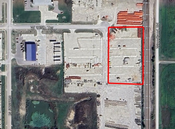
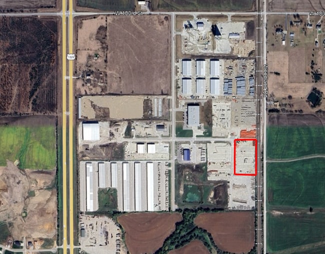
20125 W 185Th Ter
Kansas City, MO-KS
CUMMINS PROPERTY FOURTH PLAT, LOT 1
EP20730000-0001
JOHNSON
Commercialnec
Kansas
R-R
1
2024
11.85 AC
2025
South Johnson County
053801
Kansas City
NEARBY LISTINGS FOR SALE OR LEASE
DEMOGRAPHICS near 20125 W 185Th Ter
1 mile
3 mile
5 mile
2025 Total Population
1,218
9,429
47,090
2030 Population
1,302
9,977
49,196
Pop Growth 2025-2030
+ 6.90%
+ 5.81%
+ 4.47%
Average Age
41
38
38
2025 Total Households
437
3,200
15,621
HH Growth 2025-2030
+ 6.86%
+ 5.97%
+ 4.73%
Median Household Inc
$106,377
$121,786
$119,744
Avg Household Size
2.70
2.90
2.90
2025 Avg HH Vehicles
3.00
2.00
2.00
Median Home Value
$437,096
$427,756
$369,223
Median Year Built
2001
2006
2002
Nearby Places
Map Layers
Map Styles
 Street
 Aerial
Transit
 Traffic
 Biking
Places
Listings with unknown addresses are not visible on the map
- Restaurants
- Banks
- Shops
- Fitness
- Groceries
SALE & LEASE HISTORY
LISTING DATE
SALE/LEASE

Jun 30, 2025
For Lease
Nearby Properties
Address
Land Use
TOTAL SIZE
Lot Size
Zoning
Address
Land Use
TOTAL SIZE
Lot Size
Zoning
1,060,732 SF
57.62 AC
MP-2
Address
Land Use
TOTAL SIZE
Lot Size
Zoning
327,169 SF
141.81 AC
R-R
Address
Land Use
TOTAL SIZE
Lot Size
Zoning
720,320 SF
39.19 AC
MP-2
Address
Land Use
TOTAL SIZE
Lot Size
Zoning
508,664 SF
29.46 AC
MP-2
Address
Land Use
TOTAL SIZE
Lot Size
Zoning
103,102 SF
31.90 AC
R-1
Address
Land Use
TOTAL SIZE
Lot Size
Zoning
102,280 SF
30.53 AC
RP-4
Address
Land Use
TOTAL SIZE
Lot Size
Zoning
70,643 SF
18.45 AC
RP-1
Address
Land Use
TOTAL SIZE
Lot Size
Zoning
320,891 SF
39.07 AC
M-2
Address
Land Use
TOTAL SIZE
Lot Size
Zoning
244,992 SF
15.75 AC
MP-2
Address
Land Use
TOTAL SIZE
Lot Size
Zoning
212,032 SF
9.53 AC
RUR
Address
Land Use
TOTAL SIZE
Lot Size
Zoning
71,221 SF
14.16 AC
Address
Land Use
TOTAL SIZE
Lot Size
Zoning
137,532 SF
12.02 AC
M-2
Address
Land Use
TOTAL SIZE
Lot Size
Zoning
65,691 SF
11.51 AC
RP-1
Address
Land Use
TOTAL SIZE
Lot Size
Zoning
127,880 SF
5.77 AC
M-2
Address
Land Use
TOTAL SIZE
Lot Size
Zoning
688,460 SF
116.12 AC
MP-2
Address
Land Use
TOTAL SIZE
Lot Size
Zoning
601,670 SF
37.16 AC
MP-2
Address
Land Use
TOTAL SIZE
Lot Size
Zoning
24,144 SF
11.10 AC
RP-3
Address
Land Use
TOTAL SIZE
Lot Size
Zoning
446,772 SF
28.49 AC
MP-2
Address
Land Use
TOTAL SIZE
Lot Size
Zoning
436,174 SF
22.56 AC
MP-2
Address
Land Use
TOTAL SIZE
Lot Size
Zoning
483,903 SF
63.47 AC
M-1
Address
Land Use
TOTAL SIZE
Lot Size
Zoning
533,662 SF
24.67 AC
MP-2
Address
Land Use
TOTAL SIZE
Lot Size
Zoning
41,250 SF
6.01 AC
R-R
Address
Land Use
TOTAL SIZE
Lot Size
Zoning
136,176 SF
8.26 AC
RP-3
Address
Land Use
TOTAL SIZE
Lot Size
Zoning
109,026 SF
11.21 AC
M-1
Address
Land Use
TOTAL SIZE
Lot Size
Zoning
92.22 AC
R-1
Address
Land Use
TOTAL SIZE
Lot Size
Zoning
72,000 SF
13.82 AC
R-R
Address
Land Use
TOTAL SIZE
Lot Size
Zoning
10,440 SF
155.35 AC
RP-1
Address
Land Use
TOTAL SIZE
Lot Size
Zoning
14,098 SF
3.06 AC
CTY RUR
Address
Land Use
TOTAL SIZE
Lot Size
Zoning
15,436 SF
2.60 AC
M-1
Address
Land Use
TOTAL SIZE
Lot Size
Zoning
231,750 SF
22.02 AC
M-1
The World's #1 Commercial Real Estate Marketplace
Connect with us
© 2026 CoStar Group
The information above has been obtained from sources believed reliable. While we do not doubt its accuracy we have not verified it and make no guarantee, warranty or representation about it. It is your responsibility to independently confirm its accuracy and completeness. Any projections, opinions, assumptions, or estimates used are for example only and do not represent the current or future performance of the property. The value of this transaction to you depends on tax and other factors which should be evaluated by your tax, financial, and legal advisors. You and your advisors should conduct a careful, independent investigation of the property to determine to your satisfaction the suitability of the property for your needs.