Property Record
2013 Eastside 2Nd St, Sheridan, WY 82801
NEARBY LISTINGS FOR SALE OR LEASE
-
-
View all Sheridan listings for sale on LoopNet.com
Property Detail
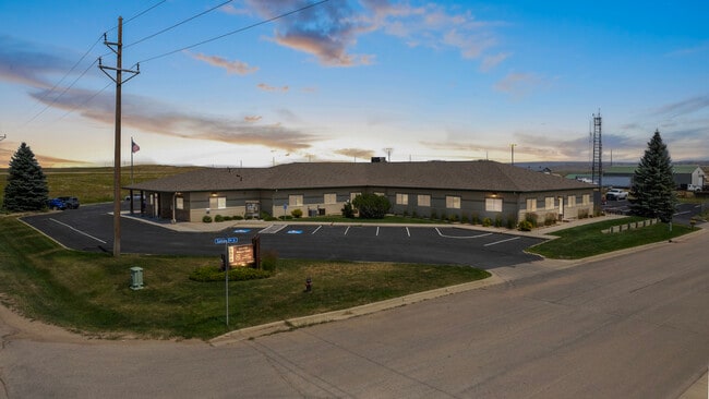
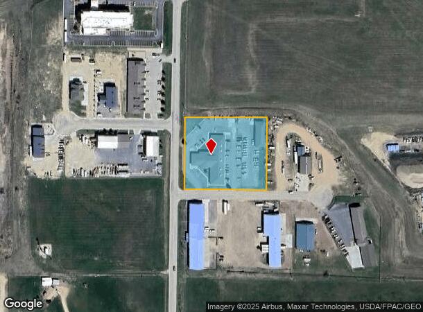
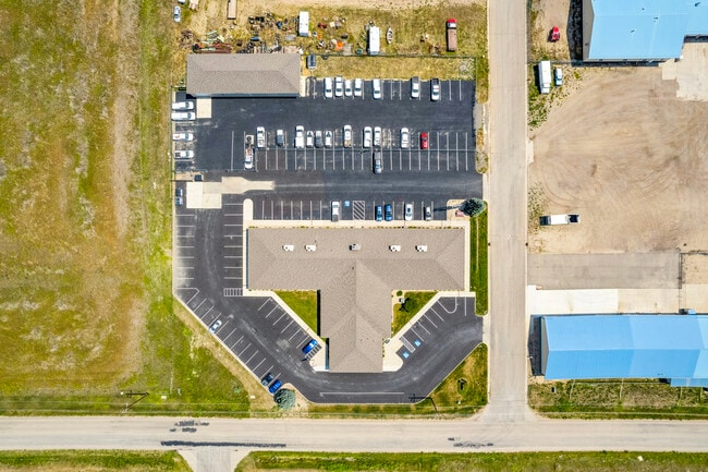
2013 Eastside 2Nd St
Sheridan, WY
Eastside Industrial Park One
03-5684-25-2-04-008-25
PART LOT7
Officebuilding
Sheridan
X
Wyoming
56033C0770E
7-9
2025
2.20 AC
2025
I-25 Corridor/Casper
000501
Other Market Areas
13,533 SF
DEMOGRAPHICS near 2013 Eastside 2Nd St
1 Mile
3 Mile
5 Mile
2024 Total Population
303
19,436
23,382
2029 Population
335
21,356
25,662
Pop Growth 2024-2029
+ 10.56%
+ 9.88%
+ 9.75%
Average Age
41
42
42
2024 Total Households
150
8,837
10,321
HH Growth 2024-2029
+ 10.67%
+ 9.98%
+ 9.88%
Median Household Inc
$40,833
$54,087
$56,686
Avg Household Size
2.00
2.10
2.20
2024 Avg HH Vehicles
2.00
2.00
2.00
Median Home Value
$212,963
$262,470
$280,232
Median Year Built
1986
1976
1978
Nearby Places
Map Layers
Map Styles
 Street
 Aerial
- Restaurants
- Banks
- Shops
- Fitness
- Groceries
SALE & LEASE HISTORY
LISTING DATE
SALE/LEASE

Jul 16, 2024
For Sale
Nearby Properties
Address
Land Use
TOTAL SIZE
Lot Size
Zoning
Address
Land Use
TOTAL SIZE
Lot Size
Zoning
104,640 SF
9.10 AC
A
Address
Land Use
TOTAL SIZE
Lot Size
Zoning
183,642 SF
22.36 AC
A
Address
Land Use
TOTAL SIZE
Lot Size
Zoning
40,118 SF
7.42 AC
Address
Land Use
TOTAL SIZE
Lot Size
Zoning
107,748 SF
10.27 AC
Address
Land Use
TOTAL SIZE
Lot Size
Zoning
22,305 SF
0.77 AC
Address
Land Use
TOTAL SIZE
Lot Size
Zoning
40,217 SF
2 AC
Address
Land Use
TOTAL SIZE
Lot Size
Zoning
54,648 SF
0.65 AC
Address
Land Use
TOTAL SIZE
Lot Size
Zoning
54,212 SF
4.73 AC
Address
Land Use
TOTAL SIZE
Lot Size
Zoning
142,233 SF
7.69 AC
Address
Land Use
TOTAL SIZE
Lot Size
Zoning
38,730 SF
1.44 AC
Address
Land Use
TOTAL SIZE
Lot Size
Zoning
21,836 SF
10.04 AC
Address
Land Use
TOTAL SIZE
Lot Size
Zoning
51,280 SF
3.34 AC
Address
Land Use
TOTAL SIZE
Lot Size
Zoning
47,043 SF
0.38 AC
Address
Land Use
TOTAL SIZE
Lot Size
Zoning
39,400 SF
0.43 AC
Address
Land Use
TOTAL SIZE
Lot Size
Zoning
45,051 SF
3.54 AC
Address
Land Use
TOTAL SIZE
Lot Size
Zoning
40,164 SF
2.81 AC
UR
Address
Land Use
TOTAL SIZE
Lot Size
Zoning
11,004 SF
3.74 AC
Address
Land Use
TOTAL SIZE
Lot Size
Zoning
35,119 SF
1.62 AC
Address
Land Use
TOTAL SIZE
Lot Size
Zoning
49.35 AC
UR
Address
Land Use
TOTAL SIZE
Lot Size
Zoning
8,882 SF
2.55 AC
Address
Land Use
TOTAL SIZE
Lot Size
Zoning
93,570 SF
2.45 AC
Address
Land Use
TOTAL SIZE
Lot Size
Zoning
24,520 SF
8.62 AC
Address
Land Use
TOTAL SIZE
Lot Size
Zoning
5,784 SF
17.29 AC
Address
Land Use
TOTAL SIZE
Lot Size
Zoning
65,394 SF
3.22 AC
Address
Land Use
TOTAL SIZE
Lot Size
Zoning
4,072 SF
4.93 AC
Address
Land Use
TOTAL SIZE
Lot Size
Zoning
2,094 SF
2.53 AC
Address
Land Use
TOTAL SIZE
Lot Size
Zoning
16,822 SF
0.93 AC
Address
Land Use
TOTAL SIZE
Lot Size
Zoning
16,600 SF
0.38 AC
Address
Land Use
TOTAL SIZE
Lot Size
Zoning
18,900 SF
2.98 AC
Address
Land Use
TOTAL SIZE
Lot Size
Zoning
10,817 SF
0.24 AC
The World's #1 Commercial Real Estate Marketplace
Connect with us
© 2026 CoStar Group
The information above has been obtained from sources believed reliable. While we do not doubt its accuracy we have not verified it and make no guarantee, warranty or representation about it. It is your responsibility to independently confirm its accuracy and completeness. Any projections, opinions, assumptions, or estimates used are for example only and do not represent the current or future performance of the property. The value of this transaction to you depends on tax and other factors which should be evaluated by your tax, financial, and legal advisors. You and your advisors should conduct a careful, independent investigation of the property to determine to your satisfaction the suitability of the property for your needs.