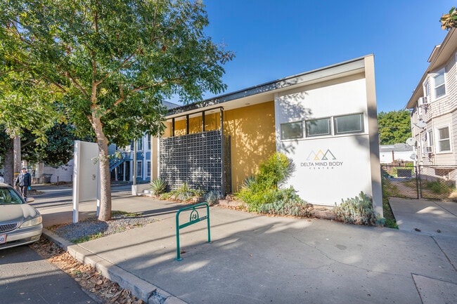
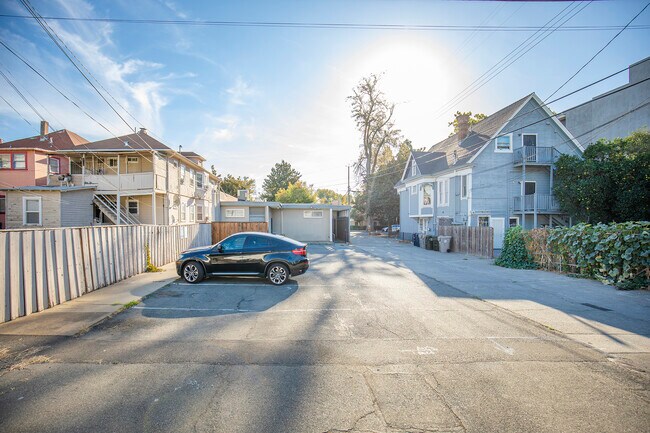
Property Record
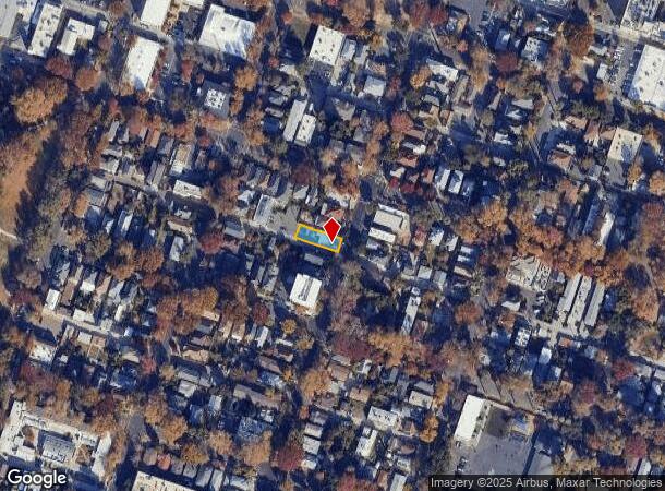
2014 10Th St, Sacramento, CA 95818

NEARBY LISTINGS FOR SALE OR LEASE
Property Detail
2014 10Th St
Sacramento--Roseville--Arden-Arcade, CA
Sacramento
009-0131-015
PORTION LOTS3&4
Officebuilding
Sacramento
X
California
06067C0180J
3,4
2024
0.11 AC
2025
Downtown
002100
Sacramento
1,588 SF
DEMOGRAPHICS near 2014 10Th St
1 Mile
3 Mile
5 Mile
2024 Total Population
25,260
149,562
360,317
2029 Population
25,763
151,725
364,407
Pop Growth 2024-2029
+ 1.99%
+ 1.45%
+ 1.14%
Average Age
40
39
38
2024 Total Households
12,675
65,715
142,128
HH Growth 2024-2029
+ 2.39%
+ 1.66%
+ 1.25%
Median Household Inc
$66,978
$75,149
$71,766
Avg Household Size
1.70
2.10
2.40
2024 Avg HH Vehicles
1.00
2.00
2.00
Median Home Value
$659,296
$599,674
$482,207
Median Year Built
1965
1960
1968
Nearby Places
Map Layers
Map Styles
 Street
 Aerial
- Restaurants
- Banks
- Shops
- Fitness
- Groceries
PUBLIC TRANSPORTATION
COMMUTER RAIL
DRIVE
WALK
Distance
4 min
1.4 mi
AIRPORT
Sacramento International
DRIVE
WALK
Distance
Sacramento International
19 min
12.2 mi
SALE & LEASE HISTORY
LISTING DATE
SALE/LEASE

Dec 02, 2022
For Lease
Apr 05, 2017
For Lease
Nearby Properties
Address
Land Use
TOTAL SIZE
Lot Size
Zoning
Address
Land Use
TOTAL SIZE
Lot Size
Zoning
1,095,507 SF
1.39 AC
H-SPD C-2-
Address
Land Use
TOTAL SIZE
Lot Size
Zoning
5.64 AC
C-3-SPD
Address
Land Use
TOTAL SIZE
Lot Size
Zoning
10.28 AC
H
Address
Land Use
TOTAL SIZE
Lot Size
Zoning
299,943 SF
4.95 AC
H
Address
Land Use
TOTAL SIZE
Lot Size
Zoning
487,483 SF
1.12 AC
C-3-SPD
Address
Land Use
TOTAL SIZE
Lot Size
Zoning
1.33 AC
R-1
Address
Land Use
TOTAL SIZE
Lot Size
Zoning
756,831 SF
1.39 AC
C-2-SPD
Address
Land Use
TOTAL SIZE
Lot Size
Zoning
399,626 SF
2.41 AC
C-3-SPD
Address
Land Use
TOTAL SIZE
Lot Size
Zoning
1.15 AC
R-1
Address
Land Use
TOTAL SIZE
Lot Size
Zoning
366,730 SF
0.89 AC
C-3-SPD
Address
Land Use
TOTAL SIZE
Lot Size
Zoning
200,616 SF
2.54 AC
C-2-SPD
Address
Land Use
TOTAL SIZE
Lot Size
Zoning
594,942 SF
2.39 AC
C-3-SPD
Address
Land Use
TOTAL SIZE
Lot Size
Zoning
676,447 SF
1.43 AC
C-3-SPD
Address
Land Use
TOTAL SIZE
Lot Size
Zoning
193,521 SF
0.60 AC
C-3-SPD
Address
Land Use
TOTAL SIZE
Lot Size
Zoning
339,329 SF
6.40 AC
R-5-PUD-SP
Address
Land Use
TOTAL SIZE
Lot Size
Zoning
213,557 SF
2.33 AC
C-3-SPD
Address
Land Use
TOTAL SIZE
Lot Size
Zoning
0.65 AC
C-4-SPD
Address
Land Use
TOTAL SIZE
Lot Size
Zoning
467,970 SF
4.59 AC
W-F
Address
Land Use
TOTAL SIZE
Lot Size
Zoning
410,420 SF
0.95 AC
C-3-SPD
Address
Land Use
TOTAL SIZE
Lot Size
Zoning
320,072 SF
2.65 AC
C-2
Address
Land Use
TOTAL SIZE
Lot Size
Zoning
R-4-PUD C-
Address
Land Use
TOTAL SIZE
Lot Size
Zoning
0.13 AC
WF
Address
Land Use
TOTAL SIZE
Lot Size
Zoning
26,712 SF
1.90 AC
R-5-PUD-SP
Address
Land Use
TOTAL SIZE
Lot Size
Zoning
26,712 SF
1.85 AC
R-5-PUD-SP
Address
Land Use
TOTAL SIZE
Lot Size
Zoning
2.88 AC
C-3-SPD
Address
Land Use
TOTAL SIZE
Lot Size
Zoning
508,916 SF
0.71 AC
C-3-SPD
Address
Land Use
TOTAL SIZE
Lot Size
Zoning
303,254 SF
10.63 AC
OB-PUD
Address
Land Use
TOTAL SIZE
Lot Size
Zoning
246,417 SF
1.19 AC
C-3-SPD
Address
Land Use
TOTAL SIZE
Lot Size
Zoning
405,074 SF
2.39 AC
C-3-SPD
Address
Land Use
TOTAL SIZE
Lot Size
Zoning
119,055 SF
1.18 AC
C-2-SPD
The World's #1 Commercial Real Estate Marketplace
Connect with us
© 2025 CoStar Group
The information above has been obtained from sources believed reliable. While we do not doubt its accuracy we have not verified it and make no guarantee, warranty or representation about it. It is your responsibility to independently confirm its accuracy and completeness. Any projections, opinions, assumptions, or estimates used are for example only and do not represent the current or future performance of the property. The value of this transaction to you depends on tax and other factors which should be evaluated by your tax, financial, and legal advisors. You and your advisors should conduct a careful, independent investigation of the property to determine to your satisfaction the suitability of the property for your needs.