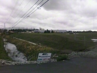
Property Record
2015 Freeway Dr, Mount Vernon, WA 98273


NEARBY LISTINGS FOR SALE OR LEASE
-
-
-
-
No Photo
-
-
-
-
View all Mount Vernon listings for sale on LoopNet.com
Property Detail
2015 Freeway Dr
Other Market Areas
City Of Mount Vernon
Mount Vernon-Anacortes, WA
(2.3716 AC) DK 17: TRACT B, CITY OF MOUNT VERNON BLA SURVEY LABELLED BLA-ENGR 19-0184, RECORDED UNDER AF#201909270129, BEING LOT 3 AND A PORTION OF LOT 2 MOUNT VERNON SHORT PLAT LU-09-045 RECORDED UNDER AF#201208140051 BEING A PORTION OF THE NORTH 51
P131204
Skagit
Vacantlandnec
Washington
2025
3
2025
2.37 AC
952200
Bellingham/Northwest
DEMOGRAPHICS near 2015 Freeway Dr
1 Mile
3 Mile
5 Mile
2024 Total Population
2,387
46,828
59,065
2029 Population
2,455
48,878
61,614
Pop Growth 2024-2029
+ 2.85%
+ 4.38%
+ 4.32%
Average Age
39
39
40
2024 Total Households
952
17,335
21,771
HH Growth 2024-2029
+ 2.94%
+ 4.51%
+ 4.44%
Median Household Inc
$37,045
$58,740
$65,094
Avg Household Size
2.40
2.60
2.60
2024 Avg HH Vehicles
2.00
2.00
2.00
Median Home Value
$303,226
$402,180
$419,736
Median Year Built
1985
1983
1985
Nearby Places
Map Layers
Map Styles
 Street
 Aerial
- Restaurants
- Banks
- Shops
- Fitness
- Groceries
PUBLIC TRANSPORTATION
COMMUTER RAIL
Mount Vernon Amtrak Station (Amtrak Cascades - Amtrak)
DRIVE
WALK
Distance
Mount Vernon Amtrak Station (Amtrak Cascades - Amtrak)
3 min
1.7 mi
AIRPORT
Bellingham International
DRIVE
WALK
Distance
Bellingham International
40 min
31.5 mi
Freight Ports
Port of Anacortes
DRIVE
WALK
Distance
Port of Anacortes
28 min
18.1 mi
SALE & LEASE HISTORY
LISTING DATE
SALE/LEASE

Sep 24, 2016
For Sale
Oct 31, 2017
For Sale
Nearby Properties
Address
Land Use
TOTAL SIZE
Lot Size
Zoning
Address
Land Use
TOTAL SIZE
Lot Size
Zoning
404,511 SF
9.01 AC
Address
Land Use
TOTAL SIZE
Lot Size
Zoning
16,345 SF
32.99 AC
Address
Land Use
TOTAL SIZE
Lot Size
Zoning
Address
Land Use
TOTAL SIZE
Lot Size
Zoning
1,500 SF
9.93 AC
Address
Land Use
TOTAL SIZE
Lot Size
Zoning
Address
Land Use
TOTAL SIZE
Lot Size
Zoning
129,102 SF
131 SF
Address
Land Use
TOTAL SIZE
Lot Size
Zoning
212,480 SF
35.36 AC
Address
Land Use
TOTAL SIZE
Lot Size
Zoning
179,460 SF
10 AC
Address
Land Use
TOTAL SIZE
Lot Size
Zoning
96,782 SF
4.50 AC
Address
Land Use
TOTAL SIZE
Lot Size
Zoning
200,145 SF
9.35 AC
Address
Land Use
TOTAL SIZE
Lot Size
Zoning
74,608 SF
87 SF
Address
Land Use
TOTAL SIZE
Lot Size
Zoning
Address
Land Use
TOTAL SIZE
Lot Size
Zoning
0.01 AC
Address
Land Use
TOTAL SIZE
Lot Size
Zoning
138,226 SF
30.55 AC
Address
Land Use
TOTAL SIZE
Lot Size
Zoning
2,468 SF
0.68 AC
Address
Land Use
TOTAL SIZE
Lot Size
Zoning
1,120 SF
18.88 AC
Address
Land Use
TOTAL SIZE
Lot Size
Zoning
0.01 AC
Address
Land Use
TOTAL SIZE
Lot Size
Zoning
64,668 SF
0.29 AC
Address
Land Use
TOTAL SIZE
Lot Size
Zoning
114,589 SF
10.63 AC
Address
Land Use
TOTAL SIZE
Lot Size
Zoning
52,239 SF
5.50 AC
Address
Land Use
TOTAL SIZE
Lot Size
Zoning
4,034 SF
87 SF
Address
Land Use
TOTAL SIZE
Lot Size
Zoning
0.01 AC
Address
Land Use
TOTAL SIZE
Lot Size
Zoning
177,896 SF
20.30 AC
Address
Land Use
TOTAL SIZE
Lot Size
Zoning
138,353 SF
10 AC
Address
Land Use
TOTAL SIZE
Lot Size
Zoning
68,326 SF
5.29 AC
Address
Land Use
TOTAL SIZE
Lot Size
Zoning
75,744 SF
4 AC
Address
Land Use
TOTAL SIZE
Lot Size
Zoning
Address
Land Use
TOTAL SIZE
Lot Size
Zoning
74,419 SF
2.16 AC
Address
Land Use
TOTAL SIZE
Lot Size
Zoning
44,812 SF
6 AC
Address
Land Use
TOTAL SIZE
Lot Size
Zoning
55,326 SF
9.12 AC
The World's #1 Commercial Real Estate Marketplace
Connect with us
© 2025 CoStar Group
The information above has been obtained from sources believed reliable. While we do not doubt its accuracy we have not verified it and make no guarantee, warranty or representation about it. It is your responsibility to independently confirm its accuracy and completeness. Any projections, opinions, assumptions, or estimates used are for example only and do not represent the current or future performance of the property. The value of this transaction to you depends on tax and other factors which should be evaluated by your tax, financial, and legal advisors. You and your advisors should conduct a careful, independent investigation of the property to determine to your satisfaction the suitability of the property for your needs.