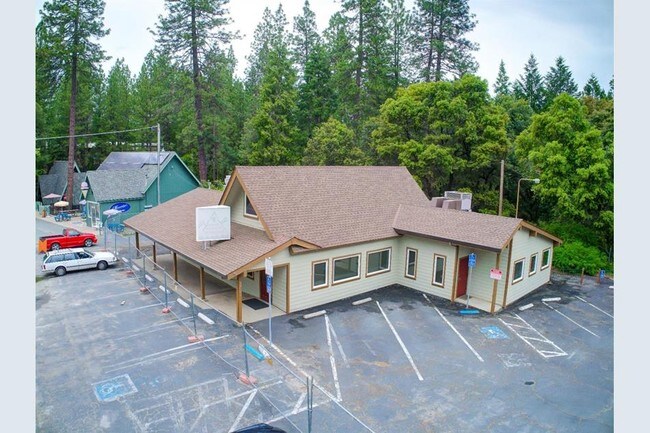
Property Record
20153 State Highway 88, Pine Grove, CA 95665
Property Detail
20153 State Highway 88
Commercialnec
POR LOT 2 BLK 1 1.64AC
C1
Amador
B and X Area of moderate flood hazard, usually the area between the limits of the 100-year and 500-year floods.
California
2024
2
2025
1.64 AC
000402
Other Market Areas
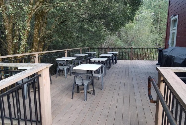
936 SF
030-200-043-000
NEARBY LISTINGS FOR SALE OR LEASE
-
-
View all Pine Grove listings for sale on LoopNet.com
DEMOGRAPHICS near 20153 State Highway 88
1 mile
3 mile
5 mile
2025 Total Population
1,179
5,785
9,100
2030 Population
1,190
5,855
9,183
Pop Growth 2025-2030
+ 0.93%
+ 1.21%
+ 0.91%
Average Age
47
49
49
2025 Total Households
491
2,442
3,912
HH Growth 2025-2030
+ 1.22%
+ 1.31%
+ 1.00%
Median Household Inc
$94,249
$82,537
$81,368
Avg Household Size
2.30
2.30
2.20
2025 Avg HH Vehicles
2.00
2.00
2.00
Median Home Value
$405,422
$419,600
$434,144
Median Year Built
1975
1977
1978
Nearby Places
Map Layers
Map Styles
 Street
 Aerial
Transit
 Traffic
 Biking
Places
Listings with unknown addresses are not visible on the map
- Restaurants
- Banks
- Shops
- Fitness
- Groceries
SALE & LEASE HISTORY
LISTING DATE
SALE/LEASE

Mar 08, 2018
For Sale
Jun 28, 2018
For Sale
Jun 05, 2019
For Sale
Nearby Properties
Address
Land Use
TOTAL SIZE
Lot Size
Zoning
Address
Land Use
TOTAL SIZE
Lot Size
Zoning
6,788 SF
0.81 AC
C1
Address
Land Use
TOTAL SIZE
Lot Size
Zoning
131.42 AC
M
Address
Land Use
TOTAL SIZE
Lot Size
Zoning
9,100 SF
1.19 AC
C1
Address
Land Use
TOTAL SIZE
Lot Size
Zoning
20,275 SF
13.09 AC
PD
Address
Land Use
TOTAL SIZE
Lot Size
Zoning
4,390 SF
3.55 AC
C1
Address
Land Use
TOTAL SIZE
Lot Size
Zoning
16.31 AC
RE
Address
Land Use
TOTAL SIZE
Lot Size
Zoning
2,816 SF
0.60 AC
C2
Address
Land Use
TOTAL SIZE
Lot Size
Zoning
3,264 SF
1.05 AC
C2
Address
Land Use
TOTAL SIZE
Lot Size
Zoning
2,920 SF
19.61 AC
T2
Address
Land Use
TOTAL SIZE
Lot Size
Zoning
120 SF
8.31 AC
T2
Address
Land Use
TOTAL SIZE
Lot Size
Zoning
11,900 SF
2.58 AC
C1
Address
Land Use
TOTAL SIZE
Lot Size
Zoning
3,973 SF
45.70 AC
R1A
Address
Land Use
TOTAL SIZE
Lot Size
Zoning
2,036 SF
18.07 AC
C2
Address
Land Use
TOTAL SIZE
Lot Size
Zoning
500 SF
4.50 AC
R1A
Address
Land Use
TOTAL SIZE
Lot Size
Zoning
3,247 SF
50.50 AC
AG
Address
Land Use
TOTAL SIZE
Lot Size
Zoning
2,500 SF
40 AC
A
Address
Land Use
TOTAL SIZE
Lot Size
Zoning
3,531 SF
35.47 AC
Address
Land Use
TOTAL SIZE
Lot Size
Zoning
3,200 SF
3.60 AC
X
Address
Land Use
TOTAL SIZE
Lot Size
Zoning
5,317 SF
0.88 AC
C1
Address
Land Use
TOTAL SIZE
Lot Size
Zoning
4,200 SF
76.90 AC
R1A
Address
Land Use
TOTAL SIZE
Lot Size
Zoning
1,218 SF
64.67 AC
R1A
Address
Land Use
TOTAL SIZE
Lot Size
Zoning
11,901 SF
0.72 AC
C1
Address
Land Use
TOTAL SIZE
Lot Size
Zoning
5,392 SF
0.58 AC
C1
Address
Land Use
TOTAL SIZE
Lot Size
Zoning
7,945 SF
0.61 AC
C1
Address
Land Use
TOTAL SIZE
Lot Size
Zoning
2,496 SF
20 AC
R1A
Address
Land Use
TOTAL SIZE
Lot Size
Zoning
12,420 SF
1.14 AC
Address
Land Use
TOTAL SIZE
Lot Size
Zoning
2,700 SF
1.05 AC
R1
Address
Land Use
TOTAL SIZE
Lot Size
Zoning
1,825 SF
34.41 AC
R1A
Address
Land Use
TOTAL SIZE
Lot Size
Zoning
120 SF
0.61 AC
C1
Address
Land Use
TOTAL SIZE
Lot Size
Zoning
9,840 SF
3.42 AC
R1
The World's #1 Commercial Real Estate Marketplace
Connect with us
© 2026 CoStar Group
The information above has been obtained from sources believed reliable. While we do not doubt its accuracy we have not verified it and make no guarantee, warranty or representation about it. It is your responsibility to independently confirm its accuracy and completeness. Any projections, opinions, assumptions, or estimates used are for example only and do not represent the current or future performance of the property. The value of this transaction to you depends on tax and other factors which should be evaluated by your tax, financial, and legal advisors. You and your advisors should conduct a careful, independent investigation of the property to determine to your satisfaction the suitability of the property for your needs.