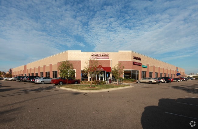
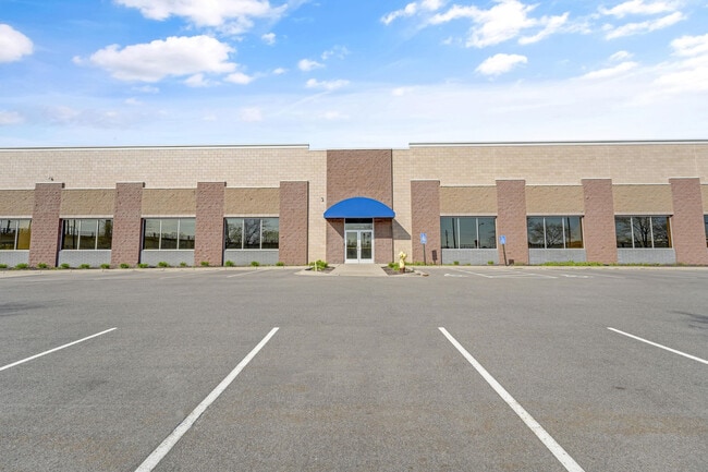
Property Record
2016 E 28Th St, Minneapolis, MN 55407


Current Lease Availabilities
Property Detail
2016 E 28Th St
36-029-24-32-0076
UNPLATTED THAT PART OF N 1/2 OF SW 1/4 LYING N OF 28TH ST E AND SWLY OF HIAWATHA AVE AND SELY OF 100 FT RR R/W EXCEPT PARCEL 1B AS SHOWN ON MN/DOT R/W T S 775X910X920
Commercialnec
HENNEPIN
I2
Minnesota
B and X Area of moderate flood hazard, usually the area between the limits of the 100-year and 500-year floods.
4.94 AC
2024
Minneapolis
2024
Minneapolis/St Paul
008500
Minneapolis-St. Paul-Bloomington, MN-WI
60,362 SF
NEARBY LISTINGS FOR SALE OR LEASE
DEMOGRAPHICS near 2016 E 28Th St
1 mile
3 mile
5 mile
2025 Total Population
30,823
267,799
503,272
2030 Population
30,875
269,673
504,457
Pop Growth 2025-2030
+ 0.17%
+ 0.70%
+ 0.24%
Average Age
36
36
37
2025 Total Households
11,858
123,883
223,055
HH Growth 2025-2030
+ 0.26%
+ 0.85%
+ 0.33%
Median Household Inc
$53,546
$70,817
$82,086
Avg Household Size
2.30
2.00
2.10
2025 Avg HH Vehicles
1.00
1.00
1.00
Median Home Value
$311,396
$366,056
$384,237
Median Year Built
1949
1962
1954
Nearby Places
Map Layers
Map Styles
 Street
 Aerial
Layers
 Traffic
 Biking
Places
Listings with unknown addresses are not visible on the map
- Restaurants
- Banks
- Shops
- Fitness
- Groceries
PUBLIC TRANSPORTATION
TRANSIT/SUBWAY
Lake Street/Midtown Station (Hiawatha Line - Minneapolis-Saint Paul Metro Transit Light Rail)
Drive
Walk
Distance
Lake Street/Midtown Station (Hiawatha Line - Minneapolis-Saint Paul Metro Transit Light Rail)
2 min
9 min
0.5 mi
Franklin Avenue Station (Hiawatha Line - Minneapolis-Saint Paul Metro Transit Light Rail)
Drive
Walk
Distance
Franklin Avenue Station (Hiawatha Line - Minneapolis-Saint Paul Metro Transit Light Rail)
3 min
19 min
1.0 mi
COMMUTER RAIL
Target Field Station (Northstar Corridor - Northstar Commuter Rail)
Drive
Walk
Distance
Target Field Station (Northstar Corridor - Northstar Commuter Rail)
9 min
3.4 mi
St. Paul-Minneapolis (Empire Builder - Amtrak)
Drive
Walk
Distance
St. Paul-Minneapolis (Empire Builder - Amtrak)
17 min
10.0 mi
AIRPORT
Minneapolis-St Paul International/Wold-Chamberlain
Drive
Walk
Distance
Minneapolis-St Paul International/Wold-Chamberlain
17 min
8.2 mi
Freight Ports
Port Milwaukee
Drive
Walk
Distance
Port Milwaukee
376 min
338.3 mi
Nearby Properties
Address
Land Use
TOTAL SIZE
Lot Size
Zoning
Address
Land Use
TOTAL SIZE
Lot Size
Zoning
141,277 SF
44.78 AC
Address
Land Use
TOTAL SIZE
Lot Size
Zoning
1,462,182 SF
1 AC
B4-2
Address
Land Use
TOTAL SIZE
Lot Size
Zoning
2,094,377 SF
2.10 AC
B4-2
Address
Land Use
TOTAL SIZE
Lot Size
Zoning
1,821,999 SF
2.51 AC
B4-2
Address
Land Use
TOTAL SIZE
Lot Size
Zoning
Address
Land Use
TOTAL SIZE
Lot Size
Zoning
1,934,403 SF
1.67 AC
B4-2
Address
Land Use
TOTAL SIZE
Lot Size
Zoning
1,021,060 SF
1.71 AC
B4S-2
Address
Land Use
TOTAL SIZE
Lot Size
Zoning
2,282,334 SF
3.25 AC
B4-2
Address
Land Use
TOTAL SIZE
Lot Size
Zoning
1,054,492 SF
1.70 AC
B4-1
Address
Land Use
TOTAL SIZE
Lot Size
Zoning
495,632 SF
1.72 AC
C1
Address
Land Use
TOTAL SIZE
Lot Size
Zoning
1,208,190 SF
1.20 AC
B4-2
Address
Land Use
TOTAL SIZE
Lot Size
Zoning
176,108 SF
27.45 AC
Address
Land Use
TOTAL SIZE
Lot Size
Zoning
621,608 SF
1.03 AC
B4-2
Address
Land Use
TOTAL SIZE
Lot Size
Zoning
458,470 SF
1.18 AC
OR3
Address
Land Use
TOTAL SIZE
Lot Size
Zoning
907,129 SF
1.65 AC
B4-1
Address
Land Use
TOTAL SIZE
Lot Size
Zoning
442,731 SF
0.97 AC
B4S-2
Address
Land Use
TOTAL SIZE
Lot Size
Zoning
1,044,454 SF
1.08 AC
B4-2
Address
Land Use
TOTAL SIZE
Lot Size
Zoning
1,261,574 SF
2.52 AC
B4-2
Address
Land Use
TOTAL SIZE
Lot Size
Zoning
695,624 SF
3.67 AC
C2
Address
Land Use
TOTAL SIZE
Lot Size
Zoning
2.67 AC
C3A
Address
Land Use
TOTAL SIZE
Lot Size
Zoning
615,172 SF
1.98 AC
I1
Address
Land Use
TOTAL SIZE
Lot Size
Zoning
275,782 SF
2.40 AC
C3A
Address
Land Use
TOTAL SIZE
Lot Size
Zoning
722,423 SF
1.33 AC
B4-2
Address
Land Use
TOTAL SIZE
Lot Size
Zoning
1,424,796 SF
1.13 AC
B4-1
Address
Land Use
TOTAL SIZE
Lot Size
Zoning
577,656 SF
2.92 AC
C3A
Address
Land Use
TOTAL SIZE
Lot Size
Zoning
557,654 SF
3.15 AC
C2
Address
Land Use
TOTAL SIZE
Lot Size
Zoning
478,616 SF
2.28 AC
C2
Address
Land Use
TOTAL SIZE
Lot Size
Zoning
513,403 SF
0.73 AC
C2
Address
Land Use
TOTAL SIZE
Lot Size
Zoning
1,235,416 SF
1.12 AC
B4-2
Address
Land Use
TOTAL SIZE
Lot Size
Zoning
323,404 SF
2.54 AC
B4S-2
The World's #1 Commercial Real Estate Marketplace
Connect with us
© 2026 CoStar Group
The information above has been obtained from sources believed reliable. While we do not doubt its accuracy we have not verified it and make no guarantee, warranty or representation about it. It is your responsibility to independently confirm its accuracy and completeness. Any projections, opinions, assumptions, or estimates used are for example only and do not represent the current or future performance of the property. The value of this transaction to you depends on tax and other factors which should be evaluated by your tax, financial, and legal advisors. You and your advisors should conduct a careful, independent investigation of the property to determine to your satisfaction the suitability of the property for your needs.