Property Record
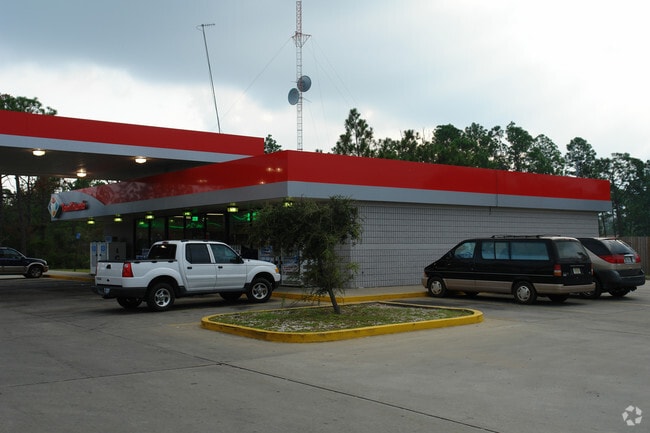
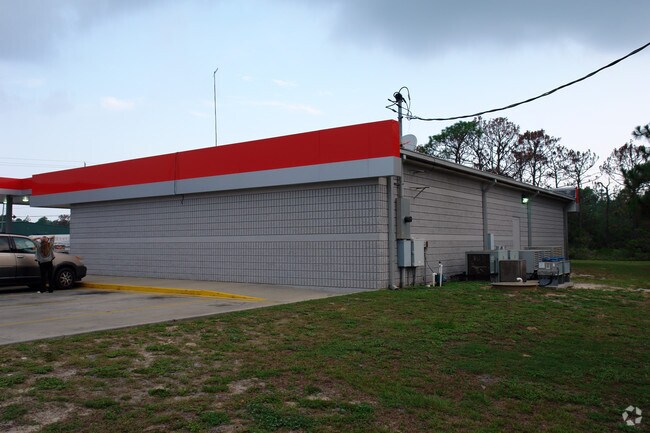
2016 Highway 87, Navarre, FL 32566

Property Detail
2016 Highway 87
20-2S-26-0000-00520-0000
BEG ON E R/W OF HWY 87 AT N LN OF SEC THN S89*55'45E 234.44 FT TO W LN OF 1ST ADD TO NAVA- RRE THN S0*31'42E 202.66 FT FT TO N R/W OF LAREDO ST THN S 89*50'27W 264.83 FT TO E R/W OF HWY 87 THN N7*57'57E ON RD 205.80 FT TO POB LESS OR 1862 PG 660 TO D
Storemultistory
Santa Rosa
HCD
Florida
B and X Area of moderate flood hazard, usually the area between the limits of the 100-year and 500-year floods.
0.97 AC
2024
Navarre
2025
Pensacola
010827
Pensacola-Ferry Pass-Brent, FL
9,118 SF
NEARBY LISTINGS FOR SALE OR LEASE
DEMOGRAPHICS near 2016 Highway 87
1 mile
3 mile
5 mile
2025 Total Population
7,112
29,793
51,652
2030 Population
7,682
32,655
56,377
Pop Growth 2025-2030
+ 8.01%
+ 9.61%
+ 9.15%
Average Age
37
40
40
2025 Total Households
2,564
11,335
19,390
HH Growth 2025-2030
+ 7.80%
+ 9.78%
+ 9.25%
Median Household Inc
$90,534
$93,715
$96,451
Avg Household Size
2.70
2.60
2.60
2025 Avg HH Vehicles
2.00
2.00
2.00
Median Home Value
$364,821
$394,995
$402,680
Median Year Built
2002
2000
2000
Nearby Places
Map Layers
Map Styles
 Street
 Aerial
Transit
 Traffic
 Biking
Places
Listings with unknown addresses are not visible on the map
- Restaurants
- Banks
- Shops
- Fitness
- Groceries
PUBLIC TRANSPORTATION
AIRPORT
Eglin AFB/Destin-Ft Walton Beach
Drive
Walk
Distance
Eglin AFB/Destin-Ft Walton Beach
53 min
27.3 mi
Pensacola International
Drive
Walk
Distance
Pensacola International
51 min
29.7 mi
Freight Ports
Port of Panama City
Drive
Walk
Distance
Port of Panama City
118 min
74.0 mi
Nearby Properties
Address
Land Use
TOTAL SIZE
Lot Size
Zoning
Address
Land Use
TOTAL SIZE
Lot Size
Zoning
44,985 SF
317.38 AC
NB-C
Address
Land Use
TOTAL SIZE
Lot Size
Zoning
344,974 SF
16.11 AC
R3
Address
Land Use
TOTAL SIZE
Lot Size
Zoning
375,552 SF
10.62 AC
PBD
Address
Land Use
TOTAL SIZE
Lot Size
Zoning
131,381 SF
8.84 AC
HNB
Address
Land Use
TOTAL SIZE
Lot Size
Zoning
244,004 SF
10.54 AC
HCD
Address
Land Use
TOTAL SIZE
Lot Size
Zoning
110,921 SF
9.65 AC
HCD
Address
Land Use
TOTAL SIZE
Lot Size
Zoning
131,381 SF
11.25 AC
HNB
Address
Land Use
TOTAL SIZE
Lot Size
Zoning
23.12 AC
C
Address
Land Use
TOTAL SIZE
Lot Size
Zoning
248,857 SF
22.80 AC
PBD
Address
Land Use
TOTAL SIZE
Lot Size
Zoning
106,696 SF
15.59 AC
HCD
Address
Land Use
TOTAL SIZE
Lot Size
Zoning
68,134 SF
21.16 AC
R1
Address
Land Use
TOTAL SIZE
Lot Size
Zoning
7,800 SF
7.68 AC
R2
Address
Land Use
TOTAL SIZE
Lot Size
Zoning
77,417 SF
8.06 AC
HCD
Address
Land Use
TOTAL SIZE
Lot Size
Zoning
97,214 SF
2.79 AC
HCD
Address
Land Use
TOTAL SIZE
Lot Size
Zoning
65,936 SF
1.86 AC
PBD
Address
Land Use
TOTAL SIZE
Lot Size
Zoning
68,334 SF
4.45 AC
HCD
Address
Land Use
TOTAL SIZE
Lot Size
Zoning
85,562 SF
36.21 AC
PBD
Address
Land Use
TOTAL SIZE
Lot Size
Zoning
48,055 SF
9.12 AC
HCD
Address
Land Use
TOTAL SIZE
Lot Size
Zoning
19,350 SF
9.10 AC
HCD
Address
Land Use
TOTAL SIZE
Lot Size
Zoning
60,854 SF
7.07 AC
HCD
Address
Land Use
TOTAL SIZE
Lot Size
Zoning
14,448 SF
17.20 AC
P
Address
Land Use
TOTAL SIZE
Lot Size
Zoning
48,198 SF
1.76 AC
PBD
Address
Land Use
TOTAL SIZE
Lot Size
Zoning
21,567 SF
5.56 AC
HCD
Address
Land Use
TOTAL SIZE
Lot Size
Zoning
4,975 SF
6.03 AC
HCD
Address
Land Use
TOTAL SIZE
Lot Size
Zoning
8,714 SF
7 AC
P2-HON
Address
Land Use
TOTAL SIZE
Lot Size
Zoning
45,672 SF
2.47 AC
PUD
Address
Land Use
TOTAL SIZE
Lot Size
Zoning
2,046 SF
0.79 AC
HCD
Address
Land Use
TOTAL SIZE
Lot Size
Zoning
3.39 AC
NB-C
Address
Land Use
TOTAL SIZE
Lot Size
Zoning
37,436 SF
4.79 AC
R3
The World's #1 Commercial Real Estate Marketplace
Connect with us
© 2026 CoStar Group
The information above has been obtained from sources believed reliable. While we do not doubt its accuracy we have not verified it and make no guarantee, warranty or representation about it. It is your responsibility to independently confirm its accuracy and completeness. Any projections, opinions, assumptions, or estimates used are for example only and do not represent the current or future performance of the property. The value of this transaction to you depends on tax and other factors which should be evaluated by your tax, financial, and legal advisors. You and your advisors should conduct a careful, independent investigation of the property to determine to your satisfaction the suitability of the property for your needs.