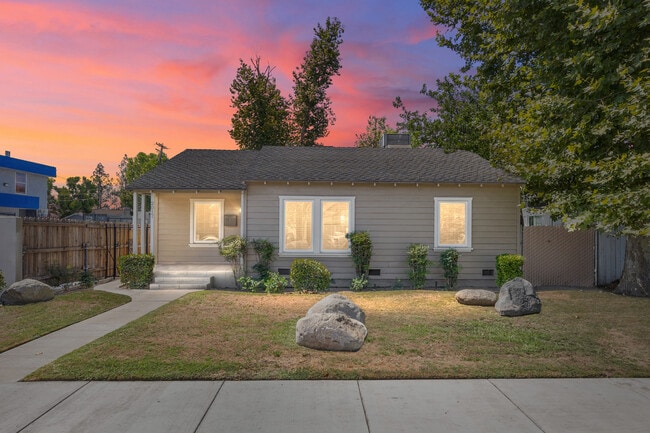
Property Record
2017 Brundage Ln, Bakersfield, CA 93304


Save to a Folder
{{folder.Name}}
{{folder.ListingIds.length}} Properties
{{folder.ListingIds.length}} Property
Create a New Folder
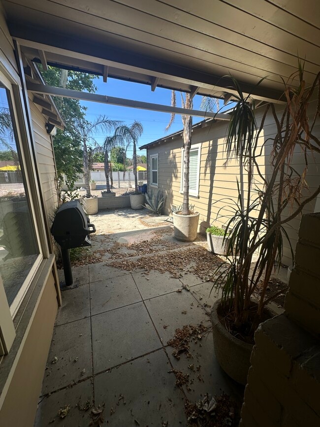
Property Detail
2017 Brundage Ln
Bakersfield-Delano, CA
TRACT 1010 , BLOCK A , LOT 7
147-271-05-00-1
KERN
Officebuilding
California
B and X Area of moderate flood hazard, usually the area between the limits of the 100-year and 500-year floods.
7
2024
0.15 AC
2025
South Bakersfield
001902
Bakersfield
1,319 SF
NEARBY LISTINGS FOR SALE OR LEASE
DEMOGRAPHICS near 2017 Brundage Ln
1 mile
3 mile
5 mile
2025 Total Population
20,882
138,468
340,135
2030 Population
21,076
139,643
343,456
Pop Growth 2025-2030
+ 0.93%
+ 0.85%
+ 0.98%
Average Age
35
35
35
2025 Total Households
6,944
45,674
108,323
HH Growth 2025-2030
+ 0.96%
+ 0.90%
+ 1.02%
Median Household Inc
$49,447
$51,021
$58,378
Avg Household Size
2.90
2.90
3.00
2025 Avg HH Vehicles
2.00
2.00
2.00
Median Home Value
$259,999
$269,874
$301,349
Median Year Built
1954
1970
1975
Nearby Places
Map Layers
Map Styles
 Street
 Aerial
Layers
 Traffic
 Biking
Places
Listings with unknown addresses are not visible on the map
- Restaurants
- Banks
- Shops
- Fitness
- Groceries
PUBLIC TRANSPORTATION
COMMUTER RAIL
Drive
Walk
Distance
6 min
2.5 mi
AIRPORT
Meadows Field
Drive
Walk
Distance
Meadows Field
16 min
8.2 mi
SALE & LEASE HISTORY
LISTING DATE
SALE/LEASE

May 09, 2025
For Lease
Jul 24, 2024
For Sale
Nearby Properties
Address
Land Use
TOTAL SIZE
Lot Size
Zoning
Address
Land Use
TOTAL SIZE
Lot Size
Zoning
23,615 SF
39.38 AC
C2
Address
Land Use
TOTAL SIZE
Lot Size
Zoning
402,037 SF
17.72 AC
R1
Address
Land Use
TOTAL SIZE
Lot Size
Zoning
104,693 SF
2.09 AC
HOSP
Address
Land Use
TOTAL SIZE
Lot Size
Zoning
Address
Land Use
TOTAL SIZE
Lot Size
Zoning
85,971 SF
5.31 AC
C-2
Address
Land Use
TOTAL SIZE
Lot Size
Zoning
59,242 SF
3.01 AC
C2
Address
Land Use
TOTAL SIZE
Lot Size
Zoning
112,849 SF
5.31 AC
C-2
Address
Land Use
TOTAL SIZE
Lot Size
Zoning
114,500 SF
12.02 AC
C-2
Address
Land Use
TOTAL SIZE
Lot Size
Zoning
16.64 AC
Address
Land Use
TOTAL SIZE
Lot Size
Zoning
155,550 SF
18.51 AC
M2
Address
Land Use
TOTAL SIZE
Lot Size
Zoning
185,181 SF
14.67 AC
C2
Address
Land Use
TOTAL SIZE
Lot Size
Zoning
188,976 SF
4.92 AC
Address
Land Use
TOTAL SIZE
Lot Size
Zoning
87,389 SF
1.76 AC
M1
Address
Land Use
TOTAL SIZE
Lot Size
Zoning
161,539 SF
4 AC
CO
Address
Land Use
TOTAL SIZE
Lot Size
Zoning
233,512 SF
9.19 AC
R-3
Address
Land Use
TOTAL SIZE
Lot Size
Zoning
66,849 SF
5.32 AC
CO
Address
Land Use
TOTAL SIZE
Lot Size
Zoning
79,325 SF
7.77 AC
C-2
Address
Land Use
TOTAL SIZE
Lot Size
Zoning
71,000 SF
5.89 AC
C-2
Address
Land Use
TOTAL SIZE
Lot Size
Zoning
193,524 SF
2.34 AC
C-O
Address
Land Use
TOTAL SIZE
Lot Size
Zoning
127,308 SF
8.25 AC
R-2
Address
Land Use
TOTAL SIZE
Lot Size
Zoning
78,140 SF
2.52 AC
CC
Address
Land Use
TOTAL SIZE
Lot Size
Zoning
140,210 SF
1.74 AC
C-2
Address
Land Use
TOTAL SIZE
Lot Size
Zoning
105,513 SF
1.60 AC
C-B
Address
Land Use
TOTAL SIZE
Lot Size
Zoning
200,503 SF
5.85 AC
C-2-D
Address
Land Use
TOTAL SIZE
Lot Size
Zoning
79,987 SF
3.22 AC
SP
Address
Land Use
TOTAL SIZE
Lot Size
Zoning
115,267 SF
9.14 AC
C-2
Address
Land Use
TOTAL SIZE
Lot Size
Zoning
75,569 SF
2.32 AC
C-O
Address
Land Use
TOTAL SIZE
Lot Size
Zoning
5,756 SF
9.70 AC
C-2-D
Address
Land Use
TOTAL SIZE
Lot Size
Zoning
147,451 SF
9.55 AC
C2
Address
Land Use
TOTAL SIZE
Lot Size
Zoning
0.96 AC
The World's #1 Commercial Real Estate Marketplace
Connect with us
© 2026 CoStar Group
The information above has been obtained from sources believed reliable. While we do not doubt its accuracy we have not verified it and make no guarantee, warranty or representation about it. It is your responsibility to independently confirm its accuracy and completeness. Any projections, opinions, assumptions, or estimates used are for example only and do not represent the current or future performance of the property. The value of this transaction to you depends on tax and other factors which should be evaluated by your tax, financial, and legal advisors. You and your advisors should conduct a careful, independent investigation of the property to determine to your satisfaction the suitability of the property for your needs.