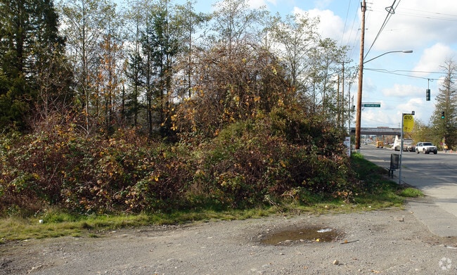
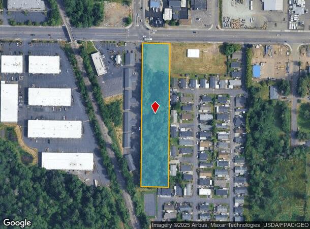
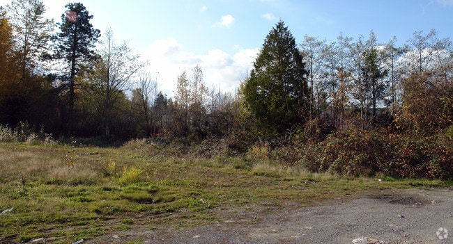
Property Record
2018 112 Th St E, Puyallup, WA 98372

NEARBY LISTINGS FOR SALE OR LEASE
Property Detail
2018 112 Th St E
031910-1029
SECTION 10 TOWNSHIP 19 RANGE 03 QUARTER 11 : BEG 30 FT S & 426.29 FT W OF NE COR SEC TH W 142.1 FT TH S 766.38 FT TH E 142.1 FT TH N 766.38 FT TO BEG EXC N 10 FT DEEDED TO PIERCE CO PER ETN W863340 FOR ADDL RT OF WY FOR 112TH ST E EASE & RESTR OF REC
Commercialacreage
Pierce
X
Washington
53053C0319E
2.47 AC
2024
Spanaway
2025
Seattle/Puget Sound
0713051021
Seattle-Tacoma-Bellevue, WA
768 SF
DEMOGRAPHICS near 2018 112 Th St E
1 Mile
3 Mile
5 Mile
2024 Total Population
7,621
88,387
230,942
2029 Population
8,016
91,570
237,983
Pop Growth 2024-2029
+ 5.18%
+ 3.60%
+ 3.05%
Average Age
36
38
38
2024 Total Households
2,814
31,681
81,959
HH Growth 2024-2029
+ 5.37%
+ 3.73%
+ 3.13%
Median Household Inc
$69,552
$70,883
$76,154
Avg Household Size
2.60
2.60
2.70
2024 Avg HH Vehicles
2.00
2.00
2.00
Median Home Value
$364,851
$388,763
$391,887
Median Year Built
1996
1982
1980
Nearby Places
Map Layers
Map Styles
 Street
 Aerial
- Restaurants
- Banks
- Shops
- Fitness
- Groceries
PUBLIC TRANSPORTATION
COMMUTER RAIL
Lakewood Station (Seattle - Tacoma/Lakewood - Sound Transit)
DRIVE
WALK
Distance
Lakewood Station (Seattle - Tacoma/Lakewood - Sound Transit)
8 min
5.4 mi
South Tacoma Station (Seattle - Tacoma/Lakewood - Sound Transit)
DRIVE
WALK
Distance
South Tacoma Station (Seattle - Tacoma/Lakewood - Sound Transit)
11 min
7.2 mi
AIRPORT
Seattle-Tacoma International
DRIVE
WALK
Distance
Seattle-Tacoma International
41 min
25.7 mi
Freight Ports
Port of Tacoma
DRIVE
WALK
Distance
Port of Tacoma
13 min
7.3 mi
SALE & LEASE HISTORY
LISTING DATE
SALE/LEASE

Sep 24, 2016
For Sale
Nearby Properties
Address
Land Use
TOTAL SIZE
Lot Size
Zoning
Address
Land Use
TOTAL SIZE
Lot Size
Zoning
325,526 SF
17.31 AC
UCOR
Address
Land Use
TOTAL SIZE
Lot Size
Zoning
251,080 SF
18.22 AC
UCOR
Address
Land Use
TOTAL SIZE
Lot Size
Zoning
280,578 SF
6.52 AC
UCOR
Address
Land Use
TOTAL SIZE
Lot Size
Zoning
378,996 SF
34.43 AC
MHR
Address
Land Use
TOTAL SIZE
Lot Size
Zoning
226,029 SF
15.19 AC
UCOR
Address
Land Use
TOTAL SIZE
Lot Size
Zoning
258,250 SF
10.83 AC
NCOR
Address
Land Use
TOTAL SIZE
Lot Size
Zoning
176,385 SF
27.35 AC
MSF
Address
Land Use
TOTAL SIZE
Lot Size
Zoning
273,816 SF
12.03 AC
Address
Land Use
TOTAL SIZE
Lot Size
Zoning
121,400 SF
8.45 AC
R2
Address
Land Use
TOTAL SIZE
Lot Size
Zoning
158,177 SF
8.50 AC
NCOR
Address
Land Use
TOTAL SIZE
Lot Size
Zoning
297,048 SF
50.92 AC
NCOR
Address
Land Use
TOTAL SIZE
Lot Size
Zoning
202,424 SF
3.50 AC
ECOR
Address
Land Use
TOTAL SIZE
Lot Size
Zoning
115,242 SF
6.60 AC
NCOR
Address
Land Use
TOTAL SIZE
Lot Size
Zoning
153,698 SF
7.61 AC
MHR
Address
Land Use
TOTAL SIZE
Lot Size
Zoning
104,071 SF
6 AC
Address
Land Use
TOTAL SIZE
Lot Size
Zoning
144,324 SF
9.54 AC
MHR
Address
Land Use
TOTAL SIZE
Lot Size
Zoning
120,968 SF
0.12 AC
TCTR
Address
Land Use
TOTAL SIZE
Lot Size
Zoning
133,718 SF
23.28 AC
MSF
Address
Land Use
TOTAL SIZE
Lot Size
Zoning
123,256 SF
14.63 AC
RR
Address
Land Use
TOTAL SIZE
Lot Size
Zoning
50,418 SF
15.45 AC
CE
Address
Land Use
TOTAL SIZE
Lot Size
Zoning
102,303 SF
10.09 AC
UCOR
Address
Land Use
TOTAL SIZE
Lot Size
Zoning
164,280 SF
25.62 AC
RR
Address
Land Use
TOTAL SIZE
Lot Size
Zoning
76,367 SF
0.46 AC
UCOR
Address
Land Use
TOTAL SIZE
Lot Size
Zoning
106,065 SF
18.81 AC
RR
Address
Land Use
TOTAL SIZE
Lot Size
Zoning
98,595 SF
3.86 AC
UCOR
Address
Land Use
TOTAL SIZE
Lot Size
Zoning
73,586 SF
1.93 AC
TAC
Address
Land Use
TOTAL SIZE
Lot Size
Zoning
76,349 SF
3.76 AC
UCOR
Address
Land Use
TOTAL SIZE
Lot Size
Zoning
75,024 SF
1.85 AC
R2
Address
Land Use
TOTAL SIZE
Lot Size
Zoning
110,132 SF
12.81 AC
CCX
Address
Land Use
TOTAL SIZE
Lot Size
Zoning
93,540 SF
3.63 AC
MHR
The World's #1 Commercial Real Estate Marketplace
Connect with us
© 2025 CoStar Group
The information above has been obtained from sources believed reliable. While we do not doubt its accuracy we have not verified it and make no guarantee, warranty or representation about it. It is your responsibility to independently confirm its accuracy and completeness. Any projections, opinions, assumptions, or estimates used are for example only and do not represent the current or future performance of the property. The value of this transaction to you depends on tax and other factors which should be evaluated by your tax, financial, and legal advisors. You and your advisors should conduct a careful, independent investigation of the property to determine to your satisfaction the suitability of the property for your needs.