Property Record
2018 E Highway 37, Tuttle, OK 73089
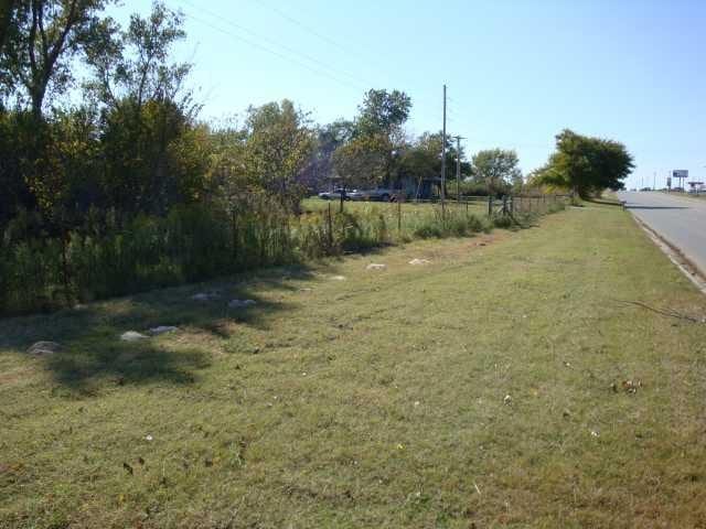

Property Detail
2018 E Highway 37
Oklahoma City, OK
06-09-05-02000 PT LOT 4 LYING NW/4 COMM. AT NW/C LOT 4 TH N 89 DEG 44'56" E ALONG N LINE LOT 4 768.14', S 00 DEG. 15' 04" E 5
0000-06-09N-05W-2-006-00
Grady
Warehouse
Oklahoma
A Areas with a 1% annual chance of flooding and a 26% chance of flooding over the life of a 30-year mortgage.
4
2025
3.25 AC
2025
Grady County
000902
Oklahoma City
4,500 SF
NEARBY LISTINGS FOR SALE OR LEASE
-
-
View all Tuttle listings for sale on LoopNet.com
DEMOGRAPHICS near 2018 E Highway 37
1 mile
3 mile
5 mile
2025 Total Population
606
7,332
13,271
2030 Population
636
7,705
14,060
Pop Growth 2025-2030
+ 4.95%
+ 5.09%
+ 5.95%
Average Age
41
40
41
2025 Total Households
215
2,643
4,797
HH Growth 2025-2030
+ 5.12%
+ 5.03%
+ 5.86%
Median Household Inc
$106,090
$101,550
$102,381
Avg Household Size
2.80
2.70
2.70
2025 Avg HH Vehicles
3.00
3.00
3.00
Median Home Value
$290,178
$292,704
$293,123
Median Year Built
1993
1996
1995
Nearby Places
Map Layers
Map Styles
 Street
 Aerial
Layers
 Traffic
 Biking
Places
Listings with unknown addresses are not visible on the map
- Restaurants
- Banks
- Shops
- Fitness
- Groceries
PUBLIC TRANSPORTATION
AIRPORT
Will Rogers World
Drive
Walk
Distance
Will Rogers World
33 min
20.1 mi
Freight Ports
Tulsa Port Of Catoosa
Drive
Walk
Distance
Tulsa Port Of Catoosa
166 min
149.0 mi
Nearby Properties
Address
Land Use
TOTAL SIZE
Lot Size
Zoning
Address
Land Use
TOTAL SIZE
Lot Size
Zoning
8,528 SF
2.09 AC
Address
Land Use
TOTAL SIZE
Lot Size
Zoning
5,152 SF
6.99 AC
Address
Land Use
TOTAL SIZE
Lot Size
Zoning
31,301 SF
7.48 AC
Address
Land Use
TOTAL SIZE
Lot Size
Zoning
3,996 SF
2.03 AC
Address
Land Use
TOTAL SIZE
Lot Size
Zoning
3,410 SF
1.81 AC
Address
Land Use
TOTAL SIZE
Lot Size
Zoning
8,042 SF
1.63 AC
Address
Land Use
TOTAL SIZE
Lot Size
Zoning
4,155 SF
1.49 AC
Address
Land Use
TOTAL SIZE
Lot Size
Zoning
5,549 SF
1.37 AC
Address
Land Use
TOTAL SIZE
Lot Size
Zoning
7,224 SF
1.52 AC
Address
Land Use
TOTAL SIZE
Lot Size
Zoning
3,900 SF
3 AC
Address
Land Use
TOTAL SIZE
Lot Size
Zoning
4,536 SF
2.63 AC
Address
Land Use
TOTAL SIZE
Lot Size
Zoning
9,238 SF
1.43 AC
Address
Land Use
TOTAL SIZE
Lot Size
Zoning
5.54 AC
Address
Land Use
TOTAL SIZE
Lot Size
Zoning
3,364 SF
0.86 AC
Address
Land Use
TOTAL SIZE
Lot Size
Zoning
3,600 SF
0.92 AC
Address
Land Use
TOTAL SIZE
Lot Size
Zoning
800 SF
1.10 AC
Address
Land Use
TOTAL SIZE
Lot Size
Zoning
860 SF
1.84 AC
Address
Land Use
TOTAL SIZE
Lot Size
Zoning
1,860 SF
43.54 AC
IP
Address
Land Use
TOTAL SIZE
Lot Size
Zoning
4,200 SF
0.73 AC
Address
Land Use
TOTAL SIZE
Lot Size
Zoning
9,372 SF
1.03 AC
Address
Land Use
TOTAL SIZE
Lot Size
Zoning
3,213 SF
0.64 AC
Address
Land Use
TOTAL SIZE
Lot Size
Zoning
8,000 SF
0.90 AC
Address
Land Use
TOTAL SIZE
Lot Size
Zoning
12,240 SF
1.16 AC
Address
Land Use
TOTAL SIZE
Lot Size
Zoning
2,880 SF
1.13 AC
Address
Land Use
TOTAL SIZE
Lot Size
Zoning
4,000 SF
2.43 AC
Address
Land Use
TOTAL SIZE
Lot Size
Zoning
1,200 SF
1.03 AC
The World's #1 Commercial Real Estate Marketplace
Connect with us
© 2026 CoStar Group
The information above has been obtained from sources believed reliable. While we do not doubt its accuracy we have not verified it and make no guarantee, warranty or representation about it. It is your responsibility to independently confirm its accuracy and completeness. Any projections, opinions, assumptions, or estimates used are for example only and do not represent the current or future performance of the property. The value of this transaction to you depends on tax and other factors which should be evaluated by your tax, financial, and legal advisors. You and your advisors should conduct a careful, independent investigation of the property to determine to your satisfaction the suitability of the property for your needs.